Macenta
Macenta | |
|---|---|
Sub-prefecture and town | |
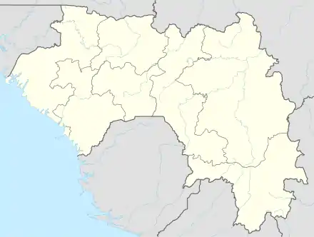 Macenta Location in Guinea | |
| Coordinates: 8°33′N 9°28′W | |
| Country | |
| Region | Nzérékoré Region |
| Prefecture | Macenta Prefecture |
| Population (2008 est.) | |
| • Total | 88,376 |
Geography
Macenta is the capital of the Macenta Prefecture in southeastern Guinea is located in the Guinea Highlands (at 620 metres (2,030 ft)) on the road from Nzérékoré to Guéckédou. The Nianda River joins the Makonda River near Macenta.[1] Macenta is also located near the border of Liberia.
Climate
Macenta has a tropical monsoon climate (Köppen climate classification Am).
| Climate data for Macenta | |||||||||||||
|---|---|---|---|---|---|---|---|---|---|---|---|---|---|
| Month | Jan | Feb | Mar | Apr | May | Jun | Jul | Aug | Sep | Oct | Nov | Dec | Year |
| Average high °C (°F) | 34.0 (93.2) |
35.2 (95.4) |
34.7 (94.5) |
33.0 (91.4) |
32.7 (90.9) |
31.5 (88.7) |
30.1 (86.2) |
29.7 (85.5) |
31.0 (87.8) |
30.2 (86.4) |
31.6 (88.9) |
32.2 (90.0) |
32.2 (90.0) |
| Daily mean °C (°F) | 22.6 (72.7) |
24.6 (76.3) |
25.6 (78.1) |
25.6 (78.1) |
25.2 (77.4) |
24.4 (75.9) |
23.7 (74.7) |
23.7 (74.7) |
24.5 (76.1) |
24.4 (75.9) |
24.0 (75.2) |
22.7 (72.9) |
24.2 (75.6) |
| Average low °C (°F) | 9.5 (49.1) |
11.4 (52.5) |
14.4 (57.9) |
17.3 (63.1) |
17.9 (64.2) |
17.6 (63.7) |
17.9 (64.2) |
18.3 (64.9) |
17.7 (63.9) |
17.2 (63.0) |
14.7 (58.5) |
10.6 (51.1) |
15.4 (59.7) |
| Average rainfall mm (inches) | 12 (0.5) |
46 (1.8) |
99 (3.9) |
188 (7.4) |
227 (8.9) |
282 (11.1) |
383 (15.1) |
535 (21.1) |
466 (18.3) |
264 (10.4) |
168 (6.6) |
41 (1.6) |
2,711 (106.7) |
| Average rainy days (≥ 1.0 mm) | 1 | 5 | 8 | 13 | 15 | 18 | 22 | 25 | 22 | 17 | 10 | 2 | 158 |
| Average relative humidity (%) | 72 | 69 | 71 | 77 | 80 | 83 | 85 | 78 | 81 | 81 | 81 | 77 | 78 |
| Source: NOAA[2] | |||||||||||||
Recent history
French colonial and settlement influx influenced by Liberians circa 2000. It is the source of the 2014 African Ebola outbreak.[3]
Economy
Macenta is the major trading market town for tea, coffee, rice, cassava, shea butter extract, kola nuts, palm oil, and kernels grown nearby. A tea processing plant was built in Macenta in 1968, and the town has an agricultural research station, a sawmill, and several secondary schools.[4] A trade in smuggling is believed to have developed in Macenta. Tigui Mining Company, which specialises in gold and diamond extraction and is owned by former model Tigui Camara, has licenses to work on diamond extraction in the locality.[5]
The town is served by Macenta Airport.
Hospitals
- Hôpital Préfectoral de Macenta
- Centre Medical Mission Phil Africaine
- Centre de Santé Bowa
- Centre de Santé de Patrice
Schools
- Collège de Tripo Cabar
- l'École Patrice Lumumba
- Ecole primaire de Kamandou Koura
Districts
Kamandou Koura
Kamandou Cite
Bowa 1
Bowa 2
Bamala
References
- Anderson, Ewan.W. (2003). International Boundaries: A Geopolitical Atlas By Ewan W. Anderson (2003). Routledge. p. 939. ISBN 1-57958-375-X. Retrieved 2008-06-16.
- "Macenta Climate Normals 1961–1990". National Oceanic and Atmospheric Administration. Retrieved October 19, 2015.
- "Ebola Map | Virus & Contagious Disease Surveillance".
- Encyclopædia Britannica, Retrieved on June 16, 2008
- "Interview avec Tiguidanke Camara, la seule femme propriétaire d'une compagnie minière en Afrique francophone". La Tribune (in French). Retrieved 2022-01-25.
Capital: Macenta | ||
| Sub-prefectures | 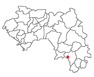 | |