Manassas, Georgia
Manassas is a city in Tattnall County, Georgia, United States. Per the 2020 census, the population was 59.[4]
Manassas, Georgia | |
|---|---|
 Location in Tattnall County and the state of Georgia | |
| Coordinates: 32°9′51″N 82°1′17″W | |
| Country | United States |
| State | Georgia |
| County | Tattnall |
| Area | |
| • Total | 0.78 sq mi (2.01 km2) |
| • Land | 0.77 sq mi (2.00 km2) |
| • Water | 0.00 sq mi (0.01 km2) |
| Elevation | 210 ft (64 m) |
| Population (2020) | |
| • Total | 59 |
| • Density | 76.33/sq mi (29.48/km2) |
| Time zone | UTC-5 (Eastern (EST)) |
| • Summer (DST) | UTC-4 (EDT) |
| ZIP code | 30438 |
| Area code | 912 |
| FIPS code | 13-49504[2] |
| GNIS feature ID | 0332310[3] |
History
The community was named after Manassas Foy, the son of a local citizen.[5] The Georgia General Assembly incorporated Manassas as a city in 1920.[6]
Geography
Manassas is located at 32°9′51″N 82°1′17″W (32.164091, -82.021337).[7]
According to the United States Census Bureau, the city has a total area of 0.8 square miles (2.1 km2), all of it land.
Demographics
| Census | Pop. | Note | %± |
|---|---|---|---|
| 1930 | 197 | — | |
| 1940 | 165 | −16.2% | |
| 1950 | 128 | −22.4% | |
| 1960 | 154 | 20.3% | |
| 1970 | 144 | −6.5% | |
| 1980 | 116 | −19.4% | |
| 1990 | 123 | 6.0% | |
| 2000 | 100 | −18.7% | |
| 2010 | 94 | −6.0% | |
| 2020 | 59 | −37.2% | |
| U.S. Decennial Census[8] 2010[9] 2020[10] | |||
2020 census
| Race / Ethnicity | Pop 2010[9] | Pop 2020[10] | % 2010 | % 2020 |
|---|---|---|---|---|
| White alone (NH) | 46 | 36 | 48.94% | 61.02% |
| Black or African American alone (NH) | 36 | 23 | 38.30% | 38.98% |
| Native American or Alaska Native alone (NH) | 0 | 0 | 0.00% | 0.00% |
| Asian alone (NH) | 0 | 0 | 0.00% | 0.00% |
| Pacific Islander alone (NH) | 0 | 0 | 0.00% | 0.00% |
| Some Other Race alone (NH) | 0 | 0 | 0.00% | 0.00% |
| Mixed Race/Multi-Racial (NH) | 1 | 0 | 1.06% | 0.00% |
| Hispanic or Latino (any race) | 11 | 0 | 11.70% | 0.00% |
| Total | 94 | 59 | 100.00% | 100.00% |
Note: the US Census treats Hispanic/Latino as an ethnic category. This table excludes Latinos from the racial categories and assigns them to a separate category. Hispanics/Latinos can be of any race.
2000 Census
As of the census[2] of 2000, there were 100 people, 40 households, and 24 families residing in the city. The population density was 128.7 inhabitants per square mile (49.7/km2). There were 50 housing units at an average density of 64.4 per square mile (24.9/km2). The racial makeup of the city was 41.00% White and 59.00% African American.
There were 40 households, out of which 20.0% had children under the age of 18 living with them, 37.5% were married couples living together, 17.5% had a female householder with no husband present, and 40.0% were non-families. 32.5% of all households were made up of individuals, and 22.5% had someone living alone who was 65 years of age or older. The average household size was 2.50 and the average family size was 3.17.
In the city, the population was spread out, with 22.0% under the age of 18, 10.0% from 18 to 24, 20.0% from 25 to 44, 31.0% from 45 to 64, and 17.0% who were 65 years of age or older. The median age was 43 years. For every 100 females, there were 75.4 males. For every 100 females age 18 and over, there were 81.4 males.
The median income for a household in the city was $13,750, and the median income for a family was $26,250. Males had a median income of $33,750 versus $13,750 for females. The per capita income for the city was $12,698. There were 28.6% of families and 46.8% of the population living below the poverty line, including 68.4% of under eighteens and 50.0% of those over 64.
References
- "2020 U.S. Gazetteer Files". United States Census Bureau. Retrieved December 18, 2021.
- "U.S. Census website". United States Census Bureau. Retrieved January 31, 2008.
- "US Board on Geographic Names". United States Geological Survey. October 25, 2007. Retrieved January 31, 2008.
- "Manassas city, Georgia". United States Census Bureau. Retrieved April 15, 2022.
- Krakow, Kenneth K. (1975). Georgia Place-Names: Their History and Origins (PDF). Macon, GA: Winship Press. p. 143. ISBN 0-915430-00-2.
- Acts and Resolutions of the General Assembly of the State of Georgia. Clark & Hines, State Printers. 1920. p. 1164.
- "US Gazetteer files: 2010, 2000, and 1990". United States Census Bureau. February 12, 2011. Retrieved April 23, 2011.
- "Decennial Census of Population and Housing by Decades". US Census Bureau.
- "P2 HISPANIC OR LATINO, AND NOT HISPANIC OR LATINO BY RACE – 2010: DEC Redistricting Data (PL 94-171) – Manassas city, Georgia". United States Census Bureau.
- "P2 HISPANIC OR LATINO, AND NOT HISPANIC OR LATINO BY RACE – 2020: DEC Redistricting Data (PL 94-171) – Manassas city, Georgia". United States Census Bureau.
Municipalities and communities of Tattnall County, Georgia, United States | ||
|---|---|---|
| Cities | 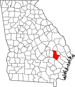 Map of Georgia highlighting Tattnall County | |
| CDP | ||
| Unincorporated community | ||
| Ghost town | ||