Mandurah Road
Mandurah Road is the name given to two roads in the cities of Perth and Mandurah, Western Australia, which link together at Stakehill Road, Karnup.
Mandurah Road | |
|---|---|
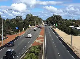 | |
| Mandurah Road from footbridge near Mandurah railway station | |
| General information | |
| Type | Highway |
| Length | 41 km (25 mi) |
| Route number(s) |
|
| Major junctions | |
| North end | |
| |
| South end | |
| Location(s) | |
| Major settlements | Baldivis, Karnup, Meadow Springs, Mandurah |
| Highway system | |
Route description
The northern part starts in the Kwinana Beach industrial area. After 2 km and reaching the City of Rockingham boundary, it becomes a semi-rural single carriageway road which runs past wetlands east of Rockingham such as Lake Cooloongup and Lake Walyungup. It also provides access to the residential and rural-residential sections of the suburb of Baldivis.
The southern part starts at Stakehill Road and is a dual carriageway and part of National Highway 1. It is actually a continuation of Ennis Avenue coming from Rockingham. It continues to Mandurah, where it intersects with Mandjoogoordap Drive at a roundabout before crossing Pinjarra Road and heading west to meet Old Coast Road which was traditionally the main road to Bunbury and South West of Western Australia, until the opening of Forrest Highway superseded it. However Old Coast Road still serves as an alternative route there.
History
Until 2005, the road changed name at the City of Mandurah boundary line (between Singleton and Madora Bay) to "Fremantle Road", but this was changed by a decision of the City of Mandurah in September 2005.[1][2] This change has been recognised by the Government in the 2007 Streetsmart street directory.
Major intersections
All intersections below are controlled by traffic signals unless otherwise indicated.
| LGA | Location | km | mi | Destinations | Notes |
|---|---|---|---|---|---|
| Kwinana | Kwinana Beach | 0 | 0.0 | Northern terminus, continues as Mason Road northbound. Staggered T-intersections favouring Patterson and Rockingham Roads. No right turn possible between Patterson Road northbound and Mandurah Road southbound | |
| Kwinana–Rockingham boundary | Kwinana Beach-East Rockingham boundary | 1.9– 2.0 | 1.2– 1.2 | Wellard Road eastbound / Office Road westbound – Kwinana Beach, Leda, Calista, Wellard. | Unsignalised staggered T-intersections favouring Mandurah Road |
| East Rockingham-Leda–Cooloongup–Hillman quadripoint | 5.2 | 3.2 | Gilmore Avenue eastbound / | State Route 22 northern concurrency terminus. Connects to Rockingham Trade Centre and Murdoch University Rockingham Campus | |
| Leda–Baldivis-Cooloongup tripoint | 6.4 | 4.0 | State Route 22 southern concurrency terminus. Connects to the Kwinana Freeway intersection with Mundijong Road. Northbound traffic turns left, southbound traffic turns right at unsignalised T-junction. | ||
| Rockingham | Baldivis-Warnbro–Waikiki tripoint | 11.2 | 7.0 | Roundabout, Access to Warnbro railway station | |
| Baldivis-Karnup boundary | 17.7 | 11.0 | Stakehill Road – Karnup, Hopeland, Serpentine | Unsignalised T-junction. Northbound traffic turn left, southbound traffic turn right. Connection to Kwinana Freeway via Karnup Road | |
| Port Kennedy–Baldivis-Karnup tripoint | 18.2 | 11.3 | National Route 1 northern concurrency terminus. Northbound traffic turn right, southbound traffic turn left | ||
| Karnup-Secret Harbour boundary | 20.9 | 13.0 | Anstey Road – Secret Harbour | Unsignalised T-junction. | |
| Karnup-Golden Bay boundary | 23.1 | 14.4 | Dampier Drive – Golden Bay, Secret Harbour, Rockingham | Connects to Warnbro Sound Avenue | |
| 23.9 | 14.9 | Paganoni Road – Karnup | Connects to Kwinana Freeway | ||
| Karnup-Singleton boundary | 25.7 | 16.0 | Redwood Avenue eastbound / Singleton Beach Road westbound – Singleton, Karnup | ||
| Mandurah | Lakelands-Madora Bay boundary | 28.2 | 17.5 | Banksiadale Gate eastbound / Madora Beach Road westbound – Madora Bay, Lakelands | |
| 28.6 | 17.8 | Lake Valley Drive – Madora Bay, Meadow Springs | Access to Lakelands railway station. Connects to Mandjoogoordap Drive via Lilydale Drive | ||
| Meadow Springs-Madora Bay boundary | 29.7 | 18.5 | Broadstone Vista eastbound / Lord Hobart Drive westbound – Madora Bay, Meadow Springs | ||
| Meadow Springs-San Remo boundary | 31.3 | 19.4 | Meadow Springs Drive – Madora Bay, Meadow Springs | ||
| Meadow Springs-Mandurah-Silver Sands tripoint | 32.9 | 20.4 | Mandurah Terrace - Mandurah Foreshore | ||
| Meadow Springs-Greenfields-Mandurah tripoint | 33.4 | 20.8 | Gordon Road – Greenfields, Parklands, Nambeelup, North Dandalup | Connects to Kwinana Freeway and South Western Highway via Lakes Road | |
| Greenfields-Mandurah boundary | 34.6 | 21.5 | Roundabout. Northbound traffic turn left via slip lane, southbound traffic turn right. Access to Peel Education Campus | ||
| 35.7 | 22.2 | Access to Mandurah railway station and Peel Health Campus | |||
| Greenfields-Coodanup-Mandurah tripoint | 36.7 | 22.8 | Pinjarra Road – Mandurah, Barragup, Ravenswood, Pinjarra | Access to Mandurah Forum | |
| Dudley Park | 38.6 | 24.0 | Leslie Street northbound / Mariners Cove Drive southbound – Mandurah, Coodanup | ||
| Peel Inlet | 39.8– 40.2 | 24.7– 25.0 | Mandurah Estuary Bridge | ||
| Mandurah | Halls Head-Erskine boundary | 41.0 | 25.5 | Old Coast Road – Mandurah, Falcon, Dawesville, Bunbury | Southern terminus. Continues as |
1.000 mi = 1.609 km; 1.000 km = 0.621 mi
| |||||
See also
References
- City of Mandurah (7 September 2005). "Name Change Proposed for Entry Roads". Media release. Archived from the original on 23 August 2006. Retrieved 15 January 2007.
- City of Mandurah (20 September 2005). "Minutes of Council Meeting (Item G.20)". p. 8. Archived from the original on 27 August 2006. Retrieved 15 January 2007.
Road infrastructure in Mandurah | ||
|---|---|---|
| Highways and roads | ||
| Bridges |
| |
| |||||
| National Highways | |||||
| National Routes | |||||
| State Routes | |||||
| Tourist Drives | |||||