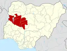
Mariga, Nigeria
Mariga is a Local Government Area in Niger State, Nigeria. Its headquarters are in the town of Bangi in the north of the area. Other towns in the LGA are Igwama and Inkwai. Various endangered Kamuku languages are spoken in Mariga LGA.[1]
Mariga
Mamman A Umar Mariga Gada Biyu | |
|---|---|
LGA and town | |
 Mariga Location in Nigeria | |
| Coordinates: 10°42′N 5°50′E | |
| Country | |
| State | Niger State |
| Government | |
| • Local Government Chairman and the Head of the Local Government Council | Shehu Haruna |
| Area | |
| • Total | 5,552 km2 (2,144 sq mi) |
| Population (2006 census) | |
| • Total | 199,430 |
| Time zone | UTC+1 (WAT) |
| 3-digit postal code prefix | 922 |
| ISO 3166 code | NG.NI.MR |
It has an area of 5,552 km² and a population of 199,430 at the 2006 census. Mariga is the commercial nerve center of northern part of Niger State and is the second largest Local Government in the state.
Mariga's economy is primarily based on agriculture and Trade. Agriculture mainly consists of maize, groundnuts and guinea corn production. Mariga is a market town for the surrounding area, and is home to traders specializing in the buying and selling of cattle, as well as major crop exporters.
People
The principal inhabitants of the city are the Kamuku people. The Hausa language is widely spoken in Mariga. Kamuku languages are also spoken in the LGA. Mariga is a Hausa and Fulani dominated city that is largely Muslims. The majority of Mariga’s Muslims are Sunni. Christians and followers of other non-Muslim religions form a small part of the population.
Climate
With an annual temperature of 32.13°C, 2.67% higher than the national average for Nigeria, the district of Mariga in that country has a tropical wet and dry climate.[2]
Transportation
Mariga is strategically located and owns its leading position as commercial hub in northern part of the state. Mariga is linked to many Local Government cities by road.[3]
The postal code of the area is 922.[4]
The LGA includes the Zugurma Game Reserve, a section of the Kainji National Park.[5]
References
- Blench, Roger (2019). An Atlas of Nigerian Languages (4th ed.). Cambridge: Kay Williamson Educational Foundation.
- "Mariga, Niger, NG Climate Zone, Monthly Averages, Historical Weather Data". tcktcktck.org. Retrieved 2023-09-10.
- "Nigeria 2006 Census Figures( Population )". Archived from the original on 2014-08-21. Retrieved 2011-12-04.
- "Post Offices- with map of LGA". NIPOST. Archived from the original on 2012-11-26. Retrieved 2009-10-20.
- "Kainji Lake National Park". United Nations Environment Programme: World Conservation Monitoring Centre. Archived from the original on 2007-09-30. Retrieved 2010-10-21.
