Meredzhi
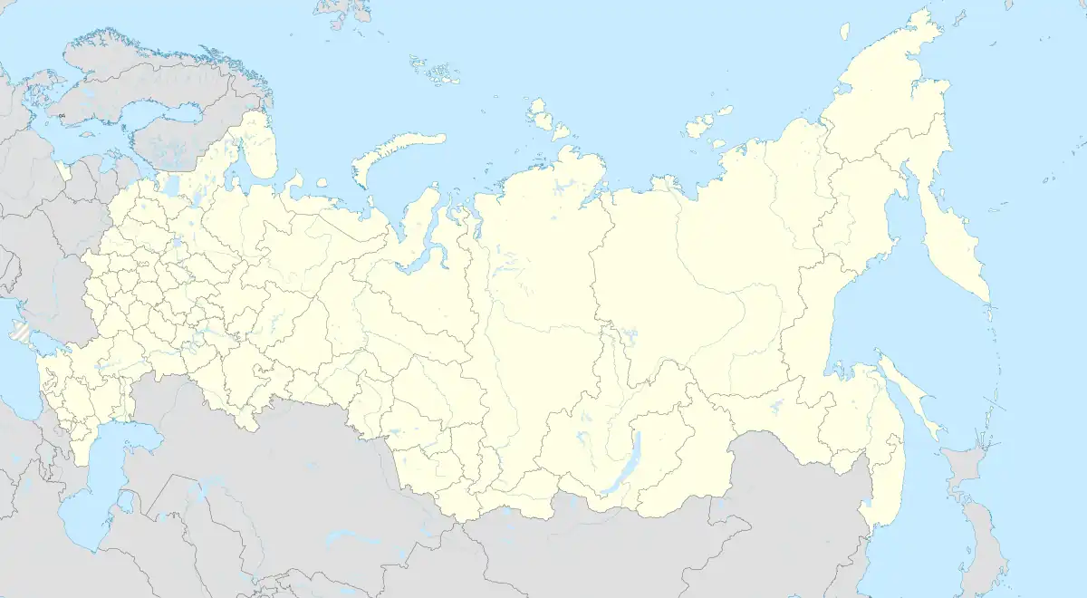
Meredzhi[lower-alpha 1] is a non-residential rural locality (a selo) in Galanchozhsky District of the Republic of Chechnya, Russia (Until September 26, 2018, it was in the Sunzhensky District of Ingushetia[5][6]).
Meredzhi
Мереджи | |
|---|---|
| Other transcription(s) | |
| • Chechen | Мержа |
| • Ingush | Мерж, Мерже |
 | |
Location of Meredzhi | |
 Meredzhi Location of Meredzhi 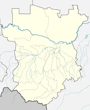 Meredzhi Meredzhi (Chechnya) | |
| Coordinates: 42°56′16″N 45°07′58″E | |
| Country | Russia |
| Federal subject | Chechnya |
| Population | |
| • Total | 0 |
| • Estimate (2021)[2] | 0 |
| • Subordinated to | Galanchozhsky District |
History
Meredzhi is the ancestral aul of the Merzhoy teip.
In the second half of the 18th century (1770s), the German researcher J. A. Güldenstädt indicated the village of Meredzhi among the total number of Kist villages which he opposes them with the Chechens.[7] Meredzhi was mentioned as an Ingush village in 1823 by S. M. Bronevskiy.[8]
In 1858, Naib of Little Chechnya Said-Dulla by order of Nikolay Yevdokimov made punitive raids on Shagot-Kokh, Dattykh, Azerze, Meredzhi and other villages, where many abreks were hiding.[9]
According to the Regulations on the management of the Terek Oblast in 1862, the Ingushskiy Okrug was established as part of the Western Department. It included societies of Nazranians, Karabulaks, Galgai, Kistins, Akkins and Tsorins[10] (also Meredzhin society and some Galanchozh and Yalkharoy auls).[11] The village of Meredzhi was part of the Gorsky section of the Ingush district.[11] In 1866 the Ingush-speaking Chechen village of Meredzhi (Meredzhi society, some Galanchozh, Yalkharoy auls and Akkin society) was ceded to the Argunskiy Okrug due to them belonging to the same nation as the locals (Chechen) and geographically closer to the central governance of the Okrug.[12]
Demographics
National censuses done by the Russian empire and the Soviet Union in 1874, 1883, 1891, 1914 and 1926 showed that all of the inhabitants of Meredzhi and its surrounding villages were ethnic Chechens in all 5 censuses.[13][14][15][16][17]
Geography
Meredzhi is located on the right bank of the Fortanga river, on the Meredzhi river, at the foot of the Kyurelam mountain range. The nearest settlements: in the northwest (downstream of Fortanga) — the village of Dattykh, in the northeast (upstream of Fortanga) — the village of Gandalbos, in the west – the village of Tsecha-Akhki, in the east – the village of Khaykharoy.
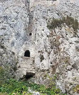
Gallery

Notes
References
- Russian Federal State Statistics Service (2011). Всероссийская перепись населения 2010 года. Том 1 [2010 All-Russian Population Census, vol. 1]. Всероссийская перепись населения 2010 года [2010 All-Russia Population Census] (in Russian). Federal State Statistics Service.
- "Таблица 5. Численность населения России, федеральных округов, субъектов Российской Федерации, городских округов, муниципальных районов, муниципальных округов, городских и сельских поселений, городских населенных пунктов, сельских населенных пунктов с населением 3000 человек и более". Всероссийской переписи населения 2020 года
- Кодзоев & Киева 2021, p. 37.
- Доклад о границах и территории Ингушетии 2021, p. 72.
- Кавказский Узел: анализ картографов 2018.
- Zheng 2018.
- Гюльденштедт 2002, p. 242.
- Броневский 1823, p. 166.
- Кавказская археографическая комиссия (1904). Акты, собранные Кавказской археографической комиссией [Acts collected by the Caucasian Archaeographic Commission] (in Russian). Vol. 12. Тифлис: Типография Главного Управления Наместника Кавказского. p. 1116.
- Сборник документов и материалов 2020, pp. 255–257.
- Сборник статистических сведений о Кавказе 1869, p. 45.
- https://viewer.rusneb.ru/ru/000200_000018_RU_NLR_BIBL_A_012304072?page=3&rotate=0&theme=white
- https://viewer.rusneb.ru/ru/000200_000018_v19_rc_1224684?page=33&rotate=0&theme=white
- "Statistical tables of populated areas of the Terek region / ed. Tersk. stat. com. ed. Evg. Maksimov. — Vladikavkaz, 1890—1891. — 7 t. p. 60". Archived from the original on May 22, 2019. Retrieved February 1, 2023.
- "Settled results of the 1926 census in the North Caucasus region — Don State Public". Archived from the original on October 20, 2021. Retrieved February 1, 2023.
- https://viewer.rusneb.ru/ru/000200_000018_v19_rc_1519880?page=65&rotate=0&theme=white
- http://elib.shpl.ru/ru/nodes/46057-spisok-naselennyh-mest-terskoy-oblasti-po-dannym-k-1-mu-iyulya-1914-goda-vladikavkaz-1915#mode/inspect/page/175/zoom/9
Bibliography
- Кодзоев, Н. Д.; Киева, З. Х. (2021). Накостхоев, Х. А.; Хайрова, Р. Р. (eds.). Ономастикон Ингушетии [Onomasticon of Ingushetia] (in Russian). Москва: ТПК «Центробланк». pp. 1–121. ISBN 978-5-91303-022-1.
- Общенациональная Комиссия по рассмотрению вопросов, связанных с определением территории и границ Ингушетии (2021). Всемирный конгресс ингушского народа (ed.). Доклад о границах и территории Ингушетии (общие положения) [Report on the borders and territory of Ingushetia (general provisions)] (archival documents, maps, illustrations) (in Russian). Назрань. pp. 1–175.
{{cite book}}: CS1 maint: location missing publisher (link) - Учред. ООО «МЕМО» (с 2008); Шведов, Г. С., eds. (2018). "Неравноценный обмен Ингушетии с Чечнёй: анализ картографов" [The unequal exchange of Ingushetia with Chechnya: an analysis of cartographers] (Article). Кавказский Узел [Caucasian Knot] (Online Media) (in Russian). Москва: свид. Эл № ФС 77-31048 от January 25, 2008, выдано Роскомнадзором.
- Zheng, Junzhi (December 13, 2018). Ingouchie-Tchétchénie : l'accord de la discorde [Ingushetia-Chechnya: the agreement of discord] (Article) (in French). Orient XXI.
- Гюльденштедт, Иоганн Антон (2002). "VI. Провинция Кистия, или Кистетия" [VI. Province of Kistia, or Kistetia]. In Карпов, Ю. Ю. (ed.). Путешествие по Кавказу в 1770–1773 гг. [Journey through the Caucasus in 1770–1773.] (in Russian). Translated by Шафроновской, Т. К. Санкт-Петербург: Петербургское Востоковедение. pp. 238–243. ISBN 5-85803-213-3.
- Броневский, С. М. (1823). "Кисты (глава третья)" [Kists (chapter three)]. Новейшие географические и исторические известия о Кавказе (часть вторая) [The latest geographical and historical news about the Caucasus (part two)] (PDF) (in Russian). Москва: Типография С. Селивановского. pp. 151–186.
- Картоев, М. М. (2020). Ингушетия в политике Российской империи на Кавказе. XIX век. Сборник документов и материалов [Ingushetia in the policy of the Russian Empire in the Caucasus. 19th century. Collection of documents and materials] (in Russian) (2 ed.). Ростов-на-Дону: Южный издательский дом. pp. 1–760. ISBN 978-5-98864-060-8.
- Воронов, Н. И.; Кавказский отдел Императорского русского географического общества (1869). "Список горских аулов Кубанской и Терской областей" [List of mountain villages of the Kuban and Terek Oblasts]. Сборник статистических сведений о Кавказе [Collection of statistical information about the Caucasus] (in Russian). Тифлис: Типография Главного Управления Наместника Кавказского; типогрфия Меликова и К. pp. 41–52 (418–429 as PDF).
- Зейдлиц, Н. (1878). Терская область. Список населённых мест по сведениям 1874 года [Terek region. List of populated places according to 1874]. Списки населенных мест Кавказского края (in Russian) (1st ed.). Тифлис: Типография Главного управлении наместника Кавказского. pp. 1–81.