Mindoro, Wisconsin
Mindoro is an unincorporated community and census-designated place (CDP) in La Crosse County, Wisconsin, United States, in the town of Farmington.[2] It is part of the La Crosse Metropolitan Statistical Area.[3] It was first listed as a CDP prior to the 2020 census.
Mindoro, Wisconsin | |
|---|---|
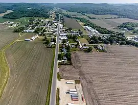
 Looking South on County C | |
 Mindoro  Mindoro | |
| Coordinates: 44°01′16″N 91°06′07″W | |
| Country | |
| State | |
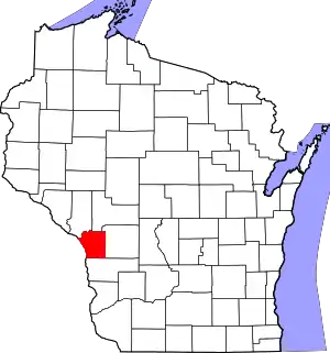
| County | La Crosse |
| Town | Farmington |
| Area | |
| • Total | 1.64 km2 (0.63 sq mi) |
| • Land | 1.64 km2 (0.63 sq mi) |
| • Water | 0.0 km2 (0.0 sq mi) |
| Elevation | 240 m (787 ft) |
| Time zone | UTC-6 (Central (CST)) |
| • Summer (DST) | UTC-5 (CDT) |
| ZIP Code | 54644 |
| Area code | 608 |
| GNIS feature ID | 1569547[2] |
| FIPS code | 55-53050 |
Geography
Mindoro is in northern La Crosse County, west of the geographic center of the town of Farmington. It sits in the Lewis Valley, south of Fleming Creek, at the entrance to Severson Coulee. County Highway C passes through the community, leading south 10 miles (16 km) to West Salem and northeast 4 miles (6 km) to Burr Oak.
According to the U.S. Census Bureau, the Mindoro CDP has an area of 0.6 square miles (1.6 km2), all land.[1]
Landmarks
The Mindoro Cut is located 3.7 miles (6.0 km) south of Mindoro, on County Highway C.
The Bell Coulee Shelter, a rock shelter that was home to an ancient people, is southeast of Mindoro.
Notable people
- Stanley R. Christianson, who posthumously was awarded the Medal of Honor for his role during the Korean War; born in Mindoro
- Virgil Roberts, member of the Wisconsin State Assembly, born in Mindoro
See also
Notes
- "2020 U.S. Gazetteer Files – Wisconsin". United States Census Bureau. Retrieved March 19, 2021.
- "Mindoro". Geographic Names Information System. United States Geological Survey, United States Department of the Interior.
- Mindoro, Wisconsin
