Moesa Region
The Moesa Region is one of the eleven administrative districts in the Canton of the Grisons (or in German: Graubünden) in Switzerland. It had an area of 473.74 square kilometers (182.91 sq mi) and a population of 8,770 (as of 31 December 2020).[1]. It was created on 1 January 2017 as part of a reorganization of the Canton.[2]
| Municipalities in the Moesa Region | ||||
|---|---|---|---|---|
| Municipality | Population (31 December 2020)[1] |
Area (km2)[3] | ||
| Buseno | 91 | 11.15 | ||
| Castaneda | 278 | 3.96 | ||
| Rossa | 151 | 58.89 | ||
| Santa Maria in Calanca | 115 | 9.31 | ||
| Lostallo | 840 | 50.86 | ||
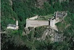
| Mesocco | 1,323 | 164.77 | ||
| Soazza | 324 | 46.42 | ||
| Cama | 589 | 15 | ||
| Grono | 1,397 | 37.12 | ||
| Roveredo (GR) | 2,597 | 38.79 | ||
| San Vittore | 864 | 22.06 | ||
| Calanca | 201 | 37.72 | ||
Moesa Region
| |
|---|---|
District | |
| Country | |
| Canton | |
| Area | |
| • Total | 473.74 km2 (182.91 sq mi) |
| Population (2020) | |
| • Total | 8,770 |
| • Density | 19/km2 (48/sq mi) |
| Time zone | UTC+1 (CET) |
| • Summer (DST) | UTC+2 (CEST) |
| Municipalities | 12 |
The region borders with the Viamala Region to the north, with Italy to the east (Lombardy: Province of Sondrio and of Como) and with the Canton of Ticino (districts of Bellinzona to the southwest, Riviera and Blenio) to the west.
Politics
Administrative division

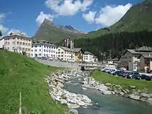
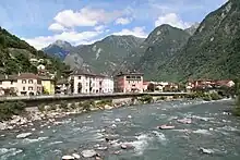
The Moesa region is divided into 12 municipalities:
Demography
The Moesa region has about 8500 inhabitants, mostly Italian-speaking, and is part of Italian-speaking Graubünden and Italian-speaking Switzerland.[4] It is linked economically to the Canton of Ticino; linguistically, however, a Lombard Alpine dialect is spoken that is heavily influenced by Germanic terms.
References
- "Ständige und nichtständige Wohnbevölkerung nach institutionellen Gliederungen, Geburtsort und Staatsangehörigkeit". bfs.admin.ch (in German). Swiss Federal Statistical Office - STAT-TAB. 31 December 2020. Retrieved 21 September 2021.
- Swiss Federal Statistical Office - Amtliches Gemeindeverzeichnis der Schweiz - Mutationsmeldungen 2016 accessed 16 February 2017
- Arealstatistik Standard - Gemeindedaten nach 4 Hauptbereichen
- Partners, Degregori & (2016-05-07). Guida ai Paradisi Fiscali (in Italian). R.E.I. Editions. ISBN 978-2-37297-284-0.