Moriches Inlet
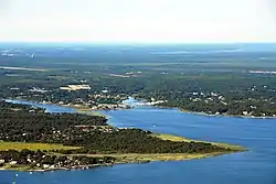
Moriches Inlet (/moʊˈrɪtʃɪz/ ⓘ moh-RITCH-iz)[2] is an inlet connecting Moriches Bay and the Atlantic Ocean. The name Moriches comes from Meritces, a Native American who owned land on Moriches Neck.[3]


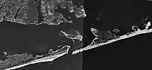
It forms the eastern border of Fire Island, New York and the western border of the barrier island on which West Hampton Dunes, New York is the closest community.
The inlet was present on Fire Island until it closed up during the 1800s. The inlet which split West Hampton from Fire Island was reformed by a Nor'easter in 1931.[4] The 1931 storm created a geographic quirk for the western tip of the West Hampton island which is in the town of Brookhaven but in order to access it via land from Brookhaven a person must go through several miles of Southampton, New York.
Between 1933 and 1938 Moriches Inlet widened to 4,000 feet (1,200 m) wide and deepened with sand being deposited on both the bay and ocean. The widening subsided in 1938 when the Great Hurricane of 1938 opened up the Shinnecock Inlet further east between Shinnecock Bay and the ocean.
In an attempt to stabilize the deterioration of the barrier island, local authorities built groines on the inlet in 1952–1953. Local authorities have consistently urged that the inlet be kept open to allow boats from the mainland of Long Island to have access to the ocean. The United States Army Corps of Engineers took over the maintenance of the inlets and jetties in the 1980s.
The Corps in turn ran into controversy with claims that the groynes and jetties were blocking the natural east to west longshore drift that replenished sand.
The inlet and groynes were to be blamed for a loss of 8–10 million cubic yards of sand on Fire Island—representing a loss of 100 feet (30 m) of beach and a depth of 12–16 feet along the entire 32-mile (51 km) Fire Island beach zone.[4]
The inlet was the initial primary water access route for recovery ships following the July 17, 1996, crash of TWA Flight 800, which broke up in flight and crashed into the ocean about 8 miles (13 km) from the inlet;[5][6] throughout the night of July 17-18, boats carrying human remains and aircraft debris passed from the debris field through Moriches Inlet to the East Moriches United States Coast Guard station, before recovery-vessel traffic was shifted to Shinnecock Inlet (18 miles (29 km) to the northeast of the debris field) on July 18 due to the latter inlet's wider, calmer waters.[6]
References
- "Map of the southern part of the state of New York including Long Island, the Sound, the state of Connecticut, part of the state of New Jersey, and islands adjacent : compiled from actual late surveys". Library of Congress. Retrieved 2021-11-24.
- Bright, William (2004). Native American placenames of the United States. Norman: University of Oklahoma. p. 298. ISBN 0806135980. Retrieved 12 November 2014.
- The Indian Place-Names on Long Island and Islands Adjacent, with Their Probably Significations. Tooker, William Wallace. pp 144-145
- "Sunysuffolk.edu page - Retrieved November 2, 2007". Archived from the original on August 29, 2016. Retrieved November 2, 2007.
- "In-flight Breakup Over the Atlantic Ocean, Trans World Airlines Flight 800, Boeing 747-131, N93119, Near East Moriches, New York, July 17, 1996" (PDF). National Transportation Safety Board. 23 August 2000. Archived from the original (PDF) on 5 May 2022. Retrieved 5 May 2022.
- "APPENDIXES - In-flight Breakup Over the Atlantic Ocean, Trans World Airlines Flight 800, Boeing 747-131, N93119, Near East Moriches, New York, July 17, 1996" (PDF). National Transportation Safety Board. 23 August 2000. Archived from the original (PDF) on 3 May 2022. Retrieved 5 May 2022.