Mount Princeton
Mount Princeton is a high and prominent mountain summit of the Collegiate Peaks in the Sawatch Range of the Rocky Mountains of North America. The 14,204 feet (4,329 m) fourteener is located in San Isabel National Forest, 7.8 miles (12.6 km) southwest (bearing 225°) of the Town of Buena Vista in Chaffee County, Colorado, United States. The mountain was named in honor of Princeton University.[1][2][3]
| Mount Princeton | |
|---|---|
 Mt. Princeton from near Buena Vista | |
| Highest point | |
| Elevation | 14,204 ft (4327.25 m)[1] NAVD88 |
| Prominence | 2177 ft (664 m)[2] |
| Isolation | 5.19 mi (8.36 km)[2] |
| Listing | |
| Coordinates | 38°44′57″N 106°14′33″W[1] |
| Geography | |
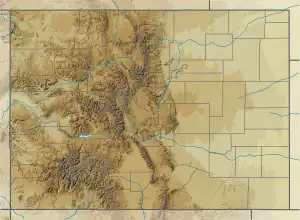
 Mount Princeton | |
| Location | Chaffee County, Colorado, U.S.[3] |
| Parent range | Sawatch Range, Collegiate Peaks[2] |
| Topo map | USGS 7.5' topographic map Mount Antero, Colorado[1] |
| Climbing | |
| Easiest route | East Slopes: Hike, class 2[4] |
Mountain
While not one of the highest peaks of the Sawatch Range, Mount Princeton is one of the most dramatic, abruptly rising nearly 7,000 feet above the Arkansas River valley in only 6 miles.[5]
The first recorded ascent was on July 17, 1877, at 12:30 pm by William Libbey of Princeton University.[6] It is likely that various miners had climbed the peak earlier.[7] The name Mount Princeton was in use as early as 1873, and the peak was most likely named by Henry Gannett, a Harvard graduate and chief topographer in a government survey led by George M. Wheeler.[7][8]
Climate
| Climate data for Mount Princeton 38.7491 N, 106.2407 W, Elevation: 13,684 ft (4,171 m) (1991–2020 normals) | |||||||||||||
|---|---|---|---|---|---|---|---|---|---|---|---|---|---|
| Month | Jan | Feb | Mar | Apr | May | Jun | Jul | Aug | Sep | Oct | Nov | Dec | Year |
| Average high °F (°C) | 22.2 (−5.4) |
21.6 (−5.8) |
26.4 (−3.1) |
31.4 (−0.3) |
40.3 (4.6) |
52.1 (11.2) |
57.3 (14.1) |
55.3 (12.9) |
49.2 (9.6) |
39.1 (3.9) |
28.7 (−1.8) |
22.5 (−5.3) |
37.2 (2.9) |
| Daily mean °F (°C) | 10.3 (−12.1) |
9.5 (−12.5) |
13.8 (−10.1) |
18.5 (−7.5) |
27.2 (−2.7) |
37.8 (3.2) |
43.2 (6.2) |
41.8 (5.4) |
35.8 (2.1) |
26.4 (−3.1) |
17.4 (−8.1) |
11.0 (−11.7) |
24.4 (−4.2) |
| Average low °F (°C) | −1.5 (−18.6) |
−2.7 (−19.3) |
1.2 (−17.1) |
5.5 (−14.7) |
14.1 (−9.9) |
23.4 (−4.8) |
29.0 (−1.7) |
28.3 (−2.1) |
22.4 (−5.3) |
13.7 (−10.2) |
6.0 (−14.4) |
−0.5 (−18.1) |
11.6 (−11.4) |
| Average precipitation inches (mm) | 3.95 (100) |
3.98 (101) |
3.44 (87) |
3.98 (101) |
2.44 (62) |
1.20 (30) |
2.82 (72) |
3.24 (82) |
2.23 (57) |
2.43 (62) |
3.30 (84) |
3.04 (77) |
36.05 (915) |
| Source: PRISM Climate Group[9] | |||||||||||||
Historical names
- Chalk Peak
- Mount Princeton – 1906 [3]
- Princeton Mountain
See also
References
- "PRINCETON". NGS Data Sheet. National Geodetic Survey, National Oceanic and Atmospheric Administration, United States Department of Commerce. Retrieved January 5, 2016.
- "Mount Princeton, Colorado". Peakbagger.com. Retrieved January 5, 2016.
- "Mount Princeton". Geographic Names Information System. United States Geological Survey, United States Department of the Interior. Retrieved October 29, 2014.
- "Mt. Princeton Routes". 14ers.com.
- Mount Princeton on Summitpost
- Merritt, J. I. (1997) "The Once and Future Mountain" Princeton Alumni Weekly Princeton University
- "William Libbey and the 1877 Expedition" Princeton Alumni Weekly Princeton University
- Borneman, Walter R. and Lampert, Lyndon J. (1994) A Climbing Guide to Colorado's Fourteeners (3rd ed.) Pruett, Boulder, Colorado, ISBN 0-87108-850-9
- "PRISM Climate Group, Oregon State University". PRISM Climate Group, Oregon State University. Retrieved October 10, 2023.
To find the table data on the PRISM website, start by clicking Coordinates (under Location); copy Latitude and Longitude figures from top of table; click Zoom to location; click Precipitation, Minimum temp, Mean temp, Maximum temp; click 30-year normals, 1991-2020; click 800m; click Retrieve Time Series button.