Mount Belford
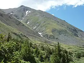
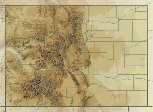
Mount Belford is a high mountain summit of the Collegiate Peaks in the Sawatch Range of the Rocky Mountains of North America. The 14,203-foot (4,329 m) fourteener is located in the Collegiate Peaks Wilderness of San Isabel National Forest, 15.0 miles (24.1 km) northwest by west (bearing 307°) of the Town of Buena Vista in Chaffee County, Colorado, United States.[1][2][3][4]
| Mount Belford | |
|---|---|
 | |
| Highest point | |
| Elevation | 14,203 ft (4,329 m)[1][2] |
| Prominence | 1,337 ft (408 m)[3] |
| Parent peak | Mount Harvard[3] |
| Isolation | 3.30 mi (5.31 km)[3] |
| Listing | Colorado Fourteener 19th |
| Coordinates | 38°57′38″N 106°21′39″W[1] |
| Geography | |
 Mount Belford | |
| Location | Chaffee County, Colorado, U.S.[4] |
| Parent range | Sawatch Range, Collegiate Peaks[3] |
| Topo map | USGS 7.5' topographic map Mount Harvard, Colorado[1] |
| Climbing | |
| Easiest route | Northwest Ridge: Hike, class 2[5] |
Climbing
Mount Belford lies near Mount Oxford and Missouri Mountain, and is often climbed in conjunction with one or both of these peaks.[6]
Climate
| Climate data for Mount Belford 38.9587 N, 106.3575 W, Elevation: 13,848 ft (4,221 m) (1991–2020 normals) | |||||||||||||
|---|---|---|---|---|---|---|---|---|---|---|---|---|---|
| Month | Jan | Feb | Mar | Apr | May | Jun | Jul | Aug | Sep | Oct | Nov | Dec | Year |
| Average high °F (°C) | 20.9 (−6.2) |
20.2 (−6.6) |
25.2 (−3.8) |
30.2 (−1.0) |
39.1 (3.9) |
51.0 (10.6) |
56.6 (13.7) |
54.5 (12.5) |
48.4 (9.1) |
38.0 (3.3) |
27.4 (−2.6) |
21.2 (−6.0) |
36.1 (2.2) |
| Daily mean °F (°C) | 9.2 (−12.7) |
8.2 (−13.2) |
12.7 (−10.7) |
17.4 (−8.1) |
26.1 (−3.3) |
36.8 (2.7) |
42.5 (5.8) |
41.0 (5.0) |
35.0 (1.7) |
25.4 (−3.7) |
16.2 (−8.8) |
9.9 (−12.3) |
23.4 (−4.8) |
| Average low °F (°C) | −2.4 (−19.1) |
−3.8 (−19.9) |
0.2 (−17.7) |
4.5 (−15.3) |
13.2 (−10.4) |
22.5 (−5.3) |
28.4 (−2.0) |
27.6 (−2.4) |
21.6 (−5.8) |
12.8 (−10.7) |
5.1 (−14.9) |
−1.5 (−18.6) |
10.7 (−11.8) |
| Average precipitation inches (mm) | 4.00 (102) |
3.91 (99) |
4.19 (106) |
5.37 (136) |
3.65 (93) |
1.48 (38) |
2.80 (71) |
3.07 (78) |
2.57 (65) |
3.03 (77) |
3.64 (92) |
3.64 (92) |
41.35 (1,049) |
| Source: PRISM Climate Group[7] | |||||||||||||
References
- "MT BELFORD". NGS Data Sheet. National Geodetic Survey, National Oceanic and Atmospheric Administration, United States Department of Commerce. Retrieved October 20, 2014.
- The elevation of Mount Belford includes an adjustment of +2.081 m (+6.83 ft) from NGVD 29 to NAVD 88.
- "Mount Belford, Colorado". Peakbagger.com. Retrieved October 20, 2014.
- "Mount Belford". Geographic Names Information System. United States Geological Survey, United States Department of the Interior. Retrieved October 29, 2014.
- "Mt. Belford Routes". 14ers.com.
- Louis W. Dawson II (1996). Dawson's Guide to Colorado's Fourteeners, Volume 1. Blue Clover Press. ISBN 0-9628867-1-8.
- "PRISM Climate Group, Oregon State University". PRISM Climate Group, Oregon State University. Retrieved October 10, 2023.
To find the table data on the PRISM website, start by clicking Coordinates (under Location); copy Latitude and Longitude figures from top of table; click Zoom to location; click Precipitation, Minimum temp, Mean temp, Maximum temp; click 30-year normals, 1991-2020; click 800m; click Retrieve Time Series button.
External links
This article is issued from Wikipedia. The text is licensed under Creative Commons - Attribution - Sharealike. Additional terms may apply for the media files.