Whiteley Peak
Whiteley Peak, elevation 10,092 ft (3,076 m), is a mountain in Grand County, Colorado north of Kremmling and close to U.S. Highway 40. The mountain is in the Rabbit Ears Range, a range composed chiefly of volcanic rock, and Whiteley Peak has some columnar jointing near the top.[3]
| Whiteley Peak | |
|---|---|
 The mountain in October, 2022 | |
| Highest point | |
| Elevation | 3,076 m (10,092 ft)[1] |
| Prominence | 364 m (1,194 ft)[2] |
| Isolation | 6.95 km (4.32 mi)[2] |
| Coordinates | 40°19′4.33″N 106°29′34.78″W |
| Geography | |
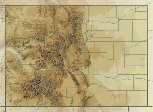
 Whiteley Peak The peak's location in Colorado | |
| Location | Grand County, Colorado |
| Parent range | Rabbit Ears Range[3] |
| Topo map | USGS Whiteley Peak |
Whiteley Peak has been called "one of the most prominent landmarks in northwestern Middle Park."[4] Its crest lies about 2,200 feet (670 m) above the nearby Muddy Creek, and the southwest face of the peak is marked by precipitous cliffs.[4]
Climbing
A narrow strip of privately-owned land encircles the peak, preventing public access for climbing.[3]
References
- "Whiteley Peak". Geographic Names Information System. United States Geological Survey, United States Department of the Interior. Retrieved 2022-10-19.
- "Whiteley Peak, Colorado". Peakbagger. n.d. Retrieved October 19, 2022.
- "Rabbit Ears Range". SummitPost. 2021. Retrieved October 19, 2022.
- Hail, Jr., William J. (1968). Geology of southwestern North Park and vicinity (PDF). Geological survey bulletin ; 1257. Washington: United States Government Printing Office. p. 70.
This article is issued from Wikipedia. The text is licensed under Creative Commons - Attribution - Sharealike. Additional terms may apply for the media files.