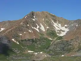
Mount Owen (Colorado)
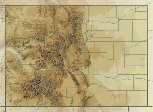
Mount Owen is the highest summit of the Ruby Range of the Rocky Mountains of North America. The 13,070-foot (3,984 m) thirteener is located in Gunnison National Forest at the edge of the Raggeds Wilderness, 8.5 miles (13.6 km) west-northwest (bearing 290°) of the Town of Crested Butte in Gunnison County, Colorado, United States.[1][2][3][4]
| Mount Owen | |
|---|---|
 Mount Owen | |
| Highest point | |
| Elevation | 13,070 ft (3,984 m)[1][2] |
| Prominence | 1,358 ft (414 m)[3] |
| Isolation | 7.39 mi (11.89 km)[3] |
| Listing | Colorado range high points |
| Coordinates | 38°54′33″N 107°07′30″W[1] |
| Geography | |
 Mount Owen | |
| Location | Gunnison County, Colorado, U.S.[4] |
| Parent range | Elk Mountains, Highest summit of the Ruby Range[3] |
| Topo map | USGS 7.5' topographic map Oh-be-joyful, Colorado[1] |
Mountain
See also
References
- "OWEN". NGS Data Sheet. National Geodetic Survey, National Oceanic and Atmospheric Administration, United States Department of Commerce. Retrieved October 21, 2014.
- The elevation of Mount Owen includes an adjustment of +1.990 m (+6.53 ft) from NGVD 29 to NAVD 88.
- "Mount Owen, Colorado". Peakbagger.com. Retrieved October 21, 2014.
- "Mount Owen". Geographic Names Information System. United States Geological Survey, United States Department of the Interior. Retrieved October 29, 2014.
External links
 Media related to Mount Owen (Colorado) at Wikimedia Commons
Denver (capital) | |
| Topics |
|
| Society | |
| Cities |
|
| Counties |
|
| Regions |
|
| Federal |
| ||||||||||||||||||||||||||||||||
|---|---|---|---|---|---|---|---|---|---|---|---|---|---|---|---|---|---|---|---|---|---|---|---|---|---|---|---|---|---|---|---|---|---|
| State |
| ||||||||||||||||||||||||||||||||
| Trails |
| ||||||||||||||||||||||||||||||||
This article is issued from Wikipedia. The text is licensed under Creative Commons - Attribution - Sharealike. Additional terms may apply for the media files.