National Register of Historic Places listings in Davis County, Utah
This is a list of the National Register of Historic Places listings in Davis County, Utah.

This is intended to be a complete list of the properties and districts on the National Register of Historic Places in Davis County, Utah, United States. Latitude and longitude coordinates are provided for many National Register properties and districts; these locations may be seen together in a map.[1]
There are 62 properties and districts listed on the National Register in the county. Two other sites in the county were once listed, but have since been removed.
This National Park Service list is complete through NPS recent listings posted October 20, 2023.[2]
Current listings
| [3] | Name on the Register[4] | Image | Date listed[5] | Location | City or town | Description |
|---|---|---|---|---|---|---|
| 1 | Joseph Adams House | 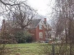 Joseph Adams House |
February 17, 1978 (#78002655) |
300 N. Adamswood Rd. 41°03′55″N 111°56′42″W |
Layton | |
| 2 | James and Hannah Atkinson House | 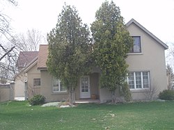 James and Hannah Atkinson House |
July 15, 1999 (#99000847) |
1510 S. 1100 West 40°52′29″N 111°54′40″W |
Woods Cross | |
| 3 | Barnard-Garn-Barber House | 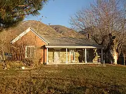 Barnard-Garn-Barber House |
November 17, 1997 (#97001309) |
1198 N. Main St. 40°55′54″N 111°52′43″W |
Centerville | |
| 4 | John George Moroni Barnes House | 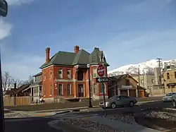 John George Moroni Barnes House |
February 11, 1982 (#82004120) |
42 W. Center St. 41°02′07″N 111°56′20″W |
Kaysville | |
| 5 | John R. Barnes House | 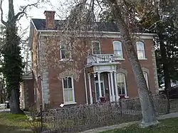 John R. Barnes House |
July 23, 1982 (#82004121) |
10 S. 100 West 41°02′05″N 111°56′23″W |
Kaysville | |
| 6 | Henry Blood House | 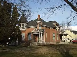 Henry Blood House |
April 29, 1980 (#80003897) |
95 S. 300 West 41°02′01″N 111°56′35″W |
Kaysville | Home of Henry H. Blood, former Governor of Utah. |
| 7 | Bountiful Historic District | 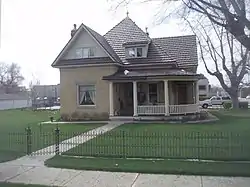 Bountiful Historic District |
October 26, 2005 (#05001194) |
Roughly bounded by 200 W., 500 S., 400 E., and 400 N. 40°53′21″N 111°52′42″W |
Bountiful | |
| 8 | Bountiful Tabernacle |  Bountiful Tabernacle |
January 1, 1976 (#76001813) |
Main and Center Sts. 40°53′21″N 111°52′43″W |
Bountiful | |
| 9 | Thomas and Margaret Brandon House |  Thomas and Margaret Brandon House |
November 17, 1997 (#97001310) |
185 E. Center St. 40°55′06″N 111°52′34″W |
Centerville | |
| 10 | William Capener House |  William Capener House |
January 5, 1984 (#84002172) |
252 N. 400 East 40°55′12″N 111°52′16″W |
Centerville | |
| 11 | Leroy and Alice Cheney House | 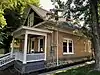 Leroy and Alice Cheney House |
July 12, 2021 (#100006718) |
676 North Main St. 40°55′30″N 111°52′44″W |
Centerville | |
| 12 | Clark Lane Historic District | 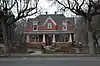 Clark Lane Historic District |
October 7, 1994 (#94001208) |
207-399 W. State and 33 N. 200 West 40°58′50″N 111°53′36″W |
Farmington | |
| 13 | Osmyn and Emily Deuel House | 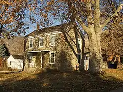 Osmyn and Emily Deuel House |
November 17, 1997 (#97001311) |
271 S. 200 East 40°54′53″N 111°52′31″W |
Centerville | |
| 14 | John, Harriet, and Eliza Jennett Duncan House | 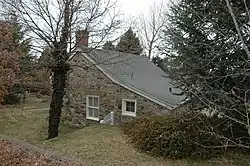 John, Harriet, and Eliza Jennett Duncan House |
November 17, 1997 (#97001312) |
445 N. 400 East 40°55′19″N 111°52′21″W |
Centerville | |
| 15 | James and Jane Eldredge House | 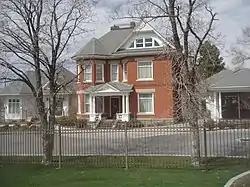 James and Jane Eldredge House |
June 10, 2005 (#05000595) |
564 W. 400 North 40°53′40″N 111°53′35″W |
West Bountiful | |
| 16 | Farmer's Union Building | 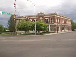 Farmer's Union Building |
November 30, 1978 (#78002656) |
12 S. Main St. 41°03′38″N 111°57′54″W |
Layton | |
| 17 | Farmington Main Street Historic District | 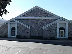 Farmington Main Street Historic District |
October 20, 2011 (#11000756) |
Approximately Main St. from 200 South to 600 North, along 600 North to Park Lane and 100 North from Main St to 100 West 40°58′50″N 111°53′15″W |
Farmington | |
| 18 | Farmington Tithing Office | 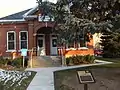 Farmington Tithing Office |
March 28, 1985 (#85000686) |
110 N. Main St. 40°58′56″N 111°53′14″W |
Farmington | |
| 19 | Fielding Garr Ranch | 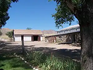 Fielding Garr Ranch |
January 21, 1983 (#83004402) |
Off State Route 127 40°55′31″N 112°09′59″W |
Antelope Island | |
| 20 | First National Bank of Layton | 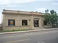 First National Bank of Layton |
April 5, 2006 (#06000232) |
50 W. Gentile St. 41°03′38″N 111°57′57″W |
Layton | |
| 21 | Joseph N. and Algie Ford House | 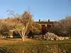 Joseph N. and Algie Ford House |
November 18, 2005 (#05001289) |
1394 N. Main St. 40°56′12″N 111°52′39″W |
Centerville | |
| 22 | Ford-Rigby House | 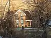 Ford-Rigby House |
November 17, 1997 (#97001313) |
1592 N. Main St. 40°56′27″N 111°52′47″W |
Centerville | |
| 23 | James Green House | 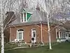 James Green House |
February 11, 1982 (#82004118) |
206 N. 100 East 40°53′30″N 111°52′38″W |
Bountiful | |
| 24 | Hector C. Haight House | 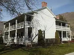 Hector C. Haight House |
May 17, 1985 (#85001141) |
208 N. Main St. 40°59′03″N 111°53′11″W |
Farmington | |
| 25 | Thomas and Caroline Harris House | 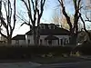 Thomas and Caroline Harris House |
June 11, 1998 (#98000639) |
275 S. 200 East 40°54′54″N 111°52′30″W |
Centerville | |
| 26 | Harris-Tingey House | 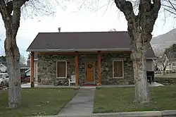 Harris-Tingey House |
November 17, 1997 (#97001314) |
269 E. Center St. 40°55′03″N 111°52′28″W |
Centerville | |
| 27 | Joseph and Ann Hill Cabin | 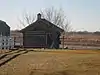 Joseph and Ann Hill Cabin |
December 4, 2015 (#15000130) |
2133 W. 1000 South 41°02′44″N 112°00′22″W |
Layton | |
| 28 | Holland-Smith-Brown House | 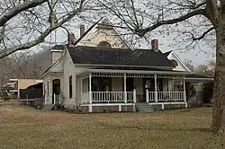 Holland-Smith-Brown House |
November 17, 1997 (#97001315) |
19 S. 200 East 40°55′01″N 111°52′31″W |
Centerville | |
| 29 | Kaysville City Hall | 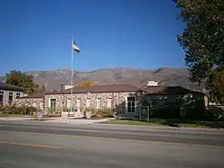 Kaysville City Hall |
September 30, 2019 (#100004476) |
44 N. Main St. 41°02′07″N 111°56′19″W |
Kaysville | |
| 30 | Kilbourn-Leak House | 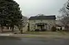 Kilbourn-Leak House |
November 17, 1997 (#97001316) |
170 N. 200 East 40°55′10″N 111°52′31″W |
Centerville | |
| 31 | George Quincy Knowlton House | 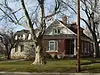 George Quincy Knowlton House |
April 17, 1995 (#95000416) |
93 E. 400 North 40°59′14″N 111°53′09″W |
Farmington | |
| 32 | Lagoon Carousel | 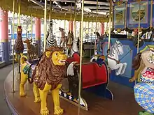 Lagoon Carousel |
October 24, 2012 (#12000883) |
375 N. Lagoon Dr. 40°59′05″N 111°53′38″W |
Farmington | Built in 1913, this hand carved Herschell-Spillman carousel has been at Lagoon Amusement Park since 1918. |
| 33 | Lagoon Flying Scooter | 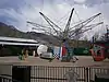 Lagoon Flying Scooter |
October 24, 2012 (#12000884) |
375 N. Lagoon Dr. 40°59′13″N 111°53′36″W |
Farmington | A Bisch-Rocco Amusement Company Flying Scooters ride at Lagoon Amusement Park. Installed in 1941, it is currently known as the Flying Aces. |
| 34 | Lagoon Roller Coaster | 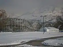 Lagoon Roller Coaster |
October 24, 2012 (#12000885) |
375 N. Lagoon Dr. 40°59′05″N 111°53′42″W |
Farmington | The 7th oldest roller coaster in the world, at Lagoon Amusement Park since 1921 |
| 35 | Layton Oregon Short Line Railroad Station | 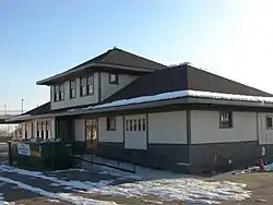 Layton Oregon Short Line Railroad Station |
January 18, 2018 (#100001979) |
200 S Main St. 41°03′24″N 111°57′52″W |
Layton | Railroad station built alongside the Oregon Short Line Railroad tracks in 1912. Used by the railroad until the 1960s, and later sold then moved 1,200 feet to the south. The building has housed several businesses since it was vacated by the railroad. |
| 36 | George W. Layton House | 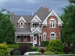 George W. Layton House |
July 23, 1982 (#82004122) |
2767 W. Gentile St. 41°03′35″N 112°01′05″W |
Layton | Red brick house with elaborate trim, designed by William Allen. Now a wedding venue. |
| 37 | John Henry Layton House | 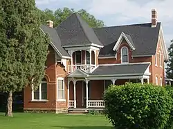 John Henry Layton House |
February 11, 1982 (#82004123) |
683 W. Gentile St. 41°03′35″N 111°58′44″W |
Layton | Also designed by William Allen, with reversed plan to George W. Layton House |
| 38 | Leonard–Taylor House | September 7, 2023 (#100009316) |
94 East 500 North 40°59′19″N 111°53′09″W |
Farmington | ||
| 39 | Mills-Hancock House |  Mills-Hancock House |
February 21, 2007 (#07000077) |
571 S. 400 West 40°55′06″N 111°52′52″W |
Centerville | |
| 40 | Nathan and Rebecca Cherry and Eliza Ford Porter Farmstead |  Nathan and Rebecca Cherry and Eliza Ford Porter Farmstead |
November 17, 1997 (#97001317) |
370 W. 400 South 40°54′48″N 111°53′05″W |
Centerville | |
| 41 | Nathan T. and Anna Porter House | 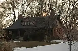 Nathan T. and Anna Porter House |
January 21, 2004 (#03001482) |
224 S. 210 West 40°54′55″N 111°52′55″W |
Centerville | |
| 42 | Melvin Harley Randall House | 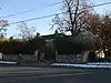 Melvin Harley Randall House |
June 20, 1980 (#80003896) |
390 E. Porter Lane 40°54′46″N 111°52′19″W |
Centerville | |
| 43 | Rich-Steeper House | 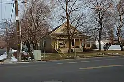 Rich-Steeper House |
November 17, 1997 (#97001318) |
415 S. Main St. 40°54′46″N 111°52′42″W |
Centerville | |
| 44 | Richards House | 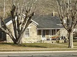 Richards House |
December 23, 1977 (#77001303) |
386 N. 100 East 40°59′12″N 111°53′02″W |
Farmington | |
| 45 | Ron's Phillips 66 Service Station | 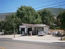 Ron's Phillips 66 Service Station |
March 26, 2018 (#100002273) |
278 N Main St. 40°55′12″N 111°52′44″W |
Centerville | |
| 46 | Salt Lake South East and North West Base Monuments (Salt Lake Base Line) | 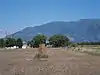 Salt Lake South East and North West Base Monuments (Salt Lake Base Line) |
January 18, 2018 (#100001980) |
1002 S. 3200 West & 209 S. 4500 West 41°04′29″N 112°01′34″W |
Layton and West Point | |
| 47 | B.H., Louisa Smith and Cecilia Dibble Roberts House | 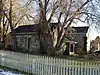 B.H., Louisa Smith and Cecilia Dibble Roberts House |
November 17, 1997 (#97001319) |
315 S. 300 East 40°54′51″N 111°52′21″W |
Centerville | Home of B. H. Roberts |
| 48 | Thomas J. and Amanda N. Smith House | 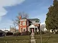 Thomas J. and Amanda N. Smith House |
February 2, 2006 (#05001632) |
472 N. Main St. 41°02′35″N 111°56′48″W |
Kaysville | |
| 49 | Smith-Larsen House | 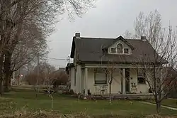 Smith-Larsen House |
November 17, 1997 (#97001320) |
280 E. Center St. 40°54′59″N 111°52′27″W |
Centerville | |
| 50 | Smoot Dairy Farmhouse | 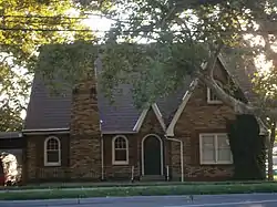 Smoot Dairy Farmhouse |
March 22, 2016 (#16000123) |
1697 N. Main St. 40°56′31″N 111°52′49″W |
Centerville | |
| 51 | Stayner-Steed House | 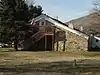 Stayner-Steed House |
August 2, 1999 (#99000846) |
79 S. 100 East 40°58′45″N 111°53′04″W |
Farmington | |
| 52 | LeConte Stewart House | 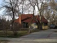 LeConte Stewart House |
June 28, 1996 (#96000721) |
172 W. 100 South 41°02′03″N 111°56′28″W |
Kaysville | |
| 53 | William Henry and Mary Streeper House | 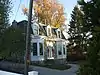 William Henry and Mary Streeper House |
November 17, 1997 (#97001321) |
1020 N. Main St. 40°55′46″N 111°52′50″W |
Centerville | |
| 54 | John W., Janet (Nettie), and May Rich Taylor House | 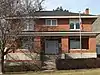 John W., Janet (Nettie), and May Rich Taylor House |
October 30, 1997 (#97001325) |
49 E. 500 North 40°59′19″N 111°53′11″W |
Farmington | |
| 55 | Thurston-Chase Cabin | 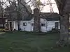 Thurston-Chase Cabin |
November 17, 1997 (#97001322) |
975 N. Main St. 40°55′43″N 111°52′45″W |
Centerville | |
| 56 | Thomas Tingey House | 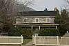 Thomas Tingey House |
July 28, 1983 (#83004401) |
20 N. 300 East 40°55′03″N 111°52′23″W |
Centerville | |
| 57 | VanFleet Hotel | 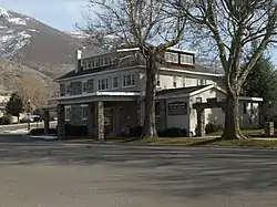 VanFleet Hotel |
December 19, 1991 (#91001819) |
88 E. State St. 40°58′48″N 111°53′05″W |
Farmington | |
| 58 | Franklin and Amelia Walton House | 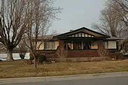 Franklin and Amelia Walton House |
November 17, 1997 (#97001323) |
96 W. 280 South 40°54′53″N 111°52′50″W |
Centerville | |
| 59 | John and Sarah Jane Wayman House | 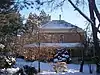 John and Sarah Jane Wayman House |
January 7, 2015 (#14001136) |
240 E. 300 South 40°54′53″N 111°52′27″W |
Centerville | |
| 60 | West Bountiful Historic District | 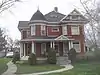 West Bountiful Historic District |
June 18, 2004 (#03000158) |
800 West (Onion St.) from 400 North to roughly 1350 North (both sides) 40°53′51″N 111°54′05″W |
West Bountiful | |
| 61 | Thomas and Elizabeth Mills Whitaker House |  Thomas and Elizabeth Mills Whitaker House |
March 28, 1996 (#96000316) |
168 N. Main St. 40°55′08″N 111°52′43″W |
Centerville | |
| 62 | James D. Wilcox House |  James D. Wilcox House |
November 26, 1985 (#85003051) |
93 E. 100 North 40°58′56″N 111°53′05″W |
Farmington |
Former listings
| [3] | Name on the Register | Image | Date listed | Date removed | Location | City or town | Description |
|---|---|---|---|---|---|---|---|
| 1 | Townsend–Palmer House | August 4, 1982 (#82004119) | December 7, 1989 | 515 S. 200 West |
Bountiful | ||
| 2 | Young Men's Hall – Tingey House |  Young Men's Hall – Tingey House |
November 17, 1997 (#97001324) | June 15, 2015 | 85 S. 300 East 40°54′59″N 111°52′21″W |
Centerville |
See also
References
- The latitude and longitude information provided in this table was derived originally from the National Register Information System, which has been found to be fairly accurate for about 99% of listings. Some locations in this table may have been corrected to current GPS standards.
- National Park Service, United States Department of the Interior, "National Register of Historic Places: Weekly List Actions", retrieved October 20, 2023.
- Numbers represent an alphabetical ordering by significant words. Various colorings, defined here, differentiate National Historic Landmarks and historic districts from other NRHP buildings, structures, sites or objects.
- "National Register Information System". National Register of Historic Places. National Park Service. April 24, 2008.
- The eight-digit number below each date is the number assigned to each location in the National Register Information System database, which can be viewed by clicking the number.
External links
![]() Media related to National Register of Historic Places in Davis County, Utah at Wikimedia Commons
Media related to National Register of Historic Places in Davis County, Utah at Wikimedia Commons
 | |||
| Topics | |
|---|---|
| Lists by state |
|
| Lists by insular areas | |
| Lists by associated state | |
| Other areas | |
| Related | |
Municipalities and communities of Davis County, Utah, United States | ||
|---|---|---|
| Cities | Map of Utah highlighting Davis County | |