National Register of Historic Places listings in Kennebec County, Maine
This is a list of the National Register of Historic Places listings in Kennebec County, Maine.

Location of Kennebec County in Maine
This is intended to be a complete list of the properties and districts on the National Register of Historic Places in Kennebec County, Maine, United States. Latitude and longitude coordinates are provided for many National Register properties and districts; these locations may be seen together in a map.[1]
There are 135 properties and districts listed on the National Register in the county, including 7 National Historic Landmarks. Five sites were once listed on the register but have since been removed.
This National Park Service list is complete through NPS recent listings posted October 20, 2023.[2]
| Androscoggin - Aroostook - Cumberland - Franklin - Hancock - Kennebec - Knox - Lincoln - Oxford - Penobscot - Piscataquis - Sagadahoc - Somerset - Waldo - Washington - York |
Current listings
| [3] | Name on the Register[4] | Image | Date listed[5] | Location | City or town | Description |
|---|---|---|---|---|---|---|
| 1 | D.V. Adams Co.-Bussell and Weston | 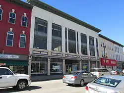 D.V. Adams Co.-Bussell and Weston |
May 2, 1986 (#86001690) |
190 Water St. 44°18′59″N 69°46′28″W |
Augusta | |
| 2 | Alls Souls Church | 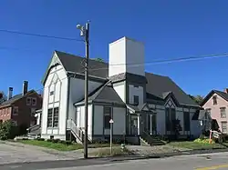 Alls Souls Church |
January 31, 1978 (#78000178) |
70 State St. 44°18′59″N 69°46′38″W |
Augusta | |
| 3 | Androscoggin Yacht Club | 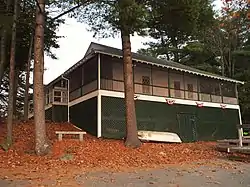 Androscoggin Yacht Club |
October 31, 2012 (#12000893) |
22 Lake St. 44°20′52″N 70°04′08″W |
Wayne | |
| 4 | Arnold Trail to Quebec |  Arnold Trail to Quebec |
October 1, 1969 (#69000018) |
Along the Kennebec River, through Wayman and Flagstaff lakes along the Dead River and Chain of Ponds to Quebec, Canada 44°40′49″N 69°59′18″W |
Augusta | Extends through Franklin, Kennebec, Sagadahoc, and Somerset counties |
| 5 | Former Augusta City Hall | 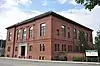 Former Augusta City Hall |
September 26, 1997 (#97001134) |
1 Cony St. 44°19′01″N 69°46′18″W |
Augusta | |
| 6 | Charles M. Bailey Public Library | 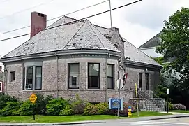 Charles M. Bailey Public Library |
June 20, 1985 (#85001264) |
Bowdoin St. 44°18′29″N 69°58′24″W |
Winthrop | |
| 7 | Moses Bailey House | Moses Bailey House |
November 8, 1984 (#84000325) |
State Route 135 44°18′20″N 69°55′24″W |
Winthrop Center | |
| 8 | Algernon Bangs House | 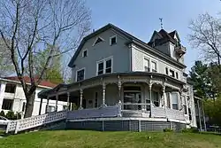 Algernon Bangs House |
February 19, 1982 (#82000751) |
16 E. Chestnut St. 44°18′47″N 69°46′02″W |
Augusta | |
| 9 | Benton Grange No. 458 | 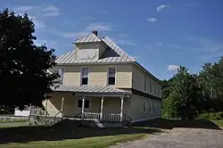 Benton Grange No. 458 |
April 28, 2004 (#04000373) |
Junction of River Rd. and School Dr. 44°35′21″N 69°35′06″W |
Benton | |
| 10 | James G. Blaine House |  James G. Blaine House |
October 15, 1966 (#66000024) |
Capitol and State Sts. 44°18′28″N 69°46′53″W |
Augusta | |
| 11 | Blossom House | 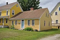 Blossom House |
April 7, 1989 (#89000250) |
Main St. 44°14′16″N 70°02′12″W |
Monmouth | |
| 12 | Bond Street Historic District | 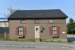 Bond Street Historic District |
April 11, 2014 (#14000137) |
8, 9, 12, 18, 21, 22 & 25 Bond St., 44°19′14″N 69°46′27″W |
Augusta | |
| 13 | Brick School | 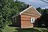 Brick School |
April 18, 1977 (#77000068) |
South of Winslow on Cushman Rd. 44°30′38″N 69°37′51″W |
Winslow | |
| 14 | Brown Memorial Library | 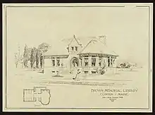 Brown Memorial Library |
April 28, 1975 (#75000099) |
53 Railroad St. 44°38′20″N 69°30′12″W |
Clinton | John Calvin Stevens, architect (1903). |
| 15 | Brunswick Square | 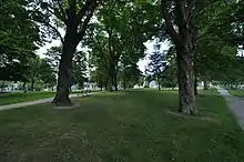 Brunswick Square |
June 28, 2021 (#100006675) |
Bounded by School St., Brunswick, Dresden, and Lincoln Aves. 44°13′37″N 69°46′31″W |
Gardiner | |
| 16 | Capitol Complex Historic District | 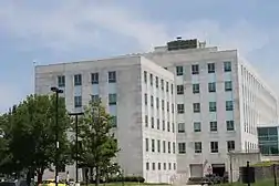 Capitol Complex Historic District |
December 31, 2001 (#01001417) |
State and Capitol Sts. 44°18′24″N 69°46′49″W |
Augusta | |
| 17 | Capitol Park | .jpg.webp) Capitol Park |
April 7, 1989 (#89000252) |
Roughly bounded by Capitol St., the Kennebec River, Union St., and State St. 44°18′23″N 69°46′43″W |
Augusta | |
| 18 | Chandler Store | 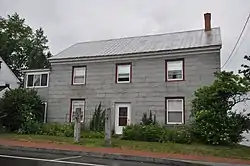 Chandler Store |
June 20, 1985 (#85001263) |
State Route 27 44°31′41″N 69°53′19″W |
Belgrade | |
| 19 | China Village Historic District | 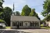 China Village Historic District |
November 23, 1977 (#77000069) |
State Route 9 44°28′41″N 69°31′10″W |
China | |
| 20 | Christ Episcopal Church | 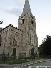 Christ Episcopal Church |
July 24, 1973 (#73000129) |
1 Dresden Ave. 44°13′39″N 69°46′32″W |
Gardiner | |
| 21 | Edmund and Rachel Clark Homestead | 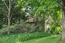 Edmund and Rachel Clark Homestead |
October 4, 2006 (#06000921) |
Address Restricted |
China | |
| 22 | Cobbossee Lighthouse | 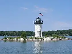 Cobbossee Lighthouse |
January 12, 1984 (#84001369) |
Ladies Delight Island 44°18′28″N 69°53′34″W |
Winthrop | Ladies Delight Light |
| 23 | Cobbosseecontee Dam Site | June 3, 1976 (#76000219) |
Address Restricted |
Manchester | ||
| 24 | Colburn House State Historic Site | 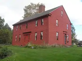 Colburn House State Historic Site |
July 28, 2004 (#04000741) |
Arnold Rd., Old State Route 27 (0.1 miles south of its junction with State Route 27) 44°11′52″N 69°45′16″W |
Pittston | |
| 25 | Colburn School |  Colburn School |
January 11, 2001 (#00001633) |
Arnold Rd., 0.4 miles south of its junction with State Route 27 44°11′49″N 69°45′04″W |
Pittston | |
| 26 | Colcord Farmstead |  Colcord Farmstead |
December 29, 2005 (#05001468) |
184 Unity Rd. 44°35′48″N 69°32′22″W |
Benton | |
| 27 | Colonial Theater |  Colonial Theater |
October 8, 2014 (#14000834) |
139 Water St. 44°19′04″N 69°46′24″W |
Augusta | |
| 28 | Cony High School |  Cony High School |
September 29, 1988 (#88001841) |
Cony Circle at Cony and Stone Sts. 44°18′58″N 69°46′03″W |
Augusta | |
| 29 | Gov. Samuel Cony House | 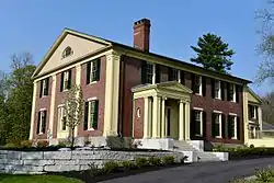 Gov. Samuel Cony House |
April 11, 1985 (#85000732) |
71 Stone St. 44°18′43″N 69°45′50″W |
Augusta | |
| 30 | Crosby Street Historic District | 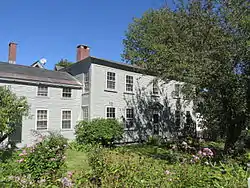 Crosby Street Historic District |
September 11, 1986 (#86002438) |
Crosby St. and Crosby Ln. 44°19′05″N 69°46′32″W |
Augusta | |
| 31 | Cumston Hall | 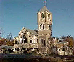 Cumston Hall |
August 14, 1973 (#73000130) |
Main St. 44°14′28″N 70°02′04″W |
Monmouth | Harry Hayman Cochrane, architect (1899-1900). |
| 32 | Cushnoc (ME 021.02) |  Cushnoc (ME 021.02) |
October 27, 1989 (#89001703) |
Near Fort Western[6] 44°18′55″N 69°46′16″W |
Augusta | Site of a 17th-century Plymouth Colony trading post |
| 33 | John Davis House | 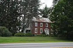 John Davis House |
July 14, 1983 (#83000454) |
State Route 9 44°16′31″N 69°46′21″W |
Chelsea | |
| 34 | Doughty Block | 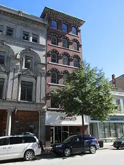 Doughty Block |
May 2, 1986 (#86001691) |
265 Water St. 44°18′55″N 69°46′28″W |
Augusta | |
| 35 | Dutton-Small House | 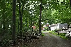 Dutton-Small House |
December 18, 1990 (#90001907) |
Bog Rd. west of Taber Hill Rd. 44°26′22″N 69°39′15″W |
Vassalboro | |
| 36 | East Vassalboro Grist and Saw Mill | 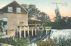 East Vassalboro Grist and Saw Mill |
January 28, 1982 (#82000752) |
State Route 32 44°27′07″N 69°36′24″W |
East Vassalboro | |
| 37 | Dr. J.W. Ellis House |  Dr. J.W. Ellis House |
August 15, 1979 (#79000148) |
62 State St. 44°19′02″N 69°46′38″W |
Augusta | |
| 38 | Elm Hill Farm |  Elm Hill Farm |
August 25, 1970 (#70000045) |
Litchfield Rd. 44°16′48″N 69°47′57″W |
Hallowell | |
| 39 | First Baptist Church |  First Baptist Church |
November 7, 1976 (#76000095) |
Park and Elm Sts. 44°33′06″N 69°37′59″W |
Waterville | |
| 40 | Fort Halifax | .jpg.webp) Fort Halifax |
November 24, 1968 (#68000015) |
On U.S. Route 201 at Winslow 44°32′05″N 69°37′47″W |
Winslow | |
| 41 | Fort Western |  Fort Western |
December 2, 1969 (#69000009) |
Bowman St. 44°18′59″N 69°46′16″W |
Augusta | |
| 42 | Foster Farm Barn | 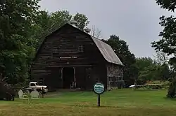 Foster Farm Barn |
November 9, 2015 (#15000768) |
538 Augusta Rd. 44°29′28″N 69°51′21″W |
Belgrade | |
| 43 | Foster-Redington House | 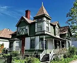 Foster-Redington House |
April 11, 2014 (#14000138) |
8 Park Place 44°33′08″N 69°38′01″W |
Waterville | |
| 44 | Fuller-Weston House | 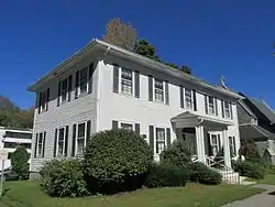 Fuller-Weston House |
March 22, 1984 (#84001374) |
11 Summer St. 44°18′59″N 69°46′45″W |
Augusta | |
| 45 | Guy P. Gannett House | 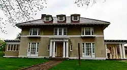 Guy P. Gannett House |
April 28, 1983 (#83000455) |
184 State St. 44°18′32″N 69°46′52″W |
Augusta | |
| 46 | Gardiner Historic District | 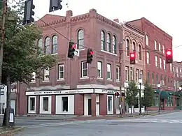 Gardiner Historic District |
May 6, 1980 (#80000233) |
Water St. 44°13′45″N 69°46′15″W |
Gardiner | |
| 47 | Gardiner Railroad Station | 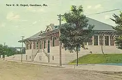 Gardiner Railroad Station |
October 29, 1982 (#82000423) |
51 Maine Ave. 44°13′51″N 69°46′18″W |
Gardiner | |
| 48 | Governor's House | 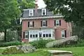 Governor's House |
February 23, 1974 (#74000319) |
Off State Route 17 44°16′48″N 69°42′08″W |
Togus | |
| 49 | Peter Grant House | 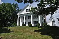 Peter Grant House |
May 17, 1976 (#76000096) |
10 Grant St. 44°14′29″N 69°46′27″W |
Farmingdale | |
| 50 | William F. Grant House |  William F. Grant House |
May 17, 2006 (#06000396) |
869 Main St. 44°28′57″N 69°37′20″W |
North Vassalboro | |
| 51 | Hallowell Historic District |  Hallowell Historic District |
October 28, 1970 (#100001675) |
The hillside of Hallowell 44°17′05″N 69°47′40″W |
Hallowell | |
| 52 | Hartford Fire Station |  Hartford Fire Station |
January 2, 2018 (#100001927) |
1 Hartford Sq. 44°18′43″N 69°46′32″W |
Augusta | |
| 53 | Heald House | .jpg.webp) Heald House |
February 15, 2005 (#05000058) |
19 West St. 44°33′13″N 69°38′14″W |
Waterville | |
| 54 | Gov. John F. Hill Mansion |  Gov. John F. Hill Mansion |
November 21, 1977 (#77000070) |
136 State St. 44°18′45″N 69°46′44″W |
Augusta | |
| 55 | Ella R. Hodgkins Intermediate School | Ella R. Hodgkins Intermediate School |
July 14, 2015 (#15000417) |
17 Malta St. 44°18′58″N 69°45′26″W |
Augusta | |
| 56 | Hussey-Littlefield Farm |  Hussey-Littlefield Farm |
January 12, 2016 (#15000969) |
63 Hussey Rd. 44°31′45″N 69°26′01″W |
Albion | |
| 57 | Abel Jones House |  Abel Jones House |
August 4, 1983 (#83000456) |
Off U.S. Route 202 44°23′53″N 69°34′13″W |
China | |
| 58 | Eli and Sybil Jones House |  Eli and Sybil Jones House |
March 22, 1984 (#84001376) |
Dirigo Corner 44°24′33″N 69°31′17″W |
South China | |
| 59 | Journal Building |  Journal Building |
May 2, 1986 (#86001692) |
325-331 Water St. 44°18′50″N 69°46′30″W |
Augusta | |
| 60 | Kennebec Arsenal | Kennebec Arsenal |
August 25, 1970 (#70000046) |
Arsenal St. 44°18′29″N 69°46′10″W |
Augusta | |
| 61 | Kennebec County Courthouse | 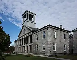 Kennebec County Courthouse |
July 25, 1974 (#74000169) |
95 State St. 44°18′53″N 69°46′39″W |
Augusta | |
| 62 | Kent Burying Ground |  Kent Burying Ground |
December 31, 2008 (#08001254) |
Northeastern corner of Fayette Corner Rd. and Oak Hill Rd. 44°25′12″N 70°04′17″W |
Fayette | |
| 63 | Kent's Hill School Historic District | 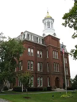 Kent's Hill School Historic District |
April 26, 1979 (#79000149) |
State Route 17 44°24′06″N 70°00′09″W |
Kent's Hill | |
| 64 | Kresge Building | 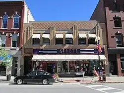 Kresge Building |
May 2, 1986 (#86001693) |
241-249 Water St. 44°18′57″N 69°46′28″W |
Augusta | |
| 65 | Philip Leach House |  Philip Leach House |
October 20, 1983 (#83003644) |
Hussey Hill Rd. 44°26′54″N 69°36′33″W |
Vassalboro | |
| 66 | Jesse Lee Church |  Jesse Lee Church |
July 19, 1984 (#84001378) |
State Route 17 and Plains Rd. 44°21′44″N 69°54′44″W |
Readfield | |
| 67 | Libby-Hill Block |  Libby-Hill Block |
May 2, 1986 (#86001694) |
227-233 Water St. 44°18′58″N 69°46′27″W |
Augusta | |
| 68 | The Lion (locomotive) | 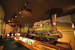 The Lion (locomotive) |
December 15, 1976 (#76000118) |
Maine State Museum 44°18′22″N 69°46′57″W |
Augusta | Listed at the University of Maine at Machias. |
| 69 | Lithgow Library | 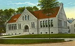 Lithgow Library |
July 24, 1974 (#74000170) |
Winthrop St. 44°18′56″N 69°46′41″W |
Augusta | |
| 70 | Lockwood Mill Historic District | 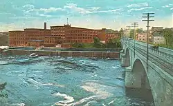 Lockwood Mill Historic District |
May 8, 2007 (#07000412) |
6, 6B, 8, 10, and 10B Water St. 44°32′46″N 69°37′47″W |
Waterville | |
| 71 | Alvin O. Lombard House |  Alvin O. Lombard House |
February 19, 1982 (#82000753) |
65 Elm St. 44°33′00″N 69°37′59″W |
Waterville | |
| 72 | Jon Lund Site | November 21, 1980 (#80000234) |
Address Restricted |
Manchester | ||
| 73 | Maine Archeological Survey Site 53.36 | December 27, 1990 (#90001901) |
Address Restricted |
Winslow | ||
| 74 | Maine Industrial School for Girls Historic District | Maine Industrial School for Girls Historic District |
April 22, 2003 (#03000289) |
Winthrop St., 0.5 miles west of its junction with Water St. 44°17′30″N 69°47′51″W |
Hallowell | |
| 75 | Maine Insane Hospital | 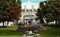 Maine Insane Hospital |
July 19, 1982 (#82000754) |
Hospital St. • Boundary increase (listed August 2, 2001: Bounded by Hospital St. and Hospital Ave. 44°18′06″N 69°46′12″W |
Augusta | |
| 76 | Maine State House |  Maine State House |
April 24, 1973 (#73000266) |
Capitol St. 44°18′25″N 69°46′56″W |
Augusta | |
| 77 | Masonic Hall |  Masonic Hall |
May 2, 1986 (#86001695) |
313-321 Water St. 44°18′51″N 69°46′30″W |
Augusta | |
| 78 | Memorial Hall |  Memorial Hall |
November 23, 1977 (#77000071) |
Church St. 44°32′45″N 69°43′12″W |
Oakland | |
| 79 | Mill Agent's House |  Mill Agent's House |
October 6, 1983 (#83003645) |
State Route 32 44°29′10″N 69°37′21″W |
North Vassalboro | |
| 80 | Moody Mansion |  Moody Mansion |
May 17, 2006 (#06000394) |
State Route 194, across from the junction with Hanley Rd. 44°10′32″N 69°40′24″W |
Pittston | |
| 81 | Lot Morrill House |  Lot Morrill House |
July 18, 1974 (#74000171) |
113 Winthrop St. 44°19′01″N 69°47′01″W |
Augusta | |
| 82 | Mt. Merici Historic District |  Mt. Merici Historic District |
March 28, 2019 (#100003588) |
152 Western Ave. & 99 St. Angela Way 44°33′17″N 69°39′21″W |
Waterville | |
| 83 | Noble Block |  Noble Block |
May 2, 1986 (#86001696) |
186 Water St. 44°19′00″N 69°46′27″W |
Augusta | |
| 84 | North Monmouth Library |  North Monmouth Library |
March 27, 2017 (#100000807) |
132 N. Main St. 44°16′33″N 70°01′40″W |
Monmouth | |
| 85 | Oakland Public Library | 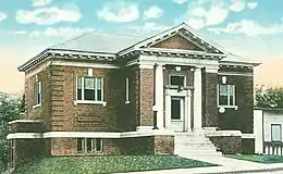 Oakland Public Library |
April 14, 2000 (#00000375) |
18 Church St. 44°32′47″N 69°43′11″W |
Oakland | |
| 86 | Oaklands | 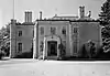 Oaklands |
July 27, 1973 (#73000131) |
Southern end of Dresden St. 44°12′48″N 69°45′58″W |
Gardiner | |
| 87 | Old Post Office | 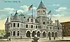 Old Post Office |
July 18, 1974 (#74000172) |
295 Water St. 44°18′52″N 69°46′27″W |
Augusta | |
| 88 | Pendle Hill | 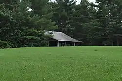 Pendle Hill |
August 4, 1983 (#83000457) |
Off U.S. Route 202 44°24′37″N 69°33′48″W |
China | |
| 89 | Pittston Congregational Church |  Pittston Congregational Church |
January 31, 1978 (#78000179) |
Junction of State Routes 27 and 194 44°13′02″N 69°45′19″W |
Pittston | |
| 90 | Pond Meeting House |  Pond Meeting House |
August 4, 1983 (#83000458) |
On U.S. Route 202 44°26′12″N 69°31′41″W |
China | On the grounds of the Friends Camp |
| 91 | Powder House Lot |  Powder House Lot |
April 11, 2002 (#02000348) |
High St., ¼ mile south of its junction with Winthrop St. 44°17′19″N 69°48′00″W |
Hallowell | |
| 92 | Powers House |  Powers House |
October 1, 1979 (#79000150) |
South of Sidney on State Route 104 44°23′23″N 69°44′07″W |
Sidney | |
| 93 | Pressey House |  Pressey House |
September 15, 1977 (#77000072) |
32 Belgrade Rd. 44°32′28″N 69°43′28″W |
Oakland | |
| 94 | Professional Building | .jpg.webp) Professional Building |
February 19, 1982 (#82000755) |
177 and 179 Main St. 44°33′07″N 69°37′52″W |
Waterville | |
| 95 | Dr. Samuel Quimby House |  Dr. Samuel Quimby House |
December 18, 1990 (#90001903) |
North Rd. east of its junction with Church Rd. 44°25′49″N 69°56′19″W |
Mount Vernon | |
| 96 | Readfield Union Meeting House |  Readfield Union Meeting House |
July 8, 1982 (#82000756) |
Church Rd. 44°23′22″N 69°58′01″W |
Readfield | |
| 97 | Redington House |  Redington House |
July 21, 1978 (#78000180) |
64 Silver St. 44°32′49″N 69°38′05″W |
Waterville | Historical society museum |
| 98 | G.W. Reed Travellers Home |  G.W. Reed Travellers Home |
February 11, 1982 (#82000757) |
Address Restricted |
Benton | |
| 99 | Laura Richards House |  Laura Richards House |
June 14, 1979 (#79000151) |
3 Dennis St. 44°13′38″N 69°46′21″W |
Gardiner | |
| 100 | River Meetinghouse |  River Meetinghouse |
September 19, 1977 (#77000073) |
U.S. Route 201 and Oak Grove Rd. 44°28′02″N 69°40′30″W |
Vassalboro | |
| 101 | Riverview House |  Riverview House |
April 12, 2001 (#01000369) |
U.S. Route 201 0.15 miles southeast of its junction with Old Federal Rd. 44°22′54″N 69°43′07″W |
Vassalboro | |
| 102 | Edwin Arlington Robinson House |  Edwin Arlington Robinson House |
November 11, 1971 (#71000070) |
67 Lincoln Ave. 44°13′20″N 69°46′25″W |
Gardiner | |
| 103 | Row House | 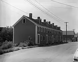 Row House |
July 1, 1970 (#70000047) |
106-114 2nd St. 44°17′14″N 69°47′29″W |
Hallowell | |
| 104 | Elizabeth Ann Seton Hospital |  Elizabeth Ann Seton Hospital |
July 11, 2016 (#16000437) |
30 Chase Ave. 44°32′57″N 69°39′31″W |
Waterville | |
| 105 | South China Meeting House | 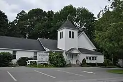 South China Meeting House |
August 4, 1983 (#83000459) |
S. China Village 44°23′45″N 69°34′27″W |
South China | |
| 106 | South Parish Congregational Church and Parish House | 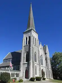 South Parish Congregational Church and Parish House |
June 22, 1980 (#80000235) |
Church St. 44°19′02″N 69°46′33″W |
Augusta | |
| 107 | Spruce Point Camps | 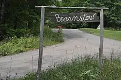 Spruce Point Camps |
February 7, 2007 (#07000011) |
84 Bearnstow Rd. 44°29′56″N 70°00′51″W |
Mount Vernon | Now known as Bearnstow. |
| 108 | St. Mark's Episcopal Church | 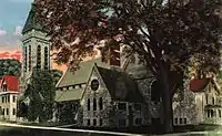 St. Mark's Episcopal Church |
July 19, 1984 (#84001379) |
9 Summer St. 44°18′59″N 69°46′43″W |
Augusta | |
| 109 | St. Mary's Church | 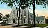 St. Mary's Church |
June 12, 1987 (#87000943) |
39 Western Ave. 44°18′42″N 69°47′03″W |
Augusta | |
| 110 | Starling Grange #156 (former) | 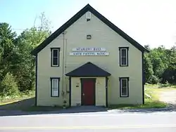 Starling Grange #156 (former) |
April 5, 2016 (#16000136) |
2769 Main St. (ME 17) 44°26′58″N 70°04′07″W |
Fayette | |
| 111 | Capt. Nathaniel Stone House | 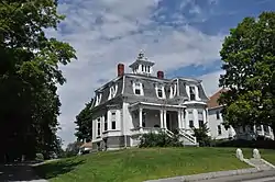 Capt. Nathaniel Stone House |
April 22, 2003 (#03000292) |
268 Maine Ave. 44°14′21″N 69°46′19″W |
Farmingdale | |
| 112 | Sturgis and Haskell Building | 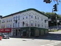 Sturgis and Haskell Building |
May 2, 1986 (#86001697) |
180-182 Water St. 44°19′00″N 69°46′27″W |
Augusta | |
| 113 | Tappan-Viles House | 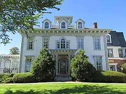 Tappan-Viles House |
February 11, 1982 (#82000759) |
154 State St. 44°18′40″N 69°46′48″W |
Augusta | |
| 114 | The Birches | 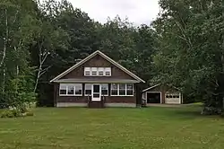 The Birches |
September 27, 1996 (#96001036) |
Off the eastern side of Foster Ln., 0.15 miles south of its junction with State Route 27 44°31′22″N 69°53′14″W |
Belgrade Lakes | |
| 115 | Tiffany Chapel |  Tiffany Chapel |
October 4, 2018 (#100003010) |
544 Tiffany Rd. 44°27′42″N 69°45′22″W |
Sidney | |
| 116 | Togus VA Medical Center and National Cemetery |  Togus VA Medical Center and National Cemetery |
October 3, 2012 (#12000826) |
1 VA Center 44°16′43″N 69°42′15″W |
Togus | |
| 117 | Two Cent Bridge |  Two Cent Bridge |
September 20, 1973 (#73000132) |
Spans the Kennebec River at Temple St. 44°33′03″N 69°37′45″W |
Waterville and Winslow | |
| 118 | Joseph H. Underwood House |  Joseph H. Underwood House |
December 28, 2005 (#05001470) |
1957 Main St. 44°24′33″N 70°02′02″W |
Fayette | |
| 119 | Universalist-Unitarian Church | 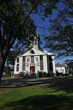 Universalist-Unitarian Church |
February 17, 1978 (#78000181) |
Silver and Elm Sts. 44°32′48″N 69°38′09″W |
Waterville | |
| 120 | Vassalboro Mill | 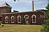 Vassalboro Mill |
October 5, 2020 (#100005649) |
934 and 960 Main St. 44°29′12″N 69°37′23″W |
Vassalboro | |
| 121 | Vaughan Homestead | 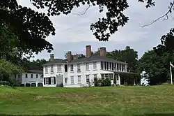 Vaughan Homestead |
October 6, 1970 (#70000091) |
Middle St. off Litchfield Rd. 44°16′36″N 69°47′43″W |
Hallowell | |
| 122 | Vickery Building | 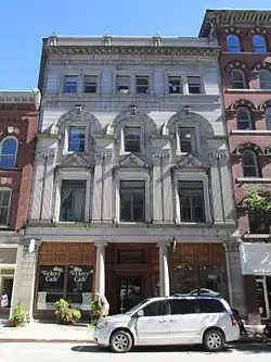 Vickery Building |
March 22, 1984 (#84001380) |
261 Water St. 44°18′46″N 69°46′28″W |
Augusta | |
| 123 | Vienna Town House | 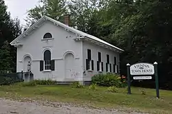 Vienna Town House |
October 29, 1982 (#82000424) |
State Route 41 44°32′21″N 69°59′57″W |
Vienna | |
| 124 | Water Street |  Water Street |
January 17, 2017 (#100000524) |
71-286 Water & 1 Winthrop Sts. 44°18′56″N 69°46′26″W |
Augusta | |
| 125 | Waterville High School | 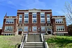 Waterville High School |
September 30, 2010 (#10000807) |
21 Gilman St. 44°33′13″N 69°38′14″W |
Waterville | aka the Gilman Street School, now apartments. |
| 126 | Waterville Main Street Historic District |  Waterville Main Street Historic District |
December 19, 2012 (#12001066) |
Roughly Main & Common Sts.; also 129-179 Main & 13 Appleton Sts. 44°32′58″N 69°37′47″W |
Waterville | Second set of addresses represent a boundary increase September 27, 2016 |
| 127 | Waterville Opera House and City Hall | 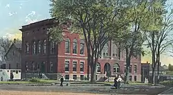 Waterville Opera House and City Hall |
January 1, 1976 (#76000097) |
Castonguay Sq. 44°32′59″N 69°37′47″W |
Waterville | |
| 128 | Waterville Post Office | 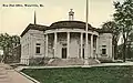 Waterville Post Office |
April 18, 1977 (#77000074) |
Main and Elm St. 44°33′08″N 69°37′54″W |
Waterville | |
| 129 | Wayne Town House | 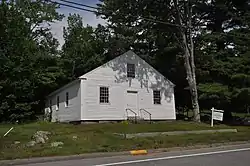 Wayne Town House |
January 1, 1976 (#76000098) |
State Route 133 44°21′10″N 70°04′25″W |
Wayne | |
| 130 | Whitehouse Block | 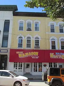 Whitehouse Block |
May 2, 1986 (#86001698) |
188 Water St. 44°19′00″N 69°46′27″W |
Augusta | |
| 131 | Williams Block | 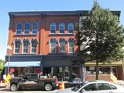 Williams Block |
May 2, 1986 (#86001699) |
183-187 Water St. 44°19′00″N 69°46′28″W |
Augusta | |
| 132 | John Williams House | 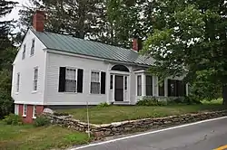 John Williams House |
December 6, 1984 (#84000531) |
Church St. 44°30′07″N 69°59′19″W |
Mount Vernon | |
| 133 | Wing Family Cemetery | 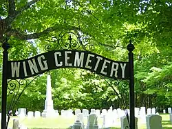 Wing Family Cemetery |
October 16, 1991 (#91001514) |
Eastern side of Pond Rd. north of its junction with State Route 133 44°22′14″N 70°04′01″W |
Wayne | |
| 134 | Winthrop Mills Company | 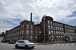 Winthrop Mills Company |
October 8, 2014 (#14000835) |
149-151 Main Street 44°18′26″N 69°58′17″W |
Winthrop | |
| 135 | Winthrop Street Historic District |  Winthrop Street Historic District |
August 6, 2001 (#01000815) |
Roughly bounded by State, Bridge, North and South Chestnut, and Green Sts. • Boundary increase (listed December 30, 2008, refnum 08001255): 20 Spring St. 44°18′54″N 69°46′52″W |
Augusta |
Former listings
| [3] | Name on the Register | Image | Date listed | Date removed | Location | City or town | Description |
|---|---|---|---|---|---|---|---|
| 1 | Klir Beck House | November 23, 1977 (#100001239) | June 30, 2017 | West of Mt. Vernon off State Route 41 44°30′26″N 70°00′05″W |
Vienna | Listed as being in the Mt. Vernon vicinity; destroyed by fire on January 27, 2000.[7] | |
| 2 | Christian Science Church | June 13, 1986 (#86001271) | August 5, 1987 | 17 Lincoln Ave. |
Gardiner | Delisted due to extensive alterations. | |
| 3 | Dinsmore Grain Company Mill | 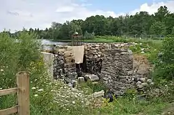 Dinsmore Grain Company Mill |
November 3, 1979 (#79000147) | March 21, 2023 | West of Palermo on State Route 3 44°24′32″N 69°28′28″W |
China | Main building apparently demolished. |
| 4 | Shrewsbury Round Barn | February 19, 1982 (#82000758) | January 15, 2004 | 109 Benton Avenue |
Winslow | Was the only round barn in the state of Maine. Was destroyed by fire on May 22, 1991. | |
| 5 | Jonas R. Shurtleff House | December 30, 1974 (#74000173) | March 21, 2023 | Augusta Rd. 44°31′36″N 69°38′34″W |
Winslow | Apparently demolished. |
See also
Wikimedia Commons has media related to National Register of Historic Places in Kennebec County, Maine.
References
- The latitude and longitude information provided in this table was derived originally from the National Register Information System, which has been found to be fairly accurate for about 99% of listings. Some locations in this table may have been corrected to current GPS standards.
- National Park Service, United States Department of the Interior, "National Register of Historic Places: Weekly List Actions", retrieved October 20, 2023.
- Numbers represent an alphabetical ordering by significant words. Various colorings, defined here, differentiate National Historic Landmarks and historic districts from other NRHP buildings, structures, sites or objects.
- "National Register Information System". National Register of Historic Places. National Park Service. April 24, 2008.
- The eight-digit number below each date is the number assigned to each location in the National Register Information System database, which can be viewed by clicking the number.
- "Cushnoc Archeological Site". National Historic Landmark summary listing. National Park Service. Retrieved 2008-03-03.
- "Fire levels Beck home". Sun Journal (Lewiston, Maine). January 28, 2000. p. B1. Retrieved July 6, 2022 – via Newspapers.com.
| Topics | |
|---|---|
| Lists by state |
|
| Lists by insular areas | |
| Lists by associated state | |
| Other areas | |
| Related | |
Municipalities and communities of Kennebec County, Maine, United States | ||
|---|---|---|
| Cities | Kennebec County map | |
| Towns | ||
| Unorganized territory | ||
| CDPs | ||
| Other villages | ||
This article is issued from Wikipedia. The text is licensed under Creative Commons - Attribution - Sharealike. Additional terms may apply for the media files.