National Register of Historic Places listings in Somerset County, Maine
This is a list of the National Register of Historic Places listings in Somerset County, Maine.
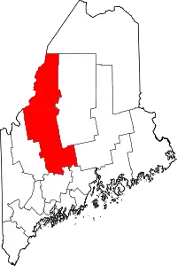
Location of Somerset County in Maine
This is intended to be a complete list of the properties and districts on the National Register of Historic Places in Somerset County, Maine, United States. Latitude and longitude coordinates are provided for many National Register properties and districts; these locations may be seen together in a map.[1]
There are 59 properties and districts listed on the National Register in the county, including 1 National Historic Landmark.
This National Park Service list is complete through NPS recent listings posted October 20, 2023.[2]
| Androscoggin - Aroostook - Cumberland - Franklin - Hancock - Kennebec - Knox - Lincoln - Oxford - Penobscot - Piscataquis - Sagadahoc - Somerset - Waldo - Washington - York |
Current listings
| [3] | Name on the Register[4] | Image | Date listed[5] | Location | City or town | Description |
|---|---|---|---|---|---|---|
| 1 | Anson Grange No. 88 | 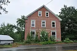 Anson Grange No. 88 |
April 28, 2004 (#04000371) |
10 Elm St. 44°51′16″N 69°53′55″W |
North Anson | |
| 2 | Arnold Trail to Quebec | 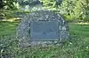 Arnold Trail to Quebec |
October 1, 1969 (#69000018) |
Along the Kennebec River, through Wayman and Flagstaff lakes along the Dead River and Chain of Ponds to Quebec, Canada 45°10′22″N 70°02′32″W |
Bingham | Extends through Franklin, Kennebec, Sagadahoc, and Somerset counties |
| 3 | Bailey Farm Windmill | 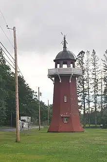 Bailey Farm Windmill |
June 28, 1988 (#88000885) |
State Route 16 44°51′45″N 69°55′49″W |
North Anson | |
| 4 | Asa Bates Memorial Chapel | 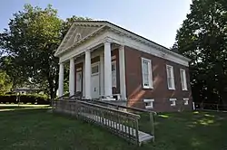 Asa Bates Memorial Chapel |
October 31, 2002 (#02001272) |
2 Ten Lots Rd. 44°35′29″N 69°41′51″W |
Fairfield Center | |
| 5 | Bigelow-Page House | 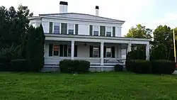 Bigelow-Page House |
April 20, 1988 (#88000395) |
20 High St. 44°46′10″N 69°43′13″W |
Skowhegan | |
| 6 | Bingham Free Meetinghouse | 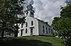 Bingham Free Meetinghouse |
June 3, 1976 (#76000113) |
S. Main St. (U.S. Route 201) 45°03′08″N 69°52′58″W |
Bingham | |
| 7 | Birch Island House | March 7, 1996 (#96000246) |
Birch Island 45°35′15″N 70°25′36″W |
Holeb | ||
| 8 | Bloomfield Academy | 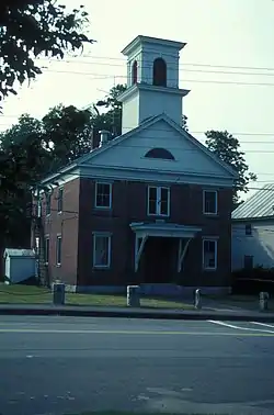 Bloomfield Academy |
February 19, 1982 (#82000778) |
Main St. 44°45′37″N 69°43′04″W |
Skowhegan | |
| 9 | Caratunk Falls Archeological District | 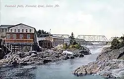 Caratunk Falls Archeological District |
May 30, 1986 (#86001200) |
Address Restricted |
Solon | |
| 10 | Carrabasset Inn | 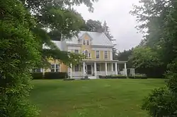 Carrabasset Inn |
April 14, 2000 (#00000376) |
Junction of Union St. and State Route 8 44°51′10″N 69°53′44″W |
North Anson | |
| 11 | Gov. Abner Coburn House | 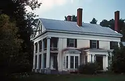 Gov. Abner Coburn House |
July 30, 1974 (#74000193) |
Main St. 44°45′43″N 69°43′00″W |
Skowhegan | |
| 12 | Concord Haven | 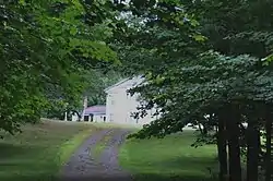 Concord Haven |
October 2, 1992 (#92001297) |
Eastern side of State Route 16, 1.7 miles (2.7 km) north of its junction with Berry Rd. 44°58′34″N 69°52′42″W |
Embden | |
| 13 | Connor-Bovie House | 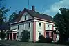 Connor-Bovie House |
January 18, 1974 (#74000321) |
22 Summit Street 44°35′14″N 69°36′03″W |
Fairfield | |
| 14 | Cotton-Smith House | 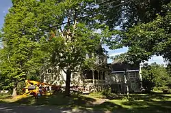 Cotton-Smith House |
June 18, 1992 (#92000794) |
42 High St. 44°35′11″N 69°36′02″W |
Fairfield | |
| 15 | C. F. Douglas House | 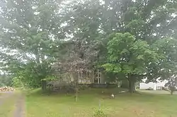 C. F. Douglas House |
December 18, 1978 (#78000200) |
State Route 8 44°42′46″N 69°47′44″W |
Norridgewock | |
| 16 | Dudley's Corner School House | 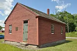 Dudley's Corner School House |
July 15, 2002 (#02000787) |
5 Dudley Corner Rd. 44°46′20″N 69°40′34″W |
Skowhegan | |
| 17 | Eaton School | 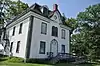 Eaton School |
June 23, 1988 (#88000884) |
Junction of Main St. and Mercer Rd. 44°42′48″N 69°47′55″W |
Norridgewock | |
| 18 | Embden Town House | 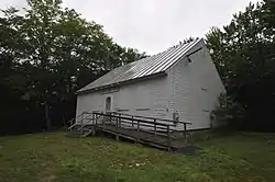 Embden Town House |
October 16, 1989 (#89001704) |
Cross Town Rd. 44°54′42″N 69°55′57″W |
Embden | |
| 19 | The Evergreens |  The Evergreens |
February 8, 1982 (#82000779) |
Ferry Street[6] 44°56′17″N 69°52′03″W |
Solon | Archaeological site, on the Evergreens Campground property |
| 20 | First Baptist Church, Former | 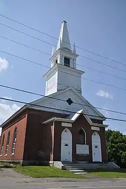 First Baptist Church, Former |
June 21, 1991 (#91000770) |
Western side of Main St., south of State Route 104 44°45′37″N 69°43′03″W |
Skowhegan | |
| 21 | Founders Hall | 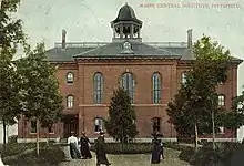 Founders Hall |
October 9, 1979 (#79000167) |
S. Main St. 44°46′46″N 69°23′14″W |
Pittsfield | The central campus building of Maine Central Institute. |
| 22 | Gerald Hotel | 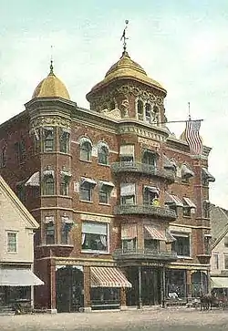 Gerald Hotel |
March 25, 2013 (#12000894) |
151-157 Main St. 44°35′13″N 69°35′43″W |
Fairfield | |
| 23 | Amos Gerald House |  Amos Gerald House |
June 24, 1980 (#80000252) |
107 Main St. 44°35′05″N 69°35′54″W |
Fairfield | |
| 24 | Gould House | 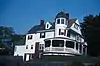 Gould House |
February 19, 1982 (#82001886) |
31 Elm St. 44°46′01″N 69°43′23″W |
Skowhegan | |
| 25 | Hinckley Good Will Home Historic District | 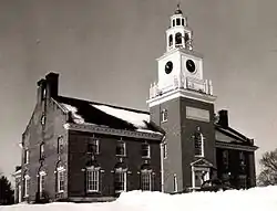 Hinckley Good Will Home Historic District |
January 9, 1987 (#87000232) |
U.S. Route 201 44°40′05″N 69°37′59″W |
Hinckley | |
| 26 | History House | 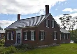 History House |
December 29, 1983 (#83003677) |
40 Elm St. 44°45′56″N 69°43′32″W |
Skowhegan | |
| 27 | Hodgdon Site | April 23, 1980 (#80000253) |
Address Restricted |
Embden | ||
| 28 | Samuel Holden House | 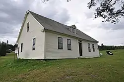 Samuel Holden House |
December 14, 1995 (#95001459) |
Eastern side of U.S. Route 201, 0.25 miles (0.40 km) north of its junction with an MDOT road 45°39′04″N 70°15′54″W |
Moose River | |
| 29 | Ingalls House | 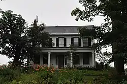 Ingalls House |
June 5, 1975 (#75000110) |
Main St. 44°40′39″N 69°56′18″W |
Mercer | |
| 30 | Kromberg Barn | 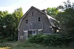 Kromberg Barn |
January 22, 2009 (#08001357) |
Eastern side of E. Pond Rd., across from 462 E. Pond Rd. 44°37′08″N 69°46′10″W |
Smithfield | |
| 31 | Lakewood Theater | 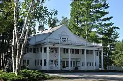 Lakewood Theater |
June 18, 1975 (#75000111) |
On the banks of Lake Wesserunsett 44°49′53″N 69°46′38″W |
Madison | |
| 32 | Lawrence Library | 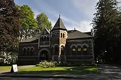 Lawrence Library |
December 31, 1974 (#74000322) |
33 Lawrence Avenue 44°35′16″N 69°36′10″W |
Fairfield | |
| 33 | Madison Public Library | 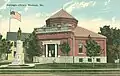 Madison Public Library |
January 5, 1989 (#88003022) |
Old Point Ave. 44°47′46″N 69°52′48″W |
Madison | |
| 34 | Maine Spinning Company Mill | 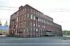 Maine Spinning Company Mill |
June 20, 2022 (#100007808) |
7 Island Ave. 44°45′50″N 69°43′12″W |
Skowhegan | |
| 35 | Sophie May House | 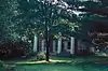 Sophie May House |
October 8, 1976 (#76000114) |
Sophie May Lane 44°43′04″N 69°48′03″W |
Norridgewock | |
| 36 | Mercer Union Meetinghouse | 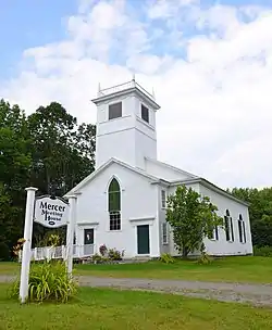 Mercer Union Meetinghouse |
January 9, 2007 (#06001223) |
Main St., 0.1 miles (0.16 km) west of its junction with U.S. Route 2 44°40′37″N 69°55′54″W |
Mercer | |
| 37 | Moose River Congregational Church | 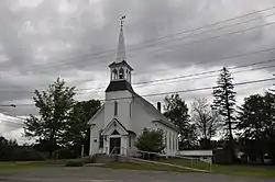 Moose River Congregational Church |
October 8, 1998 (#98001234) |
Junction of U.S. Route 201 and Nichols Rd. 45°38′24″N 70°15′43″W |
Jackman | |
| 38 | New Portland Wire Bridge | 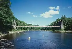 New Portland Wire Bridge |
January 12, 1970 (#70000065) |
Wire Bridge Rd. over the Carrabassett River 44°53′27″N 70°05′37″W |
New Portland | |
| 39 | Norridgewock Archeological District | 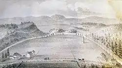 Norridgewock Archeological District |
April 12, 1993 (#93000606) |
Three sites in Madison, Starks, and Norridgewock[7] 44°46′01″N 69°53′00″W |
Norridgewock, Madison and Starks | |
| 40 | Norridgewock Female Academy | 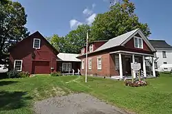 Norridgewock Female Academy |
March 7, 1996 (#96000244) |
Northern side of U.S. Route 2, 0.05 miles (0.080 km) west of its junction with Upper Main Street 44°42′48″N 69°47′54″W |
Norridgewock | Now owned by the Norridgewock Historical Society. |
| 41 | Norridgewock Free Public Library | 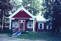 Norridgewock Free Public Library |
February 4, 1982 (#82000780) |
Sophie May Lane 44°43′04″N 69°47′56″W |
Norridgewock | |
| 42 | Old Point and Sebastian Rale Monument | 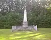 Old Point and Sebastian Rale Monument |
April 2, 1973 (#73000147) |
South of Madison off Alternate U.S. Route 201 44°46′08″N 69°53′17″W |
Madison | |
| 43 | Pittsfield Public Library | 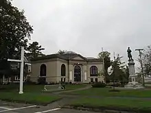 Pittsfield Public Library |
January 4, 1983 (#83000471) |
Main St. 44°46′55″N 69°26′50″W |
Pittsfield | |
| 44 | Pittsfield Railroad Station | Pittsfield Railroad Station |
January 23, 1980 (#80000254) |
Central St. 44°46′57″N 69°23′02″W |
Pittsfield | |
| 45 | Pittsfield Universalist Church | 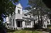 Pittsfield Universalist Church |
July 14, 1983 (#83000472) |
N. Main and Easy Sts. 44°47′03″N 69°22′55″W |
Pittsfield | |
| 46 | Pittston Farm | 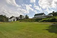 Pittston Farm |
July 10, 2000 (#00000762) |
Western end of Seboomook Lake at its confluence with the south branch of the Penobscot River 45°53′39″N 69°57′47″W |
Pittston Academy Grant | |
| 47 | Quincy Building | 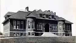 Quincy Building |
October 4, 1978 (#78000330) |
South of Hinckley 44°39′45″N 69°37′40″W |
Hinckley | |
| 48 | Skowhegan Fire Station | 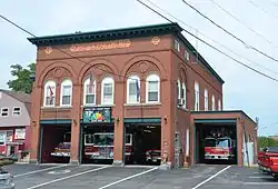 Skowhegan Fire Station |
October 20, 1983 (#83003679) |
Island Ave. 44°45′50″N 69°43′09″W |
Skowhegan | |
| 49 | Skowhegan Free Public Library | 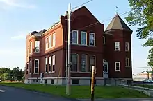 Skowhegan Free Public Library |
April 14, 1983 (#83000473) |
9 Elm St. 44°45′58″N 69°43′15″W |
Skowhegan | |
| 50 | Skowhegan Historic District | 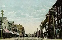 Skowhegan Historic District |
February 19, 1982 (#82000781) |
Madison Ave., Water St. and Russell St. 44°45′57″N 69°43′05″W |
Skowhegan | |
| 51 | Somerset Academy | 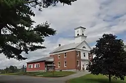 Somerset Academy |
July 19, 1984 (#84001499) |
Academy St. 44°55′37″N 69°40′18″W |
Athens | |
| 52 | Somerset County Courthouse | 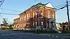 Somerset County Courthouse |
November 8, 1984 (#84000332) |
Court St. 44°45′59″N 69°43′10″W |
Skowhegan | |
| 53 | South Solon Meetinghouse | 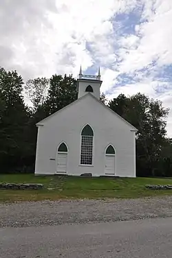 South Solon Meetinghouse |
June 16, 1980 (#80000255) |
5 miles (8.0 km) southeast of Solon 44°54′47″N 69°46′44″W |
Solon | |
| 54 | Spaulding House | 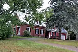 Spaulding House |
December 18, 1978 (#78000201) |
Main St. 44°42′51″N 69°47′45″W |
Norridgewock | |
| 55 | Temples Historic District | 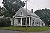 Temples Historic District |
May 12, 1983 (#83000474) |
Madison Ave. 44°51′22″N 69°53′46″W |
North Anson | |
| 56 | Henry Knox Thatcher House | October 29, 2002 (#02001273) |
Old State Route 3 and Elm St. 44°40′40″N 69°56′03″W |
Mercer | ||
| 57 | Weston Homestead | 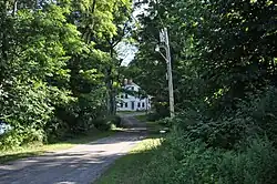 Weston Homestead |
November 23, 1977 (#77000086) |
North of Madison on Weston Ave. 44°49′13″N 69°52′13″W |
Madison | |
| 58 | Samuel Weston Homestead | 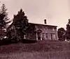 Samuel Weston Homestead |
November 10, 1980 (#80000256) |
South of Skowhegan on U.S. Route 201 44°44′50″N 69°39′55″W |
Skowhegan | |
| 59 | Young Surgical Building-Central Maine Sanatorium | 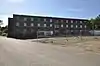 Young Surgical Building-Central Maine Sanatorium |
June 28, 2021 (#100006674) |
50 Mountain Ave. 44°36′23″N 69°35′59″W |
Fairfield |
Former listings
| [3] | Name on the Register | Image | Date listed | Date removed | Location | City or town | Description |
|---|---|---|---|---|---|---|---|
| 1 | Steward-Emery House | 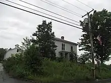 Steward-Emery House |
December 17, 1992 (#92001705) | March 21, 2023 | Main St., 0.25 miles (0.40 km) north of its junction with State Route 16 44°51′24″N 69°53′52″W |
North Anson |
See also
Wikimedia Commons has media related to National Register of Historic Places in Somerset County, Maine.
References
- The latitude and longitude information provided in this table was derived originally from the National Register Information System, which has been found to be fairly accurate for about 99% of listings. Some locations in this table may have been corrected to current GPS standards.
- National Park Service, United States Department of the Interior, "National Register of Historic Places: Weekly List Actions", retrieved October 20, 2023.
- Numbers represent an alphabetical ordering by significant words. Various colorings, defined here, differentiate National Historic Landmarks and historic districts from other NRHP buildings, structures, sites or objects.
- "National Register Information System". National Register of Historic Places. National Park Service. April 24, 2008.
- The eight-digit number below each date is the number assigned to each location in the National Register Information System database, which can be viewed by clicking the number.
- "Archived copy" (PDF). Archived from the original (PDF) on 2014-12-21. Retrieved 2014-11-14.
{{cite web}}: CS1 maint: archived copy as title (link) - "Research and Preservation at Norridgewock NHL" (PDF). National Park Service. Retrieved 2015-04-27.
| Topics | |
|---|---|
| Lists by state |
|
| Lists by insular areas | |
| Lists by associated state | |
| Other areas | |
| Related | |
Municipalities and communities of Somerset County, Maine, United States | ||
|---|---|---|
| Towns | Somerset County map | |
| Plantations | ||
| Unorganized territories | ||
| CDPs | ||
| Other villages | ||
This article is issued from Wikipedia. The text is licensed under Creative Commons - Attribution - Sharealike. Additional terms may apply for the media files.