Neibert, West Virginia
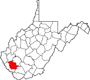
Neibert is an unincorporated community and census-designated place (CDP) in Logan County, West Virginia, United States. Its population was 183 as of the 2010 census.[2]
Neibert, West Virginia | |
|---|---|
 Neibert Bottom Road | |
 Neibert  Neibert | |
| Coordinates: 37°47′17″N 81°56′30″W | |
| Country | United States |
| State | West Virginia |
| County | Logan |
| Area | |
| • Total | 0.630 sq mi (1.63 km2) |
| • Land | 0.612 sq mi (1.59 km2) |
| • Water | 0.018 sq mi (0.05 km2) |
| Elevation | 718 ft (219 m) |
| Population | |
| • Total | 183 |
| • Density | 299.0/sq mi (115.4/km2) |
| Time zone | UTC-5 (Eastern (EST)) |
| • Summer (DST) | UTC-4 (EDT) |
| ZIP Code | 25632 (Lyburn) |
| Area code(s) | 304 & 681 |
| GNIS feature ID | 1544085[3] |
| FIPS code | 54-57916 |
Geography
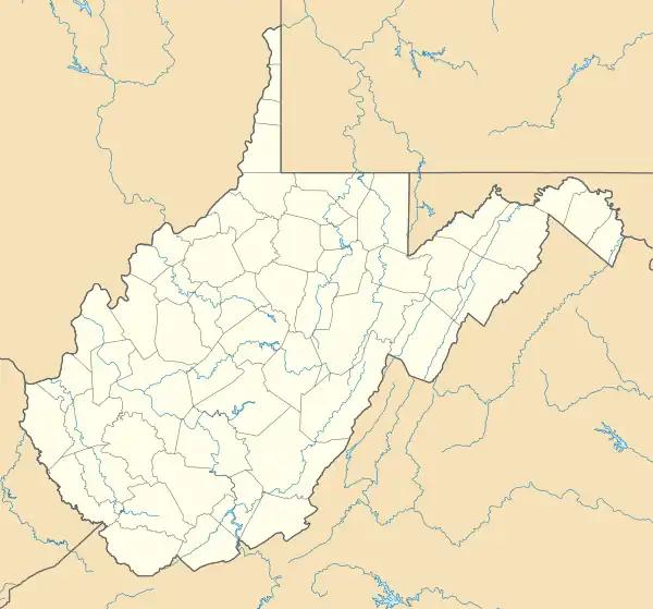
Neibert is in south-central Logan County, on the east side of the Guyandotte River. Hanging Rock Highway, former West Virginia Route 10, is the main road through the community, leading northwest (downriver) 8 miles (13 km) to Logan, the county seat, and southeast (upriver) 6 miles (10 km) to Man. Current WV-10 is a four-lane freeway that bypasses Neibert on the west side of the river; the closest access point is 0.8 miles (1.3 km) south of town, where Hanging Rock Highway crosses WV-10.
According to the U.S. Census Bureau, the Neibert CDP has a total area of 0.62 square miles (1.6 km2), of which 0.02 square miles (0.05 km2), or 2.83%, are water.[1]
References
- "2020 U.S. Gazetteer Files – West Virginia". United States Census Bureau. Retrieved March 16, 2021.
- "Total Population: 2010 Census DEC Summary File 1 (P1), Neibert CDP, West Virginia". data.census.gov. U.S. Census Bureau. Retrieved March 16, 2021.
- U.S. Geological Survey Geographic Names Information System: Neibert, West Virginia