Verdunville, West Virginia
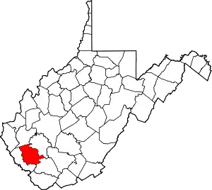
Verdunville is an unincorporated community and census-designated place (CDP) in Logan County, West Virginia, United States. It is 3.5 miles (5.6 km) west of Logan, the county seat. Verdunville has a post office with ZIP code 25649.[4] The Verdunville CDP includes the neighboring community of Shegon. As of the 2010 census, the total CDP population was 687.[2]
Verdunville, West Virginia | |
|---|---|
 Verdunville  Verdunville | |
| Coordinates: 37°50′40″N 82°03′18″W | |
| Country | United States |
| State | West Virginia |
| County | Logan |
| Area | |
| • Total | 2.673 sq mi (6.92 km2) |
| • Land | 2.671 sq mi (6.92 km2) |
| • Water | 0.002 sq mi (0.005 km2) |
| Elevation | 879 ft (268 m) |
| Population | |
| • Total | 687 |
| • Density | 257.2/sq mi (99.3/km2) |
| Time zone | UTC-5 (Eastern (EST)) |
| • Summer (DST) | UTC-4 (EDT) |
| ZIP code | 25649 |
| Area code(s) | 304 & 681 |
| GNIS feature ID | 1548644[3] |
| FIPS code | 54-83332 |
The community's name commemorates the Battle of Verdun.[5]
Geography
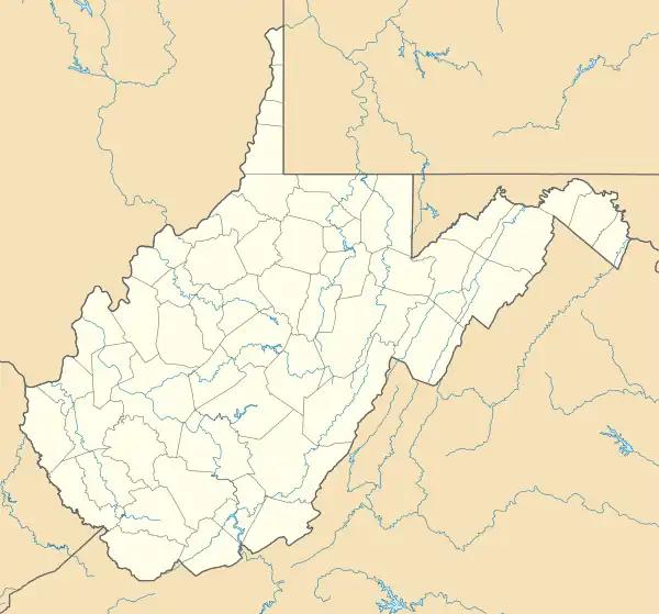
Verdunville is in west-central Logan County, in the valley of the Mud Fork, an east-flowing tributary of Island Creek and part of the Guyandotte River watershed. Mud Fork Road runs up the valley from Mount Gay in the east (near Logan), through Verdunville and Shegon to the northwest, and leads eventually to Dingess in Mingo County. U.S. Route 119, a four-lane expressway, forms the eastern edge of the Verdunville CDP, with the closest access from an interchange with West Virginia Route 73 north of the Mud Fork valley.
According to the U.S. Census Bureau, the Verdunville CDP has a total area of 2.7 square miles (6.9 km2), of which 1.1 acres (4,549 m2), or 0.07%, are water.[1]
References
- "2020 U.S. Gazetteer Files – West Virginia". United States Census Bureau. Retrieved March 17, 2021.
- "Total Population: 2010 Census DEC Summary File 1 (P1), Verdunville CDP, West Virginia". data.census.gov. U.S. Census Bureau. Retrieved March 17, 2021.
- U.S. Geological Survey Geographic Names Information System: Verdunville, West Virginia
- ZIP Code Lookup
- Kenny, Hamill (1945). West Virginia Place Names: Their Origin and Meaning, Including the Nomenclature of the Streams and Mountains. Piedmont, WV: The Place Name Press. p. 647.