Ngawi Regency
Ngawi Regency is an inland regency (kabupaten) of Indonesia, on the island of Java. Ngawi is well known around the world for its Pithecantropus erectus that was found by Eugene Dubois, a Dutchman. Ngawi is located in East Java Province, but adjoins Central Java province. Its capital Ngawi (city). Ngawi is also the main gate to enter East Java province since there are intersections that connect Surabaya–Bojonegoro–Ngawi (city)–Solo–Jogja–Bandung–Jakarta. The Regency covers an area of 1,394.74 km2 (538.51 sq mi), and had a population of 817,765 at the 2010 census[2] and 870,057 at the 2020 census;[3] the official estimate as at mid 2022 was 877,432 (comprising 435,470 males and 441,962 females).[1]
Ngawi Regency
Kabupaten Ngawi | |
|---|---|
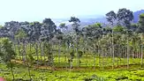
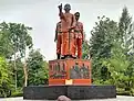
From top, left to right: Pondok Reservoir, Jamus Tea Plantation in Sine, Soerjo monument statue in Widodaren town | |
.svg.png.webp) Coat of arms | |
| Nickname(s): Ngawi Ramah • Benteng • Bambu Friendly Ngawi • Fortress • Bamboo | |
| Motto(s): Negeri Ngawi Ramah Friendly Ngawi Country | |
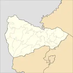 Location within Ngawi Regency | |
| Coordinates: 7°24′11″S 111°26′40.7″E | |
| Country | |
| Province | East Java |
| Anniversary | 7 July 1358 |
| Capital | Ngawi (town) |
| Government | |
| • Body | Ngawi Regencies Government |
| • Regent | Ony Anwar Harsono |
| • Vice Regent | Dwi Rianto Jatmiko |
| • Regional Secretary | Mokh. Sodiq Triwidiyanto |
| • Speaker of the regional parliament | Heru Kusnindar |
| Area | |
| • Total | 1,394.74 km2 (538.51 sq mi) |
| Highest elevation | 3,156 m (10,354 ft) |
| Lowest elevation | 47 m (154 ft) |
| Population (mid 2022 estimate)[1] | |
| • Total | 877,432 |
| • Rank | 76th in Indonesia |
| • Density | 630/km2 (1,600/sq mi) |
| Demographics | |
| • Ethnic groups | Javanese people Osing Madura Sundanese Batak Chinese Others. |
| • Religion |
|
| • Languages |
|
| Time zone | UTC+07:00 (IWST) |
| Postal code | 63211 – 63285 |
| Area code | (+62) 351 |
| ISO 3166 code | ID-JI |
| Vehicle registration | AE J**/K**/L*/M* |
| HDI | |
| Website | ngawikab.go.id |


Ngawi (town), has the largest central park ("alun-alun") in Indonesia. This large area includes a West Park and an East Park, separated by Merdeka Street. The West Park consists of a football court, a volleyball court, and a ceremonial podium near the main mosque. The East Park consists of a playground area, two tennis courts, a basketball hall, a parking area, a futsal court, a skating place, and a culinary area said to be "the most favorite place visited by Ngawinese". The municipal hall (called Alun-Alun Merdeka) is located in the central part of Ngawi town.
Van Den Bosch Fortress is a central historic site of the Ngawi Regency. It is located at the confluence of the two biggest rivers in East Java: the Solo River and the Madiun River.
Climate
Ngawi has a monsoon tropical climate (Köppen climate classification Am), dry at mid-year, with heavy rain the rest of the year.
Administrative districts
Ngawi Regency is divided into nineteen districts (kecamatan), tabulated below with their areas and their population totals from the 2010 census[2] and the 2020 census,[3] together with the official estimates as at mid 2022.[1] The table also includes the locations of the district headquarters and the number of administrative villages (rural desa and urban kelurahan) in each district.
| Name of District (kecamatan) | Area in km2 | Pop'n census 2010 | Pop'n census 2020 | Pop'n estimate mid 2022 | Admin centre | No. of villages |
|---|---|---|---|---|---|---|
| Sine | 81.43 | 41,096 | 44,681 | 45,244 | Sine | 15 |
| Ngrambe | 67.59 | 38,750 | 42,267 | 42,827 | Ngrambe | 14 |
| Jogorogo | 71.04 | 38,782 | 42,307 | 42,868 | Jogorogo | 12 |
| Kendal | 86.98 | 44,242 | 50,055 | 51,078 | Kendal | 10 |
| Geneng | 54.21 | 48,975 | 51,405 | 51,699 | Geneng | 13 |
| Gerih | 33.81 | 32,118 | 36,114 | 36,808 | Gerih | 5 |
| Kwadungan | 32.63 | 25,392 | 26,590 | 26,730 | Kwadungan | 14 |
| Pangkur | 29.93 | 26,455 | 27,489 | 27,593 | Pangkur | 9 |
| Karangjati | 70.79 | 46,927 | 47,427 | 47,351 | Karangjati | 17 |
| Bringin | 67.72 | 30,554 | 30,917 | 30,874 | Bringin | 10 |
| Padas | 42.29 | 32,231 | 34,136 | 34,391 | Padas | 12 |
| Kasreman | 46.77 | 23,407 | 24,469 | 24,590 | Kasreman | 8 |
| Ngawi (town) | 70.57 | 79,951 | 83,445 | 83,831 | Karang Asri | 16 |
| Paron | 106.05 | 86,014 | 91,739 | 92,552 | Gelung | 14 |
| Kedunggalar | 104.40 | 66,336 | 71,160 | 71,870 | Kedunggalar | 12 |
| Pitu | 89.80 | 27,072 | 29,469 | 29,847 | Pitu | 10 |
| Widodaren | 112.38 | 66,102 | 70,624 | 71,273 | Walikukun | 12 |
| Mantingan | 68.70 | 37,885 | 38,142 | 38,052 | Mantingan | 7 |
| Karanganyar | 157.64 | 25,476 | 27,621 | 27,954 | Karanganyar | 71 |
| Totals | 1,294.74 | 817,765 | 870,057 | 877,432 | Ngawi | 217 |
Trinil Site
Trinil Museum
Trinil Museum is about 15 kilometres from Ngawi (town) and near to the Bengawan Solo River. The museum contains a collection of about 1,500 fossils, some of which are a million years old. As of 2013 up to 500 fossils had yet to be identified. In the late 19th century Eugene Dubois found Pithecantropus eretus in the Trinil area.
Oldest human-made mark in the world
Researchers found in Trinil site that scratch at Pseudodon vondembuschianus trinilensis plain water clam shell aged 500,000 years is the oldest scratch in the world. Although the scratch is perhaps not art, its zig-zag shape is evidence that the scratch is human made. The clam shell has been found in 1896, but the zig-zag scratch was found in 2014.[4]
References
- Badan Pusat Statistik, Jakarta, 2023, Kabupaten Ngawi Dalam Angka 2023 (Katalog-BPS 1102001.3521)
- Biro Pusat Statistik, Jakarta, 2011.
- Badan Pusat Statistik, Jakarta, 2021.
- "Ternyata Torehan Tertua Ada di Ngawi Jawa Timur". December 5, 2014.
External links
- (in Indonesian) Official site
