North Toraja Regency
North Toraja (or Toraja Utara) is a landlocked regency (kabupaten) of South Sulawesi Province of Indonesia, and the home of the Toraja ethnic group. The local government seat is in Rantepao which is also the center of Toraja culture. Formerly this regency was the northern part of Tana Toraja Regency, but on 24 June 2008 the northeastern 36% of the latter's area was split off to form this separate North Toraja Regency. It covers an area of 1,151.47 km2 and had a population of 216,762 at the 2010 census[2] and 261,086 at the 2020 census;[3] the official estimate as at mid 2022 was 268,198, comprising 136,998 males and 131,200 females.[1]
North Toraja Regency
Kabupaten Toraja Utara | |
|---|---|
 Coat of arms | |
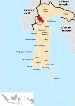 Location within South Sulawesi | |
| Country | Indonesia |
| Province | South Sulawesi |
| Capital | Rantepao |
| Area | |
| • Total | 1,151.47 km2 (444.59 sq mi) |
| Population (mid 2022 estimate)[1] | |
| • Total | 268,198 |
| • Density | 230/km2 (600/sq mi) |
| Time zone | UTC+7 (WIB) |
The Tana Toraja boundary was determined by the Dutch East Indies government in 1909. In 1926, Tana Toraja was under the administration of Bugis state, Luwu. The regentschap (or regency) status was given on 8 October 1946, the last regency given by the Dutch. Since 1984, Tana Toraja has been named as the second tourist destination after Bali by the Ministry of Tourism, Indonesia. Since then, hundreds of thousands of foreign visitors have visited this regency. In addition, numerous Western anthropologists have come to Tana Toraja to study the indigenous Torajan people and their culture.
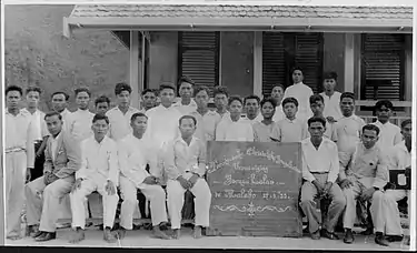
picture credits : Tropenmuseum.
Geography
Tana Toraja is located on the Sulawesi island, 300 km north of Makassar, the provincial capital of South Sulawesi. Its geographical location is between latitude of 2°-3° South and longitude 119°-120° East (center: 3°S 120°E). The area of the North Toraja Regency is 1,151.47 km2, about 2.5% of the total area of South Sulawesi province. The topography of Tana Toraja is mountainous; its minimum elevation is 150 m, while the maximum is 3,083 above the sea level.[4]
Administrative Districts
North Toraja Regency comprises twenty-one administrative Districts (Kecamatan), tabulated below with their areas and their populations at the 2010 census[2] and the 2020 census,[3] together with the official estimates as at mid 2022.[1] The table also includes the locations of the district administrative centres, the number of administrative villages (111 rural desa - here called lembang - and 40 urban kelurahan) in each district, and its post codes.
| Name of District (kecamatan) | Area in km2 | Pop'n census 2010 | Pop'n census 2020 | Pop'n estimate mid 2022 | Admin centre | No. of villages | Post code |
|---|---|---|---|---|---|---|---|
| Sopai | 47.64 | 13,042 | 15,687 | 16,098 | Nonongan Selatan | 8 | 91850 |
| Kesu | 26.00 | 15,504 | 19,150 | 19,753 | Ba'tan | 7 | 91852 |
| Sanggalangi | 39.00 | 11,129 | 13,218 | 13,532 | Buntu La'bo | 6 | 91851 |
| Buntao | 49.50 | 8,911 | 11,443 | 11,893 | Misa Ba'bana | 6 | 91841 |
| Rantebua | 84.84 | 7,595 | 8,989 | 9,196 | Buangin | 7 | 91842 |
| Nanggala | 68.00 | 9,192 | 10,376 | 10,518 | Nanggah Sangpiak Salu | 9 | 91856 |
| Tondon | 36.00 | 9,465 | 12,529 | 13,098 | Tondon Langi | 4 | 91857 |
| Tallunglipu | 9.42 | 18,068 | 20,644 | 20,976 | Tallunglipu | 7 | 91832 |
| Rantepao | 10.29 | 25,585 | 28,451 | 28,757 | Singki | 11 | 91835 (a) |
| Tikala | 23.44 | 10,275 | 12,342 | 12,662 | Buntu Barana | 7 | 91833 |
| Sesean | 40.05 | 10,893 | 13,319 | 13,712 | Pangli | 9 | 91844 |
| Balusu | 46.51 | 6,760 | 7,983 | 8,163 | Balusu | 7 | 91855 |
| Sa'dan | 80.49 | 14,923 | 18,722 | 19,370 | Satlan Malimbong | 10 | 91843 |
| Bangkelekila | 21.00 | 5,128 | 8,525 | 9,314 | Tampan Bonga | 4 | 91853 |
| Sesean Suloara | 21.68 | 6,236 | 6,943 | 7,019 | Suloara | 5 | 91845 |
| Kapala Pitu | 47.27 | 6,041 | 6,982 | 7,110 | Polo Padang | 6 | 91848 |
| Dende Piongan Napo | 77.49 | 7,979 | 9,046 | 9,178 | Dende | 8 | 91822 |
| Awan Rante Karua | 54.71 | 5,193 | 5,634 | 5,667 | Awan | 4 | 91854 |
| Rindingallo | 74.25 | 7,255 | 9,070 | 9,378 | Pangala | 9 | 91849 |
| Buntu Pepasan | 131.72 | 12,228 | 14,582 | 14,940 | Sapan | 13 | 91847 |
| Baruppu | 162.17 | 5,358 | 7,451 | 7,864 | Baruppu Selatan | 4 | 91846 |
| Totals | 1,151.47 | 216,762 | 261,086 | 268,198 | Rantepao | 151 |
Note: (a) except kelurahan of Tantepao, Manggalo and Pasale (which have post code of 91831), and Mentirotiku and Laang Tanduk (which have a post code of 91834).
See also
References
- Badan Pusat Statistik, Jakarta, 2023, Kabupaten Toraja Utara Dalam Angka 2023 (Katalog-BPS 1102001.7326)
- Biro Pusat Statistik, Jakarta, 2011.
- Badan Pusat Statistik, Jakarta, 2021.
- "Official Tana Toraja website" (in Indonesian). Archived from the original on 2005-11-10.
External links
- Toraja Treasures.com - Toraja online information.
- Official website
Regencies and cities of South Sulawesi | ||
|---|---|---|
Capital: Makassar | ||
| Regencies |  | |
| Cities | ||