Outline of Metro Manila
The following outline is provided as an overview of and topical guide to Metro Manila:

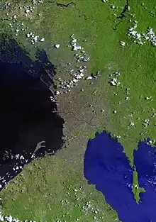
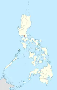
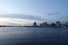
Metro Manila is the capital region of the Philippines, and is one of its seventeen administrative regions. It is located on the eastern shore of Manila Bay, in the southern portion of the island of Luzon. It lies between the Central Luzon and Calabarzon regions, with the province of Bulacan to the north, Rizal to the east, and Laguna and Cavite to the south.
Metro Manila comprises 16 cities and municipalities, including the capital city, Manila. Although Metro Manila was formed only in 1975, Manila itself dates back to 1571, with the establishment of the Province of Manila during the Spanish colonial period. The earliest evidence of human life in and around the area of Manila was dated to around 3000 BC.
With a population of 12,877,253 in 2015, Metro Manila is the largest metropolitan area in the Philippines, and the tenth most populous metropolitan area in Asia. Its total area is 619.57 square kilometres (239.22 sq mi), smaller than Philippine cities Davao City, Puerto Princesa, Zamboanga City and Butuan, and Southeast Asian city propers Bangkok, Jakarta, Hanoi and Taipei.
General reference
- Pronunciation: /məˈnɪlə/
- Common English name(s): Metro Manila, Manila (informal)
- Local name(s): Kalakhang Maynila, Maynila, Kamaynilaan
- Official English name: National Capital Region of the Republic of the Philippines
- Official local name: Pambansang Punong Rehiyon ng Republika ng Pilipinas
- Nickname(s): See: Nicknames of Manila
- Adjectival(s): Manilan, Manileño
- Demonym(s): Manileños, Manileñas, Manilans
- Abbreviation(s) and code(s):
- Common abbreviations: NCR, M.M., MNL
- Vehicle registration code: NCR (2014 series)
- ISO 3166-2 code: PH–00
- ZIP code: 1000–1800
- IDD : area code : 2
Geography

- Metro Manila is a:
- capital region
- metropolitan area
- administrative region of the Philippines.
- isthmus in southern Luzon between Manila Bay, an arm of the South China Sea, and Laguna de Bay.
Location

- Metro Manila is situated in the following regions.
- Population of Metro Manila: 12,877,253 (2015 Census[1])
- Area of Metro Manila: 613.5 km2
- Atlas of Metro Manila
- Climate of Metro Manila: tropical savanna and tropical monsoon
Geographic features


Places

- Parks in Metro Manila
- National parks
- Nature reserves
- Nature parks
- Squares and plazas
- Zoos and aquaria
- Heritage sites
Administrative divisions
Administrative divisions of Metro Manila

- Cities of Metro Manila
- Municipality of Metro Manila
- Barangays of Metro Manila
- Districts of Manila
Economy and infrastructure
- Philippine Stock Exchange
- Manila Commodity Exchange
- Makati Business Club
- Central business districts
- Mixed-use developments
- Araneta Center
- Arca South
- Ayala Center
- Bay City, Metro Manila
- Capitol Commons
- Century City, Makati
- Circuit Makati
- Eastwood City
- Entertainment City
- Eton Centris
- New Manila Bay–City of Pearl
- Newport City, Metro Manila
- Riverbanks Center
- Robinsons Cybergate
- Rockwell Center
- San Lazaro Tourism and Business Park
- Triangle Park
- U.P.-Ayala Land TechnoHub
- Skyscrapers (Tallest buildings in Metro Manila)
- Land reclamation in Metro Manila
- Poverty
Communication
- Newspapers published in Metro Manila
- Television stations in Metro Manila
- Radio stations in Metro Manila
Tourism
Transportation
- Road
- Rail
- Light Rail Transit Authority
- Metro Rail Transit Corporation
- Philippine National Railways
- Manila Light Rail Transit System
- Manila Metro Rail Transit System
- PNR Metro Commuter Line
- Strong Republic Transit System
- Rail transit stations in the Greater Manila Area
- Bicutan Automated Guideway Transit System
- University of the Philippines Diliman Automated Guideway Transit System
- Aviation
- Water
Education
- Universities and colleges in Metro Manila
- Primary and secondary schools in Metro Manila
- International schools in Metro Manila
- Libraries in Metro Manila
- University Belt
- Military schools
- Seminaries and theological colleges
Government and politics
- Metropolitan Manila Development Authority
- Chairman: Romando S. Artes
- Metro Manila Council
- Mayors of Metro Manila
- Legislative districts
- Caloocan 1st, 2nd and 3rd districts
- Las Piñas district
- Makati 1st and 2nd districts
- Malabon district
- Mandaluyong district
- Manila 1st, 2nd, 3rd, 4th, 5th and 6th districts
- Marikina 1st and 2nd districts
- Muntinlupa district
- Navotas district
- Parañaque 1st and 2nd districts
- Pasay district
- Pasig district
- Pateros-Taguig district
- Quezon City 1st, 2nd, 3rd, 4th, 5th and 6th districts
- San Juan district
- Taguig district
- Valenzuela 1st and 2nd districts
- Public services
- National Capital Region Police Office
- Eastern Police District
- Manila Police District
- Northern Police District
- Quezon City Police District
- Southern Police District
- Bureau of Fire Protection National Capital Region
- Manila Fire District
- Fire District II
- Fire District III
- Fire District IV
- Quezon City Fire District
- Bureau of Jail Management and Penology Regional Office - National Capital Region
- New Bilibid Prison
- Pasig River Rehabilitation Commission
- Laguna Lake Development Authority
- National Capital Region Police Office
- Military in Metro Manila
- Utilities
- Elections
- International relations
Health
- Hospitals in Metro Manila
- Orphanages
History
- Prehistory of Manila
- Pre-Spanish era
- Spanish colonial period
- Manila (province)
- Real Audiencia of Manila
- Manila galleon
- Battle of Bangkusay Channel
- Battle of Manila (1574)
- Conspiracy of the Maharlikas
- Sangley Rebellion
- 1645 Luzon earthquake
- Battles of La Naval de Manila
- Battle of Manila (1762)
- British occupation of Manila
- Raid on Manila (1798)
- 1880 Luzon earthquakes
- Philippine Revolution
- Spanish–American War
- American colonial period
- Province of Rizal
- Manila Army and Navy Club
- Fort William McKinley
- Philippine–American War
- Far Eastern Championship Games
- Harbor Defenses of Manila and Subic Bays
- World War II
- Post of Manila
- City of Greater Manila
- Santo Tomas Internment Camp
- Battle of Manila (1945)
- Manila massacre
- Treaty of Manila (1946)
- 1946–1986
- 1986–Present
- Mendiola massacre
- Metropolitan Manila Authority
- 1990 Luzon earthquake
- World Youth Day 1995
- Metropolitan Manila Development Authority
- Ozone Disco Club fire
- Pasig River Rehabilitation Commission
- Rizal Day bombings
- Second EDSA Revolution
- May 1 riots
- Oakwood mutiny
- Manila Peninsula siege
- PhilSports Stadium stampede
- 2007 Glorietta explosion
- Batasang Pambansa bombing
- Typhoon Ketsana
- Manila hostage crisis
- 2010 Philippine Bar exam bombing
- 2012 Metro Manila flooding
- Million People March
- Pope Francis's visit to the Philippines
- Resorts World Manila attack
- 2020 Taal Volcano eruption
- COVID-19 pandemic in Metro Manila
- Typhoon Vamco (Ulysses)
Culture
- Cultural Center of the Philippines Complex
- Annual events in Metro Manila
- Cinemas in Metro Manila
- Cultural Properties of the Philippines in Metro Manila
- Museums in Metro Manila
- Public art in Metro Manila
- Songs about Manila
- Shopping malls in Metro Manila
- Sports venues in Metro Manila
- Theaters and concert halls in Metro Manila
Religion
- Religious buildings in Metro Manila
- Buddhist temples
- Churches
- Mosques
- Roman Catholic Church
- Roman Catholic Archdiocese of Manila
- Roman Catholic Diocese of Antipolo
- Roman Catholic Diocese of Cubao
- Roman Catholic Diocese of Imus
- Roman Catholic Diocese of Kalookan
- Roman Catholic Diocese of Malolos
- Roman Catholic Diocese of Novaliches
- Roman Catholic Diocese of Parañaque
- Roman Catholic Diocese of Pasig
- Roman Catholic Diocese of San Pablo
- Military Ordinariate of the Philippines
- Roman Catholic Archdiocese of Manila
- Cemeteries in Metro Manila
References
- Census of Population (2015). Highlights of the Philippine Population 2015 Census of Population. Philippine Statistics Authority. Retrieved 20 June 2016.