Pakiri
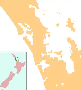
Pakiri is a locality in Auckland, in the former Rodney District of New Zealand. Leigh is about 9 kilometres (6 mi) to the south-east. The Pakiri River flows through the area and into the Hauraki Gulf to the north-east.[1][2]
Pakiri | |
|---|---|
 Pakiri | |
| Coordinates: 36°15′51″S 174°43′38″E | |
| Country | New Zealand |
| Region | Auckland Region |
| District | Auckland Council |
The area is named for the Ngāti Wai chief, Te Kiri.[3] The beach was originally known by the name Ngā One Haea o Pākiri ("The Gleaming White Sands of Pakiri"), Pākiri being the name of the Ngāti Wai pā found at the headlands of the Pakiri River.[4] Ngāti Manuhiri, an iwi descended from the early Ngāti Wai ancestors in the area, are the mana whenua for the Pakiri area.[4]
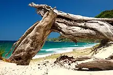
Pakiri Beach is a 14-kilometre-long (8.7 mi) white sandy beach to the north.[3] It is a tourist destination known for its natural environment.[5] The Auckland Regional Council purchased two blocks of land in 2005, totalling 178 hectares (440 acres), with three kilometres (2 mi) of beach frontage,[6][7] and is developed this into the Pākiri Regional Park.[8]
During the 1860s, Pakiri Beach was the location of a kauri sawmill at the mouth of the Pakiri River.[4] Suction dredging has been used to mine sand from the sea floor off the coast since the 1950s.[9][10] This had caused some controversy in 1994, when 170,000 cubic metres (222,000 cu yd) of sand was to be extracted to bolster the popular Mission Bay in Auckland, and was brought to the Planning Tribunal in the case Haddon v Auckland Regional Council for violation of the Resource Management Act 1991, and its provisions for kaitiakitanga.
Education
Pakiri School is a coeducational full primary school (years 1-8) with a roll of 17 students as of April 2023.[11][12] Most children are of Māori descent and are affiliated to Ngati Wai and Ngati Manuhiri. The school celebrated its 125th jubilee in 2002.[13]
References
- Peter Dowling, ed. (2004). Reed New Zealand Atlas. Reed Books. map 11. ISBN 0-7900-0952-8.
- Roger Smith, GeographX (2005). The Geographic Atlas of New Zealand. Robbie Burton. map 31. ISBN 1-877333-20-4.
- "Pakiri - Tomarata Lakes - Te Arai Point". Warkworth Information Centre. Archived from the original on 3 October 2011. Retrieved 10 September 2008.
- Cameron, Ewen; Hayward, Bruce; Murdoch, Graeme (2008). A Field Guide to Auckland: Exploring the Region's Natural and Historical Heritage. Random House New Zealand. p. 105. ISBN 978-1-86962-1513.
- Rawlings-Way, Charles (2008). Lonely Planet New Zealand. Lonely Planet. p. 154. ISBN 978-1-74104-816-2.
- "Pakiri". Auckland Regional Council. Archived from the original on 14 October 2008. Retrieved 10 September 2008.
- "ARC purchases Arrigato land". Auckland Regional Council. Retrieved 10 September 2008.
- "Council profile". aucklandcouncil.govt.nz. Auckland Council.
- "Sand dredge, Pākiri Beach". Te Ara: The Encyclopedia of New Zealand. Retrieved 10 September 2008.
- "Sand mining on the East Coast and in the Kaipara Harbour". Auckland Regional Council. Archived from the original on 14 October 2008. Retrieved 10 September 2008.
- "New Zealand Schools Directory". New Zealand Ministry of Education. Retrieved 12 December 2022.
- Education Counts: Pakiri School
- "Jubilees & reunions: Pakiri School". Education Gazette New Zealand. 81 (6). 8 April 2002.