Panenská Rozsíčka
Panenská Rozsíčka (Czech pronunciation: [ˈpanɛnskaː ˈros.siːtʃka]) is a municipality and village in Jihlava District in the Vysočina Region of the Czech Republic. It has about 200 inhabitants.
Panenská Rozsíčka | |
|---|---|
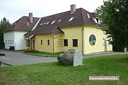 Guesthouse | |
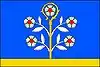 Flag 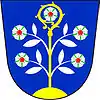 Coat of arms | |
 Panenská Rozsíčka Location in the Czech Republic | |
| Coordinates: 49°15′9″N 15°30′54″E | |
| Country | |
| Region | Vysočina |
| District | Jihlava |
| First mentioned | 1351 |
| Area | |
| • Total | 4.41 km2 (1.70 sq mi) |
| Elevation | 607 m (1,991 ft) |
| Population (2023-01-01)[1] | |
| • Total | 222 |
| • Density | 50/km2 (130/sq mi) |
| Time zone | UTC+1 (CET) |
| • Summer (DST) | UTC+2 (CEST) |
| Postal code | 589 01 |
| Website | panenskarozsicka |
Geography
Panenská Rozsíčka is located about 17 kilometres (11 mi) south of Jihlava. It lies in the Křižanov Highlands. The highest point is the Hřeben hill at 678 m (2,224 ft) above sea level. The Moravian Thaya River originates in the northern part of the municipal territory, then flows along the eastern municipal border.
History
The first written mention of Panenská Rozsíčka is from 1351.[2]
References
- "Population of Municipalities – 1 January 2023". Czech Statistical Office. 2023-05-23.
- "Základní informace o obci" (in Czech). Obec Panenská Rozsíčka. Retrieved 2023-09-20.
This article is issued from Wikipedia. The text is licensed under Creative Commons - Attribution - Sharealike. Additional terms may apply for the media files.