Peri, Corse-du-Sud
Peri is a commune in the Corse-du-Sud department of France on the island of Corsica.
Peri | |
|---|---|
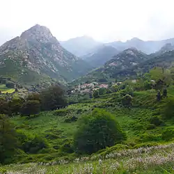 A view of the village of Peri, in spring, from the bottom of the valley of Santa Libarata | |
Location of Peri | |
 Peri 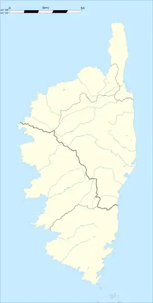 Peri | |
| Coordinates: 42°00′18″N 8°55′17″E | |
| Country | France |
| Region | Corsica |
| Department | Corse-du-Sud |
| Arrondissement | Ajaccio |
| Canton | Gravona-Prunelli |
| Intercommunality | CA Pays Ajaccien |
| Government | |
| • Mayor (2020–2026) | Baptiste Xavier Lacombe[1] |
| Area 1 | 23.65 km2 (9.13 sq mi) |
| Population | 2,038 |
| • Density | 86/km2 (220/sq mi) |
| Time zone | UTC+01:00 (CET) |
| • Summer (DST) | UTC+02:00 (CEST) |
| INSEE/Postal code | 2A209 /20167 |
| Elevation | 38–1,507 m (125–4,944 ft) (avg. 460 m or 1,510 ft) |
| 1 French Land Register data, which excludes lakes, ponds, glaciers > 1 km2 (0.386 sq mi or 247 acres) and river estuaries. | |
Population
|
| ||||||||||||||||||||||||||||||||||||||||||
| Source: EHESS[3] and INSEE (1968-2017)[4] | |||||||||||||||||||||||||||||||||||||||||||
References
- "Répertoire national des élus: les maires". data.gouv.fr, Plateforme ouverte des données publiques françaises (in French). 2 December 2020.
- "Populations légales 2020". The National Institute of Statistics and Economic Studies. 29 December 2022.
- Des villages de Cassini aux communes d'aujourd'hui: Commune data sheet Peri, EHESS (in French).
- Population en historique depuis 1968, INSEE
Wikimedia Commons has media related to Peri (Corse-du-Sud).
This article is issued from Wikipedia. The text is licensed under Creative Commons - Attribution - Sharealike. Additional terms may apply for the media files.