Rānui, Porirua
Rānui is a suburb of Porirua City approximately 21 kilometres (13 mi) north of Wellington in New Zealand. Rānui means midday in the Māori language.[2]
Rānui | |
|---|---|
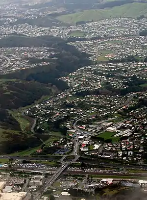 Porirua East and Rānui Heights, with Cannons Creek and Waitangiru in the distance | |
| Coordinates: 41.143°S 174.848°E | |
| Country | New Zealand |
| City | Porirua City |
| Local authority | Porirua City Council |
| Electoral ward |
|
| Area | |
| • Land | 356 ha (880 acres) |
| Population (June 2022)[1] | |
| • Total | 3,820 |
| Aotea | ||
| Porirua Central |
|
Cannons Creek |
| Linden | Takapu Valley |
Demography
Rānui, comprising the statistical areas of Porirua East and Ranui Heights, covers 3.56 km2 (1.37 sq mi).[3] It had an estimated population of 3,820 as of June 2022, with a population density of 1,073 people per km2.
| Year | Pop. | ±% p.a. |
|---|---|---|
| 2006 | 3,477 | — |
| 2013 | 3,447 | −0.12% |
| 2018 | 3,561 | +0.65% |
| Source: [4] | ||
Rānui had a population of 3,561 at the 2018 New Zealand census, an increase of 114 people (3.3%) since the 2013 census, and an increase of 84 people (2.4%) since the 2006 census. There were 1,146 households, comprising 1,743 males and 1,821 females, giving a sex ratio of 0.96 males per female, with 780 people (21.9%) aged under 15 years, 858 (24.1%) aged 15 to 29, 1,554 (43.6%) aged 30 to 64, and 369 (10.4%) aged 65 or older.
Ethnicities were 47.7% European/Pākehā, 28.6% Māori, 37.7% Pasifika, 11.3% Asian, and 2.3% other ethnicities. People may identify with more than one ethnicity.
The percentage of people born overseas was 22.4, compared with 27.1% nationally.
Although some people chose not to answer the census's question about religious affiliation, 39.5% had no religion, 46.7% were Christian, 1.1% had Māori religious beliefs, 1.7% were Hindu, 1.9% were Muslim, 1.0% were Buddhist and 1.4% had other religions.
Of those at least 15 years old, 426 (15.3%) people had a bachelor's or higher degree, and 618 (22.2%) people had no formal qualifications. 294 people (10.6%) earned over $70,000 compared to 17.2% nationally. The employment status of those at least 15 was that 1,422 (51.1%) people were employed full-time, 348 (12.5%) were part-time, and 177 (6.4%) were unemployed.[4]
| Name | Area (km2) | Population | Density (per km2) | Households | Median age | Median income |
|---|---|---|---|---|---|---|
| Porirua East | 1.21 | 2,235 | 1,847 | 681 | 29.5 years | $23,800[5] |
| Rānui Heights | 2.35 | 1,326 | 564 | 465 | 38.6 years | $36,900[6] |
| New Zealand | 37.4 years | $31,800 |
Education
Porirua East School is a co-educational state primary school for Year 1 to 6 students[7] with a roll of 97 as of April 2023.[8] The school opened in 1954.[9]
References
- "Population estimate tables - NZ.Stat". Statistics New Zealand. Retrieved 25 October 2022.
- "Rānui". Te Aka Online Māori Dictionary. Retrieved 31 May 2021.
- "ArcGIS Web Application". statsnz.maps.arcgis.com. Retrieved 31 May 2021.
- "Statistical area 1 dataset for 2018 Census". Statistics New Zealand. March 2020. Porirua East (240500) and Rānui Heights (240900).
- 2018 Census place summary: Porirua East
- 2018 Census place summary: Rānui Heights
- Education Counts: Porirua East School
- "New Zealand Schools Directory". New Zealand Ministry of Education. Retrieved 12 December 2022.
- "About our School - History". Porirua East School. Retrieved 31 May 2021.
| Populated places | |||
|---|---|---|---|
| Geographic features | |||
| Facilities and attractions |
| ||
| Government | |||
| Sports | |||
| Schools | |||