Ranotsara Nord
Ranotsara Nord (or: Ranotsara Avaratra) is a rural municipality in Madagascar.[3] It belongs to the district of Iakora, which is a part of Ihorombe Region. The population of the commune was 3,533 in 2018.
Ranotsara Nord
Ranotsara Avaratra | |
|---|---|
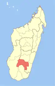
 Ranotsara Nord Location in Madagascar | |
| Coordinates: 22°47′S 46°35′E | |
| Country | |
| Region | Ihorombe |
| District | Iakora |
| Elevation | 635 m (2,083 ft) |
| Population (2018)[2] | |
| • Total | 3,533 |
| Time zone | UTC3 (EAT) |
| Postal code | 311 |
Ranotsara Nord has a riverine harbour. Primary and junior level secondary education are available in town. The majority 95% of the population of the municipality are farmers, while an additional 4% receives their livelihood from raising livestock. The most important crop is rice, while other important products are peanuts and beans. Services provide employment for 1% of the population.[4]
It is situated at the Ionaivo river and the unpaved National road 16.
Mining
The region is rich in deposits of sapphires, ruby and chrysoberyl.[5]
References
- Estimated based on DEM data from Shuttle Radar Topography Mission
- TROISIEME RECENSEMENT GENERAL DE LA POPULATION ET DE L’HABITATION
- "Ranotsara Nord Map on Latitude".
- "ILO census data". Cornell University. 2002. Retrieved 2008-05-01.
- SA MINES TANY HAFA
This article is issued from Wikipedia. The text is licensed under Creative Commons - Attribution - Sharealike. Additional terms may apply for the media files.