Roysambu
Roysambu is a commercial and residential suburb of the city of Nairobi. Located within the larger Kasarani area, it is approximately 11 kilometres (7 mi) northeast of Nairobi's central business district off Thika Road. The neighbourhood was originally known as Royal Suburbs during the colonial period; morphed to Roy-Subs; then transliterated in local pronunciation as Roysambu by African locals. The neighbourhood is a high-density, hosting the lower middle income to low income segment of the Nairobi residents.
Roysambu | |
|---|---|
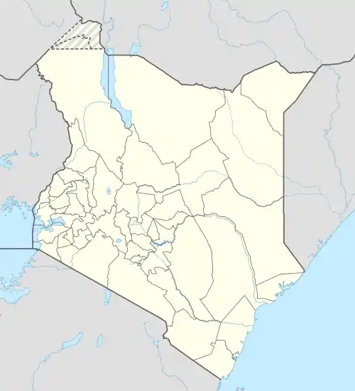
 Roysambu Location of Roysambu in Kenya | |
| Coordinates: 01°13′06″S 36°53′11″E | |
| Country | Kenya |
| County | Nairobi City |
| Sub-county | Kasarani |
| Area | |
| • Total | 11.5 km2 (4.4 sq mi) |
| Population (2019)[1] | |
| • Total | 54,752 |
| • Density | 4,758/km2 (12,320/sq mi) |
Location
Roysambu is located approximately 11 kilometres (7 mi) northeast of Nairobi's central business district, within the larger sub-county of Kasarani. It is located west of Kasarani; northeast of Zimmerman; south of Thome, north and west of Mirema.
Overview
The neighbourhood was originally known as Royal Suburbs during colonial times, shortened as Roy-Subs and later appropriated by local Kenyans as Roysambu.[2] The expansive land that Roysambu partly sits on was a coffee plantation before it was sold and subdivided.[3]
Roysambu was initially zoned as a low-density residential neighbourhood, with single family homes.[4] However, the neighbourhood has increasingly gained a large population, residents from other parts of Kenya. It is a high-density residential area, with low-rise and occasional high-rise flats, due to its affordability for students and lower middle income to low income families.[5]
Roysambu Constituency and Roysambu ward, both electoral divisions, borrow their names from the estate. The constituency encompasses other estates and neighbourhoods such as: Garden Estate, Thome, Ridgeways, Marurui, Kiwanja, Njathaini, Ngomongo, Kongo Soweto, parts of Kahawa and Githurai, Mirema, Kamiti, and Zimmerman.[6] Both electoral divisions are within the Kasarani Sub-county
Points of interest
- The United States International University Africa (USIU), a higher learning private institution near Roysambu.
- Thika Road Mall (TRM), a shopping mall in Roysambu, along TRM Drive off Thika Road.[7]
- The Moi International Sports Centre, in Kasarani.
References
- "2019 Kenya Population and Housing Census Volume II: Distribution of Population by Administrative Units". Kenya National Bureau of Statistics. p. 249. Retrieved 18 April 2023.
- "The funny origin of some of our estate names". Nairobi News. Nairobi. 8 March 2014. Retrieved 11 November 2016.
- "Roysambu background". Garra. Retrieved 11 November 2016.
- Mido, Collins Lugalia. "Zorning Ordinance-Nairobi".
{{cite journal}}: Cite journal requires|journal=(help) - Achuka, Vincent (19 September 2015). "Alarm as children compete for open spaces with cars, sewers and houses". Nation. Retrieved 11 November 2022.
- "Roysambu Constituency". Roysambu NG-CDF. Nairobi. Retrieved 11 November 2022.
- "Thika Road Mall". Retrieved 11 November 2022.
