Rushnavand, Razavi Khorasan
Rushnavand (Persian: روشناوند, also Romanized as Rūshnāvand, Rowshanāvand, Rowshnāvand, and Rushnāwand; also known as Rowsanāvand and Rūshanābād)[3] is a village in Pas Kalut Rural District of the Central District of Gonabad County, Razavi Khorasan province, Iran.
Rushnavand
Persian: روشناوند | |
|---|---|
Village | |
 Rushnavand | |
| Coordinates: 34°27′57″N 58°54′39″E[1] | |
| Country | |
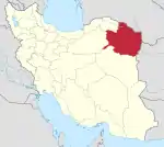
| Province | Razavi Khorasan |
| County | Gonabad |
| District | Central |
| Rural District | Pas Kalut |
| Population (2016)[2] | |
| • Total | 3,272 |
| Time zone | UTC+3:30 (IRST) |
At the 2006 National Census, its population was 2,770 in 675 households.[4] The following census in 2011 counted 3,551 people in 908 households.[5] The latest census in 2016 showed a population of 3,272 people in 921 households; it was the largest village in its rural district.[2]
References
- OpenStreetMap contributors (29 April 2023). "Rushnavand, Gonabad County" (Map). OpenStreetMap. Retrieved 29 April 2023.
- "Census of the Islamic Republic of Iran, 1395 (2016)". AMAR (in Persian). The Statistical Center of Iran. p. 09. Archived from the original (Excel) on 2 April 2022. Retrieved 19 December 2022.
- Rushnavand can be found at GEOnet Names Server, at this link, by opening the Advanced Search box, entering "-3081400" in the "Unique Feature Id" form, and clicking on "Search Database".
- "Census of the Islamic Republic of Iran, 1385 (2006)". AMAR (in Persian). The Statistical Center of Iran. p. 09. Archived from the original (Excel) on 20 September 2011. Retrieved 25 September 2022.
- "Census of the Islamic Republic of Iran, 1390 (2011)" (Excel). Iran Data Portal (in Persian). The Statistical Center of Iran. p. 09. Retrieved 19 December 2022.
| Capital | |||||||||||||||||||||
|---|---|---|---|---|---|---|---|---|---|---|---|---|---|---|---|---|---|---|---|---|---|
| Districts |
| ||||||||||||||||||||
This article is issued from Wikipedia. The text is licensed under Creative Commons - Attribution - Sharealike. Additional terms may apply for the media files.