Saint-Édouard-de-Maskinongé, Quebec
Saint-Édouard-de-Maskinongé is a municipality in the Mauricie region of the province of Quebec in Canada.
Saint-Édouard-de-Maskinongé | |
|---|---|
.JPG.webp) | |
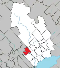 Location within Maskinongé RCM | |
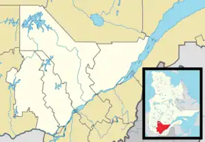 Saint-Édouard-de-Maskinongé Location in central Quebec | |
| Coordinates: 46°20′N 73°09′W[1] | |
| Country | |
| Province | |
| Region | Mauricie |
| RCM | Maskinongé |
| Constituted | January 1, 1950 |
| Government | |
| • Mayor | Johanne Champagne |
| • Federal riding | Berthier—Maskinongé |
| • Prov. riding | Maskinongé |
| Area | |
| • Total | 53.90 km2 (20.81 sq mi) |
| • Land | 52.82 km2 (20.39 sq mi) |
| Population (2021)[3] | |
| • Total | 798 |
| • Density | 15.1/km2 (39/sq mi) |
| • Pop 2016-2021 | |
| • Dwellings | 402 |
| Time zone | UTC−5 (EST) |
| • Summer (DST) | UTC−4 (EDT) |
| Postal code(s) | |
| Area code | 819 |
| Highways | |
| Website | https://municipalites-du-quebec.ca/st-edouard-de-maskinonge/ |
Demographics
Population trend:[4]
- Population in 2021: 798 (2016 to 2021 population change: 12.1%)
- Population in 2016: 712
- Population in 2011: 774
- Population in 2006: 800
- Population in 2001: 730
- Population in 1996: 744
Private dwellings occupied by usual residents: 359 (total dwellings: 402)
References
- "Reference number 135543 in Banque de noms de lieux du Québec". toponymie.gouv.qc.ca (in French). Commission de toponymie du Québec.
- "Geographic code 51050 in the official Répertoire des municipalités". www.mamh.gouv.qc.ca (in French). Ministère des Affaires municipales et de l'Habitation.
- "Profile table, Census Profile, 2021 Census of Population - Saint-Édouard-de-Maskinongé, Municipalité (MÉ) [Census subdivision], Quebec". 9 February 2022.
- Statistics Canada: 1996, 2001, 2006, 2011, 2016, 2021 census
External links
![]() Media related to Saint-Édouard-de-Maskinongé at Wikimedia Commons
Media related to Saint-Édouard-de-Maskinongé at Wikimedia Commons
Places adjacent to Saint-Édouard-de-Maskinongé, Quebec | ||||||||||||||||
|---|---|---|---|---|---|---|---|---|---|---|---|---|---|---|---|---|
| ||||||||||||||||
| Cities & towns | |
|---|---|
| Municipalities | |
| Parishes | |
This article is issued from Wikipedia. The text is licensed under Creative Commons - Attribution - Sharealike. Additional terms may apply for the media files.