Saint-Sévère, Quebec
Saint-Sévère is a parish municipality in the Mauricie region of the province of Quebec in Canada.
Saint-Sévère | |
|---|---|
 | |
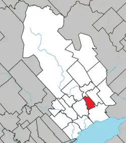 Location within Maskinongé RCM | |
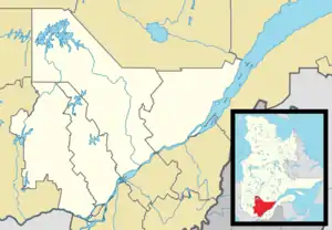 Saint-Sévère Location in central Quebec | |
| Coordinates: 46°21′N 72°54′W[1] | |
| Country | |
| Province | |
| Region | Mauricie |
| RCM | Maskinongé |
| Constituted | July 1, 1855 |
| Named for | Joseph-Sévère-Nicolas Dumoulin |
| Government | |
| • Mayor | Laurent Lavergne |
| • Federal riding | Berthier—Maskinongé |
| • Prov. riding | Maskinongé |
| Area | |
| • Total | 32.00 km2 (12.36 sq mi) |
| • Land | 31.85 km2 (12.30 sq mi) |
| Population (2021)[3] | |
| • Total | 337 |
| • Density | 10.6/km2 (27/sq mi) |
| • Pop 2016-2021 | |
| • Dwellings | 155 |
| Time zone | UTC−5 (EST) |
| • Summer (DST) | UTC−4 (EDT) |
| Postal code(s) | |
| Area code | 819 |
| Highways | No major routes |
| Website | www |
Demographics
In the 2021 Census of Population conducted by Statistics Canada, Saint-Sévère had a population of 337 living in 144 of its 155 total private dwellings, a change of 11.6% from its 2016 population of 302. With a land area of 31.85 km2 (12.30 sq mi), it had a population density of 10.6/km2 (27.4/sq mi) in 2021.[4]
References
- "Reference number 57630 in Banque de noms de lieux du Québec". toponymie.gouv.qc.ca (in French). Commission de toponymie du Québec.
- "Geographic code 51030 in the official Répertoire des municipalités". www.mamh.gouv.qc.ca (in French). Ministère des Affaires municipales et de l'Habitation.
- "Tableau de profil, Profil du recensement, Recensement de la population de 2021". 9 February 2022.
- "Population and dwelling counts: Canada, provinces and territories, and census subdivisions (municipalities), Quebec". Statistics Canada. February 9, 2022. Retrieved August 29, 2022.
External links
 Saint-Sévère travel guide from Wikivoyage
 Media related to Saint-Sévère, Quebec at Wikimedia Commons
Places adjacent to Saint-Sévère, Quebec | ||||||||||||||||
|---|---|---|---|---|---|---|---|---|---|---|---|---|---|---|---|---|
| ||||||||||||||||
| Cities & towns | |
|---|---|
| Municipalities | |
| Parishes | |
This article is issued from Wikipedia. The text is licensed under Creative Commons - Attribution - Sharealike. Additional terms may apply for the media files.