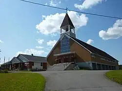
Saint-Cléophas, Quebec
Saint-Cléophas is a Parish municipality in the regional county municipality of La Matapédia in Quebec (Canada), situated in the administrative region of Bas-Saint-Laurent.
Saint-Cléophas | |
|---|---|
 | |
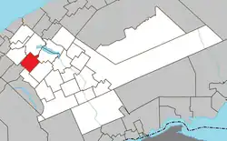
 Location within La Matapédia RCM. | |
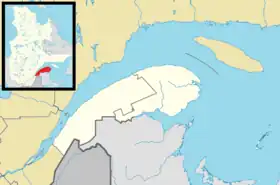
 Saint-Cléophas Location in eastern Quebec. | |
| Coordinates: 48°29′N 67°45′W[1] | |
| Country | |
| Province | |
| Region | Bas-Saint-Laurent |
| RCM | La Matapédia |
| Settled | 1908 |
| Constituted | May 19, 1921 |
| Government | |
| • Mayor | Jean-Paul Bélanger |
| • Federal riding | Haute-Gaspésie—La Mitis—Matane—Matapédia |
| • Prov. riding | Matane-Matapédia |
| Area | |
| • Total | 97.70 km2 (37.72 sq mi) |
| • Land | 97.22 km2 (37.54 sq mi) |
| Population | |
| • Total | 321 |
| • Density | 3.3/km2 (9/sq mi) |
| • Pop 2016-2021 | |
| • Dwellings | 159 |
| Time zone | UTC−5 (EST) |
| • Summer (DST) | UTC−4 (EDT) |
| Postal code(s) | |
| Area code(s) | 418 and 581 |
| Highways | No major routes |
| Website | www |
Toponymy
The name chosen for the parish during the municipal erection in 1921, highlights the work of Father Joseph Cleophas Saindon (1866-1941), a priest of the neighbouring parish of Saint-Nom-de-Marie-de-Sayabec from 1896 to 1941, serving the parish from 1918. It is also named in honour of Saint Cleophas.[4]
Administrative Region
The Parish Municipality of Saint-Cléophas is part of the La Matapédia Regional County Municipality in the Bas-Saint-Laurent. The parish of Saint-Céeophas is part of the Archdiocese of Rimouski.
Geographical Location
Saint-Cléophas is located on a side of the mountain chain of the Appalachian specifically in the section of Mt Saint-Anne. The municipality is located 8 km south of the Highway 132 through Sayabec on Lacroix Road.
Economy
The local economy is mainly based on forestry, sawmills, agriculture and cattle farms of both sheep and dairy. There are also many forests producing maple syrup. In addition, Panval plant in Sayabec provides many jobs.[5]
History
In the early 1900s, the pioneers of Sayabec created the foundations for StCléophas in a town known as Awantjish, which was described as having good soil and timber (especially birch, maple and cedar.)[6][7] By 1908, a group of settlers living in the territory of what is today St-Cléophas made offerings to the Bishop of Rimouski, Monsignor André-Albert Blais, to found a parish in the area. The prelate had considered that it was a premature gesture due to the low population of the area (about 300 people). Finally the parish opened at the end of the First World War. The mission of St-Cléophas to gain both parish and municipality status became a reality, and in 1921 the town detached from the Municipality of Sayabec. However, the pastor of Sayabec, Father Cléophas Saindon, served as the first pastor at St Cleophas until the vicar of Sayabec, Father Charles Pelletier could become pastor of St-Cléophas. It is also in 1921 that the town began to officially use a calendar to mark milestones.
Important Events
In 1944, the church chapel was burned. That same year, Georges-Émile Côté built a new sawmill. Today, the mill is no longer in operation. In 1973 a zoo was built, the St-Cléophas Ecological Centre, funded through donations from nine parishioners. In 1976 the name St-Cléophas Ecological Centre became known as Naturanimo, which closed 1996.
History of the parish
In 1918 the parish founded the first mission of St-Cléophas. On the 17th of January 1921, the first priest was appointed and so began the canonical life of the parish.
Motto
The motto of the municipality is Freedom, Love, Work .
Important People born in Saint-Cléophas
- Richard Joubert: He worked thirty years at the Canadian Broadcasting Corporation, in both Quebec City and Toronto, where he was host and producer. Since 1995, he is actively involved in the making of music both song and poetry. He also teaches lectures and courses on music and singing, and in recent years performs public poetry readings.
Tourism
Saint-Cléophas is often visited in spring for its numerous maple groves. Moreover, this is a place for hiking, snowmobile and ATV through its many trails. Between 1973 and 1996, St-Cléophas was a very important tourist attraction in the region with the Naturanimo Centre . The zoo housed mainly Canadian animals. Its varieties of species, its large size, its development and activities such as horse pulls, 4x4, tractors and country meals, added to the popularity of Naturanimo Centre. The municipality is part of the tourist region of Gaspésie–Îles-de-la-Madeleine in the Matapedia Valley.
Administration
Municipal Council
The council consists of a mayor and six councilors who are elected every four year block without territorial division through rotation.
| mandate | function | name |
|---|---|---|
| 2005 - 2009 | mayor | Madame Lise Dompierre |
| councillors | ||
| #1 | Monsieur Jean-Paul Bélanger | |
| #2 | Monsieur Marcel Bélanger | |
| #3 | Monsieur Michel Santerre | |
| #4 | Monsieur Bruno Gauvin | |
| #5 | Monsieur Stéphane Bélanger | |
| #6 | Madame Linda Hudon |
Political representations
Provincially Saint-Cléophas is part of the provincial riding of Matapédia (electoral district). In the Quebec general election of 2008, the outgoing MP Danielle Doyer, the Parti Québécois was re-elected to represent the people of Saint-Cléophas in the National Assembly of Quebec.
Federally Saint-Cléophas is part of the federal riding of Haute-Gaspésie—La Mitis—Matane—Matapédia. In the Canadian federal election of 2008, the incumbent Jean-Yves Roy of the Bloc Québécois, was elected to represent the people of Saint-Cleophas in the House of Commons of Canada.
Demographics
| Year | Pop. | ±% |
|---|---|---|
| 1931 | 622 | — |
| 1941 | 759 | +22.0% |
| 1951 | 960 | +26.5% |
| 1956 | 1,017 | +5.9% |
| 1961 | 968 | −4.8% |
| 1966 | 815 | −15.8% |
| 1971 | 608 | −25.4% |
| 1976 | 440 | −27.6% |
| 1981 | 427 | −3.0% |
| 1986 | 473 | +10.8% |
| 1991 | 440 | −7.0% |
| 1996 | 404 | −8.2% |
| 2001 | 380 | −5.9% |
| 2006 | 367 | −3.4% |
| 2011 | 334 | −9.0% |
| 2016 | 333 | −0.3% |
| 2021 | 321 | −3.6% |
In the 2021 Census of Population conducted by Statistics Canada, Saint-Cléophas had a population of 321 living in 145 of its 159 total private dwellings, a change of -3.6% from its 2016 population of 333. With a land area of 97.22 km2 (37.54 sq mi), it had a population density of 3.3/km2 (8.6/sq mi) in 2021.[9]
| 2021 | 2016 | 2011 | |
|---|---|---|---|
| Population | 321 (-3.6% from 2016) | 333 (-0.3% from 2011) | 334 (-9.0% from 2006) |
| Land area | 97.22 km2 (37.54 sq mi) | 97.44 km2 (37.62 sq mi) | 97.74 km2 (37.74 sq mi) |
| Population density | 3.3/km2 (8.5/sq mi) | 3.4/km2 (8.8/sq mi) | 3.4/km2 (8.8/sq mi) |
| Median age | 54.4 (M: 54.8, F: 54.4) | 50.9 (M: 50.8, F: 51.2) | 46.2 (M: 48.5, F: 42.8) |
| Private dwellings | 145 (total) | 156 (total) | 137 (total) |
| Median household income | $45,184 | $41,769 |
See also
References
- "Reference number 55843 in Banque de noms de lieux du Québec". toponymie.gouv.qc.ca (in French). Commission de toponymie du Québec.
- "Saint-Cléophas". Répertoire des municipalités (in French). Ministère des Affaires municipales, des Régions et de l'Occupation du territoire. Retrieved 2012-01-26.
- "2021 Community Profiles". 2021 Canadian Census. Statistics Canada. February 4, 2022. Retrieved 2022-04-27.
- The Lives of Saints. Thomas Meighan. 1729-01-01.
- "Uniboard™ to invest into particleboard capacity expansion and a new thermally fused laminate (TFL)... -- LAVAL, QC, July 14, 2015". www.newswire.ca. Retrieved 2016-03-09.
- Langelier, Jean Chrysostôme (1884-01-01). A Sketch on Gaspesia. J. Dussault.
- Duhamel, G.E. (1889). Description of the surveyed townships and explored territories of the province of Quebec. C.F. Langlois.
- Statistics Canada: 1996, 2001, 2006, 2011, 2016, 2021 census
- "Population and dwelling counts: Canada, provinces and territories, and census subdivisions (municipalities), Quebec". Statistics Canada. February 9, 2022. Retrieved August 29, 2022.
- "2016 Community Profiles". 2016 Canadian Census. Statistics Canada. August 12, 2021. Retrieved 2022-12-05.
- "2011 Community Profiles". 2011 Canadian Census. Statistics Canada. March 21, 2019. Retrieved 2013-05-12.
- "2006 Community Profiles". 2006 Canadian Census. Statistics Canada. August 20, 2019.
- "2001 Community Profiles". 2001 Canadian Census. Statistics Canada. July 18, 2021.