Saint-Sauveur-Villages
Saint-Sauveur-Villages (French pronunciation: [sɛ̃ sovœʁ vilaʒ]) is a commune in the Manche department in Normandy in north-western France.[3] It was established on 1 January 2019 by merger of the former communes of Saint-Sauveur-Lendelin (the seat), Ancteville, Le Mesnilbus, La Ronde-Haye, Saint-Aubin-du-Perron, Saint-Michel-de-la-Pierre and Vaudrimesnil.[4]
Saint-Sauveur-Villages | |
|---|---|
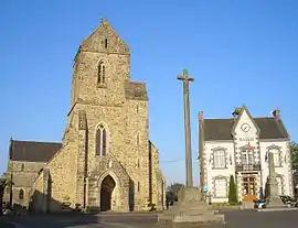 The church of Saint-Laurent, the 1571 cross and the town hall | |
Location of Saint-Sauveur-Villages | |
 Saint-Sauveur-Villages  Saint-Sauveur-Villages | |
| Coordinates: 49°07′52″N 1°24′44″W | |
| Country | France |
| Region | Normandy |
| Department | Manche |
| Arrondissement | Coutances |
| Canton | Agon-Coutainville |
| Intercommunality | Coutances Mer et Bocage |
| Government | |
| • Mayor (2020–2026) | Aurélie Gigan[1] |
| Area 1 | 53.70 km2 (20.73 sq mi) |
| Population | 3,474 |
| • Density | 65/km2 (170/sq mi) |
| Time zone | UTC+01:00 (CET) |
| • Summer (DST) | UTC+02:00 (CEST) |
| INSEE/Postal code | 50550 /50490 |
| Elevation | 15–128 m (49–420 ft) |
| 1 French Land Register data, which excludes lakes, ponds, glaciers > 1 km2 (0.386 sq mi or 247 acres) and river estuaries. | |
See also
References
- "Répertoire national des élus: les maires" (in French). data.gouv.fr, Plateforme ouverte des données publiques françaises. 13 September 2022.
- "Populations légales 2020". The National Institute of Statistics and Economic Studies. 29 December 2022.
- INSEE commune file
- Arrêté préfectoral 26 December 2018 (in French)
Wikimedia Commons has media related to Saint-Sauveur-Villages.
This article is issued from Wikipedia. The text is licensed under Creative Commons - Attribution - Sharealike. Additional terms may apply for the media files.