Salem Township, Knox County, Illinois
Salem Township is one of twenty-one townships in Knox County, Illinois, USA. As of the 2010 census, its population was 1,003 and it contained 449 housing units.[2]
Salem Township | |
|---|---|
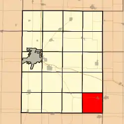 Location in Knox County | |
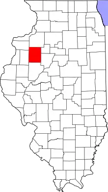 Knox County's location in Illinois | |
| Coordinates: 40°45′14″N 90°02′34″W | |
| Country | |
| State | |
| County | Knox |
| Established | November 2, 1852 |
| Area | |
| • Total | 36.36 sq mi (94.2 km2) |
| • Land | 35.76 sq mi (92.6 km2) |
| • Water | 0.6 sq mi (2 km2) 1.65% |
| Elevation | 679 ft (207 m) |
| Population (2010) | |
| • Estimate (2016)[1] | 967 |
| • Density | 28.1/sq mi (10.8/km2) |
| Time zone | UTC-6 (CST) |
| • Summer (DST) | UTC-5 (CDT) |
| ZIP codes | 61458, 61529, 61531, 61572 |
| FIPS code | 17-095-67223 |
Geography
According to the 2010 census, the township has a total area of 36.36 square miles (94.2 km2), of which 35.76 square miles (92.6 km2) (or 98.35%) is land and 0.6 square miles (1.6 km2) (or 1.65%) is water.[2]
Cities, towns, villages
Unincorporated towns
(This list is based on USGS data and may include former settlements.)
Cemeteries
The township contains these four cemeteries: Blakeslee, Summitt-Douglas, Uniontown and Yates City.
Airports and landing strips
- Tri-County Airport
Lakes
- Grandt Lake
School districts
- Farmington Central Community Unit School District 265
Political districts
- Illinois's 18th congressional district
- State House District 74
- State Senate District 37
References
- "Population and Housing Unit Estimates". Retrieved June 9, 2017.
- "Population, Housing Units, Area, and Density: 2010 - County -- County Subdivision and Place -- 2010 Census Summary File 1". United States Census. Archived from the original on February 12, 2020. Retrieved May 28, 2013.
- "Census of Population and Housing". Census.gov. Retrieved June 4, 2016.
External links
Places adjacent to Salem Township, Knox County, Illinois | |
|---|---|
Municipalities and communities of Knox County, Illinois, United States | ||
|---|---|---|
| Cities | Map of Illinois highlighting Knox County | |
| Villages | ||
| Townships | ||
| CDPs | ||
| Other unincorporated communities | ||
| Ghost towns | ||
| Footnotes | ‡This populated place also has portions in an adjacent county or counties | |
This article is issued from Wikipedia. The text is licensed under Creative Commons - Attribution - Sharealike. Additional terms may apply for the media files.