Salla
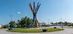
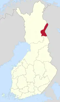
Salla (Kuolajärvi until 1936) (Inari Sami: Kyelijävri) is a municipality of Finland, located in Lapland. The municipality has a population of 3,321 (19 September 2023)[2] and covers an area of 5,873.08 square kilometres (2,267.61 sq mi) of which 142.73 km2 (55.11 sq mi) is water.[1] The population density is 0.58 inhabitants per square kilometre (1.5/sq mi).
Salla
Kyelijävri | |
|---|---|
Municipality | |
| Sallan kunta Salla kommun | |
 | |
 Coat of arms | |
 Location of Salla in Finland | |
| Coordinates: 66°50′N 028°40′E | |
| Country | |
| Region | Lapland |
| Sub-region | Eastern Lapland |
| Charter | 1857 |
| Government | |
| • Municipal manager | Erkki Parkkinen |
| Area (2018-01-01)[1] | |
| • Total | 5,873.08 km2 (2,267.61 sq mi) |
| • Land | 5,729.48 km2 (2,212.16 sq mi) |
| • Water | 142.73 km2 (55.11 sq mi) |
| • Rank | 7th largest in Finland |
| Population (2023-09-19)[2] | |
| • Total | 3,321 |
| • Rank | 207th largest in Finland |
| • Density | 0.58/km2 (1.5/sq mi) |
| Population by native language | |
| • Finnish | 96.5% (official) |
| • Swedish | 0.4% |
| • Sami | 0.1% |
| • Others | 3.1% |
| Population by age | |
| • 0 to 14 | 8.7% |
| • 15 to 64 | 52% |
| • 65 or older | 39.3% |
| Time zone | UTC+02:00 (EET) |
| • Summer (DST) | UTC+03:00 (EEST) |
| Website | www.salla.fi |
The nearby settlement of Sallatunturi is home to the Salla Ski Resort.
History

Salla is in the Eastern Lapland and as a border area was affected by the Second World War. Red Army troops invaded Finland at Salla during the Winter War but were stopped by the Finnish Army (see Battle of Salla). Parts of the municipality were ceded to the Soviet Union after the war. The ceded part is sometimes called "Old Salla" or Vanha Salla. During the Continuation War the old town of Salla was on the Soviet side of the border. The German XXXVI Corps attacked the Soviet positions in an operation code-named Polarfuchs. With the help of the Finnish 6th Division it managed to occupy all of the ceded territories. At the end of the war the German troops were pushed out of Lapland by Finnish troops in the Lapland War.
The following villages were ceded to the Soviet Union: Alakurtti, Korja (Korya), Kuolajärvi (Kuoloyarvi), Lampela, Sallansuu, Yläkurtti (Yulyakurtti), Sovajärvi (Sovayarvi), Tuutijärvi (Tuutiyarvi) and Vuorijärvi (Vuoriyarvi).
In January 2021, the mayor of Salla, Erkki Parkkinen, launched a bid to host the 2032 Summer Olympic Games to raise awareness of climate change and highlight the threat the climate crisis poses to Salla and its ecosystem, which is dependent on low temperatures for most of the year.[5]
Transportation
Salla is the terminus of a freight-only railway line from Kemijärvi. In 2006, the Finnish Rail Administration announced proposals to close the line.[6] The railway formerly extended beyond Salla into Russia, but has never carried international traffic.
Geography
Neighbour municipalities are Kemijärvi, Kuusamo, Pelkosenniemi, Posio and Savukoski.
Climate
Salla has a subarctic climate (Dfc). Summer days are mild with about 1/3 of all days experiencing precipitation with nights tending to be cool. Winters are very long, cold, snowy, and extremely cloudy, lasting from the beginning of October through April, with mid-winter thaws being rare, and cold snaps relatively common. Spring and Autumn tend to be cool, not very variable, and short, lasting only a couple weeks to a few weeks in length.
The low temperature record of Salla is -50 °C (-58 °F), which was recorded in Naruska in 1985. It was also the record of Finland until 1999. On 28 January 1999, the unofficial record of Finland, -54,3 °C (-65,7 °F), was recorded in Naruska.[7]
| Climate data for Salla (1991–2020 normals, records 1961–present) | |||||||||||||
|---|---|---|---|---|---|---|---|---|---|---|---|---|---|
| Month | Jan | Feb | Mar | Apr | May | Jun | Jul | Aug | Sep | Oct | Nov | Dec | Year |
| Record high °C (°F) | 6.3 (43.3) |
6.2 (43.2) |
9.7 (49.5) |
17.5 (63.5) |
28.0 (82.4) |
30.3 (86.5) |
31.5 (88.7) |
31.0 (87.8) |
22.9 (73.2) |
14.5 (58.1) |
8.4 (47.1) |
4.9 (40.8) |
31.5 (88.7) |
| Mean maximum °C (°F) | 1.0 (33.8) |
1.3 (34.3) |
4.8 (40.6) |
11.5 (52.7) |
20.6 (69.1) |
24.9 (76.8) |
26.3 (79.3) |
24.2 (75.6) |
18.0 (64.4) |
9.5 (49.1) |
4.0 (39.2) |
2.0 (35.6) |
27.3 (81.1) |
| Average high °C (°F) | −8.0 (17.6) |
−7.5 (18.5) |
−2.1 (28.2) |
3.8 (38.8) |
10.4 (50.7) |
16.6 (61.9) |
19.7 (67.5) |
16.8 (62.2) |
10.8 (51.4) |
2.8 (37.0) |
−2.5 (27.5) |
−5.6 (21.9) |
4.6 (40.3) |
| Daily mean °C (°F) | −12.0 (10.4) |
−11.6 (11.1) |
−6.9 (19.6) |
−0.7 (30.7) |
5.7 (42.3) |
11.7 (53.1) |
14.8 (58.6) |
12.1 (53.8) |
6.9 (44.4) |
0.3 (32.5) |
−5.3 (22.5) |
−9.1 (15.6) |
0.5 (32.9) |
| Average low °C (°F) | −16.7 (1.9) |
−16.5 (2.3) |
−12.6 (9.3) |
−5.8 (21.6) |
0.7 (33.3) |
6.3 (43.3) |
9.5 (49.1) |
7.2 (45.0) |
2.9 (37.2) |
−2.6 (27.3) |
−8.5 (16.7) |
−13.1 (8.4) |
−4.1 (24.6) |
| Mean minimum °C (°F) | −32.9 (−27.2) |
−32.4 (−26.3) |
−28.4 (−19.1) |
−19.8 (−3.6) |
−7.1 (19.2) |
−0.9 (30.4) |
1.8 (35.2) |
−1.3 (29.7) |
−5.5 (22.1) |
−15.7 (3.7) |
−23.0 (−9.4) |
−28.9 (−20.0) |
−35.6 (−32.1) |
| Record low °C (°F) | −45.3 (−49.5) |
−46.3 (−51.3) |
−38.2 (−36.8) |
−28.9 (−20.0) |
−19.2 (−2.6) |
−6.7 (19.9) |
−1.5 (29.3) |
−6.5 (20.3) |
−15.2 (4.6) |
−29.7 (−21.5) |
−36.6 (−33.9) |
−40.2 (−40.4) |
−46.3 (−51.3) |
| Average precipitation mm (inches) | 37 (1.5) |
31 (1.2) |
31 (1.2) |
30 (1.2) |
41 (1.6) |
61 (2.4) |
77 (3.0) |
59 (2.3) |
54 (2.1) |
50 (2.0) |
40 (1.6) |
39 (1.5) |
550 (21.6) |
| Average precipitation days (≥ 0.1 mm) | 20 | 17 | 16 | 14 | 15 | 16 | 17 | 16 | 16 | 18 | 21 | 20 | 206 |
| Average relative humidity (%) | 87 | 86 | 80 | 73 | 68 | 68 | 74 | 80 | 85 | 90 | 92 | 89 | 81 |
| Source 1: FMI climatological normals for Finland 1991–2020[8] | |||||||||||||
| Source 2: record highs and lows[lower-alpha 1] | |||||||||||||
Historical places

| Name | Place | Description | WGS 84 |
|---|---|---|---|
| Evangelic-Lutheran church of Salla | |||
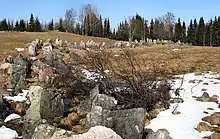
| Paikanselkä memorial area | Paikanselkä | The Winter War front line 13 March 1940, when war ended. Located where the commander of the Swedish Volunteer Corps, lieutenant colonel Magnus Dyrssen was killed on 1 March 1940.[11] | |
| Salpa Line | Defense line on the eastern border of Finland |
In popular culture
Salla was referenced in the song 66°50’N, 28°40’E by Finnish death-doom band Swallow the Sun on their 2015 triple album Songs From the North I, II and III.
References
- "Area of Finnish Municipalities 1.1.2018" (PDF). National Land Survey of Finland. Retrieved 30 January 2018.
- "Finland's preliminary population figure was 5,587,841 at the end of August 2023". StatFin. Statistics Finland. Retrieved 30 September 2023.
- "Demographic Structure by area as of 31 December 2022". Statistics Finland's PX-Web databases. Statistics Finland. Retrieved 6 September 2023.
- "Population according to age (1-year) and sex by area and the regional division of each statistical reference year, 2003–2020". StatFin. Statistics Finland. Retrieved 2 May 2021.
- "Arctic Town Launches Genius Bid for 2032 Summer Olympics to Raise Awareness of Climate Change". Retrieved 4 February 2021.
- Finnish Railway News – Year 2006
- "Suomen virallisesta pakkasennätyksestä 17 vuotta - sallalaiset tuohtuivat "väärästä" ennätyksestä".
- "FMI normals 1991-2020" (in Finnish). fmi.fi. Retrieved 12 April 2023.
- "FMI open data". FMI. Retrieved 26 April 2016.
- "FMI open data". FMI. Retrieved 26 April 2016.
- "Sotamuistomerkit ja kohteet | Nähtävyydet & Käyntikohteet | Salla". loma.salla.fi. Archived from the original on 21 February 2014.
External links
 Media related to Salla at Wikimedia Commons
- Municipality of Salla – Official website
