Sandebuur
Sandebuur is a hamlet in the Netherlands and is part of the Noordenveld municipality in Drenthe.
Sandebuur | |
|---|---|
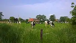
 Cows in Sandebuur | |
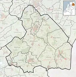
 Sandebuur Location in province of Drenthe in the Netherlands  Sandebuur Sandebuur (Netherlands) | |
| Coordinates: 53°10′19″N 6°27′21″E | |
| Country | Netherlands |
| Province | Drenthe |
| Municipality | Noordenveld |
| Area | |
| • Total | 0.13 km2 (0.05 sq mi) |
| Elevation | 1 m (3 ft) |
| Population (2021)[1] | |
| • Total | 30 |
| • Density | 230/km2 (600/sq mi) |
| Time zone | UTC+1 (CET) |
| • Summer (DST) | UTC+2 (CEST) |
| Postal code | 9315 |
| Dialing code | 050 |
History
Roderwolde is a road village which was established during the early middle ages for the excavation of peat. Due to settling of the soil, most of the village was relocated to higher grounds in the south. Sandebuur is a remnant of the earliest settlement.[3] It was first mentioned in 1781 as Sandbuir and means "neighbourhood on a sandy ground".[4]
Sandebuur is a statistical entity,[1] however the postal authorities have placed it under Roderwolde.[5] The hamlet is outside the build-up area, but is marked with place name signs. In 1840, it was home to 48 people.[6]
References
- "Kerncijfers wijken en buurten 2021". Central Bureau of Statistics. Retrieved 10 March 2022.
- "Postcodetool for 9315PA". Actueel Hoogtebestand Nederland (in Dutch). Het Waterschapshuis. Retrieved 10 March 2022.
- Ronald Stenvert (2001). Roderwolde (in Dutch). Zwolle: Waanders. p. 171. ISBN 90 400 9454 3. Retrieved 10 March 2022.
- "Sandebuur". Etymologiebank (in Dutch). Retrieved 10 March 2022.
- "Postcode 9315 in Roderwolde". Postcode bij adres (in Dutch). Retrieved 10 March 2022.
- "Sandebuur". Plaatsengids (in Dutch). Retrieved 10 March 2022.
This article is issued from Wikipedia. The text is licensed under Creative Commons - Attribution - Sharealike. Additional terms may apply for the media files.