Sisco Heights, Washington
Sisco Heights is a census-designated place (CDP) in Snohomish County, Washington, United States. It is located between Arlington and Marysville along State Route 9. As of the 2020 U.S. census, it had a population of 3,140 people.[1]
Sisco Heights, Washington | |
|---|---|
 Sisco Heights, Washington | |
| Coordinates: 48°07′08″N 122°6′27″W | |
| Country | United States |
| State | Washington |
| County | Snohomish |
| Area | |
| • Total | 12.53 sq mi (32.5 km2) |
| Elevation | 449 ft (137 m) |
| Population (2020) | |
| • Total | 3,140 |
| • Density | 250/sq mi (97/km2) |
| • Summer (DST) | Pacific |
| Area code | 360 |
A post office called Sisco was established in 1902, and remained in operation until 1918.[2] The community has the name of an early settler.[3] Its school closed around 1925.[4]
Geography
The Sisco Heights CDP is 12.53 square miles (32.5 km2).
References
- "Geography Profile: Sisco Heights CDP, Washington". United States Census Bureau. Retrieved February 9, 2022.
- "Post Offices". Jim Forte Postal History. Retrieved 25 August 2016.
- Meany, Edmond S. (1923). Origin of Washington geographic names. Seattle: University of Washington Press. p. 272.
- "Historic photos of Sisco sought by community group". The Everett Herald. October 22, 2012. Retrieved February 9, 2022.
Municipalities and communities of Snohomish County, Washington, United States | ||
|---|---|---|
| Cities | 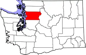 Map of Washington highlighting Snohomish County | |
| Towns | ||
| CDPs |
| |
| Other communities | ||
| Indian reservation | ||
| Military bases | ||
| Ghost town |
| |
| Footnotes | ‡This populated place also has portions in an adjacent county or counties | |
| ||
This article is issued from Wikipedia. The text is licensed under Creative Commons - Attribution - Sharealike. Additional terms may apply for the media files.