Smila
Smila (Ukrainian: Сміла [ˈs⁽ʲ⁾milɐ]) is a city located on Dnieper Upland near the Tyasmyn River, in Cherkasy Raion, Cherkasy Oblast of Ukraine.[2] The Tyasmyn River, a tributary of the Dnieper River, flows through the city.[3][4] In January 2022, the estimated population was 65 675, a 1.2% decrease from 2021.[1]
Smila
Сміла | |
|---|---|
 The Cathedral of the Intercession of the Theotokos of Smila | |
 Flag  Coat of arms | |
 Smila Location of Smila 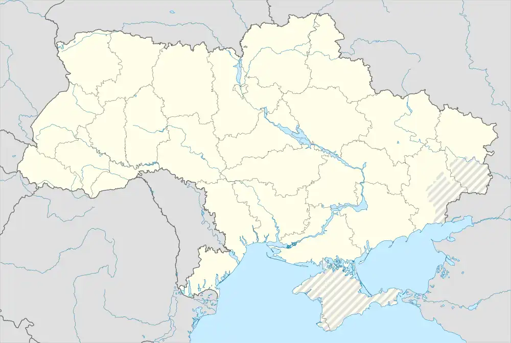 Smila Smila (Ukraine) | |
| Coordinates: 49°12′42″N 31°52′23″E | |
| Country | |
| Oblast | |
| Raion | Cherkasy Raion |
| Founded | 1542 |
| City status | 1926 |
| Government | |
| • Mayor | Mr. Serhiy Ananko |
| Area | |
| • Land | 39.85 km2 (15.39 sq mi) |
| Elevation | 101 m (331 ft) |
| Population (2022) | |
| • Total | 65,675 |
| [1] | |
| Time zone | UTC+2 (EET) |
| • Summer (DST) | UTC+3 (EEST) |
| Postal code | 20700 |
| Area code | +380 4733 |
| Sister cities | Rzhev, Newton, Iowa, Vatutine, Irpin |
| Website | smila-rada.gov.ua |
Geography
Climate
The climate in Smila is moderately continental. Winters are cold with frequent snow. Summers are warm and can be hot in July, with little rain. Periods of temperatures higher than +10 last up to 170 days. The average annual precipitation is 450–520 mm.
History
Smila arose from an early Cossack settlement founded in the late 16th century. It later came under Polish rule.[5]
The construction of the Fastiv-Znamianka railway line spurred industrial growth in Smila- in 1910, the town had 23 factories and a population of 29 000.[4]
During the Second World War, the Wehrmacht deployed Stalag 345 near Smila to hold Soviet prisoners of war. The camp was kept near Smila from early 1941 until December 1943, when the camp was moved to Zagreb.[6]
In 1957, a machine repairs factory established in 1930 was repurposed to produce new machinery. The plant produced machines for food and transportation industries, and in 1972 it employed over a thousand workers.[4]
In 1989 the population of Smila was 77,500.[4]
Until 18 July 2020, Smila was designated as a city of oblast significance and served as the administrative center of Smila Raion though it did not belong to the raion. The settlements of Ploske and Irdynivka were subordinated to Smila city council. As part of the administrative reform of Ukraine, which reduced the number of raions of Cherkasy Oblast to four, the city was merged into Cherkasy Raion.[7][8]
During the Russian invasion of Ukraine, Russian air strikes started a large fire within the city in October, 2022.[9] Air raid sirens sounded in the city as early as March, 2022.[10] A nearby Ukrainian fuel depot containing 100,000 tonnes of fuel was blown up the next day.[11]
Economy
The economic emphasis is on mechanical engineering, and the food industry is also important.[4][12] However, the town's population has generally declined since the 1980s.[12]
Smila is the transport hub for the surrounding region. Smila is where the Kyiv–Dnipro and Odesa–Russia rail routes cross, making Smila one of the most important railway junctions in Ukraine. The large station at the junction is named after Ukraine's national poet and artist, Taras Shevchenko.
Population
| 1845 | 1860 | 1897 | 1926 | 1939 | 1959 | 1970 | 1979 | 1989 | 2001 | 2012 | 2021 |
|---|---|---|---|---|---|---|---|---|---|---|---|
| 8000 | 12 600 | 15 200 | 23 000 | 34 000 | 44 534 | 55 474 | 62 282 | 79 449 | 69 681 | 68 667 | 66,475 |
Notable people
- Samuel (Shmuel) Malavsky – сantor.
- Oleksandr Kovpak – football player.
- Genia Averbuch – architect.
International relations
Sister cities:
 Newton, Iowa, United states
 Vatutine, Ukraine
- Irpin, Ukraine
 Rzhev, Russia
Gallery
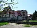 Female gymnasium building
 Assumption Church in Smila
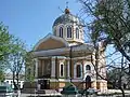 Church of the Holy Virgin
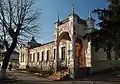 Museum of Local History
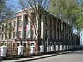 Technical Institute for Sugar Industry in Smila
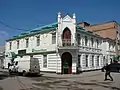 Bank building in Smila
_01.JPG.webp) Shevchenko district
Shevchenko district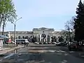 Railway station
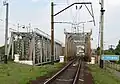 Railway bridge in Smila
 Tiasmyn River in Smila
![Nativity of Saint John the Baptist Church [uk]](../I/%D0%A5%D1%80%D0%B0%D0%BC_%D0%BD%D0%B0_%D1%87%D0%B5%D1%81%D1%82%D1%8C_%D0%A0%D1%96%D0%B7%D0%B4%D0%B2%D0%B0_%D0%86%D0%BE%D0%B0%D0%BD%D0%BD%D0%B0_%D0%A5%D1%80%D0%B5%D1%81%D1%82%D0%B8%D1%82%D0%B5%D0%BB%D1%8F.jpg.webp) Nativity of Saint John the Baptist Church
Nativity of Saint John the Baptist Church
References
- Чисельність населення в місті Сміла [Population in the city of Smila]. index.minfin.com.ua (in Ukrainian). Retrieved 2023-07-04.
- "Смілянська територіальна громада" (in Ukrainian). decentralization.gov.ua.
- "Сміла". Archived from the original on 13 September 2012.
- Struk, Danylo Husar (1993-12-15). Encyclopedia of Ukraine: Volume IV: Ph-Sr. University of Toronto Press. ISBN 978-1-4426-5126-5.
- Struk, Danylo Husar (1993-12-15). Encyclopedia of Ukraine: Volume IV: Ph-Sr. University of Toronto Press. ISBN 978-1-4426-5126-5.
- Megargee, Geoffrey P.; Hecker, Mel (2022-04-26). The United States Holocaust Memorial Museum Encyclopedia of Camps and Ghettos, 1933–1945, Volume IV: Camps and Other Detention Facilities Under the German Armed Forces. Indiana University Press. ISBN 978-0-253-06090-7.
- "Про утворення та ліквідацію районів. Постанова Верховної Ради України № 807-ІХ". Голос України (in Ukrainian). 2020-07-18. Retrieved 2020-10-03.
- "Нові райони: карти + склад" (in Ukrainian). Міністерство розвитку громад та територій України. 17 July 2020.
- "Power outages reported across Ukraine after latest Russian rocket attacks". UPI. Retrieved 2022-12-31.
- "Russia's invasion of Ukraine: List of key events from day 20". www.aljazeera.com. Retrieved 2023-07-04.
- "Russia's defence minister warns of 'uncontrolled escalation' in Ukraine conflict". France 24. 2022-10-23. Retrieved 2023-07-04.
- Cybriwsky, Roman Adrian (2018-03-15). Along Ukraine's River: A Social and Environmental History of the Dnipro. Central European University Press. ISBN 978-963-386-204-9.
- (in Ukrainian) (1972) Історія міст і сіл Української CCP - Черкаська область (History of Towns and Villages of the Ukrainian SSR - Cherkasy Oblast), Kyiv.
External links
- (in Ukrainian) Official city website
- (in Ukrainian) Unofficial city website
| Cities | Coat of arms of Smila municipality | |
|---|---|---|
| Raions | ||
|---|---|---|
| Hromadas |
| |
| Cities | ||
| Urban-type settlements | ||