Soon Valley
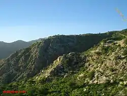
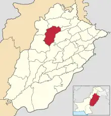
Soon Valley (Punjabi, Urdu: وادیِ سُون) is in the north west of Khushab District, Punjab, Pakistan. Its largest settlement is the town of Naushera.[1] The valley extends from the village of Padhrar to Sakesar, the highest peak in the Salt Range. The valley is 35 miles (56 km) long and has an average width of 9 miles (14 km). It covers a 300-square-mile (780 km2) area. Soon Valley has an abundance of scenic beauty, with lakes, waterfalls, jungle, natural pools and ponds. The valley has been settled since ancient times, most recently by the Awan tribe, which still resides in the valley.[2][3]
WADI E SOON ( SOON VALLEY )
وادیِ سُون Soon Sakesar Valley وادیِ سُون سکیسر | |
|---|---|
 | |
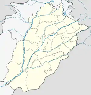
 WADI E SOON ( SOON VALLEY ) Location in Pakistan  WADI E SOON ( SOON VALLEY ) WADI E SOON ( SOON VALLEY ) (Pakistan) | |
| Coordinates: 32°58′N 72°15′E | |
| Country | |
| Region | |
| District | Khushab |
| Elevation | 1,530 m (5,010 ft) |
| Time zone | UTC+5 (PST) |
| Area code | 0454 |
The peak of Mount Sakesar is at 5,010 feet (1,530 m) above sea level. It was once the summer headquarters of the Deputy Commissioners of three districts – Campbellpur (now Attock), Mianwali and Shahpur (now Sargodha). It is the only mountain in this part of the Punjab which receives snowfall in winter. In the late 1950s the Pakistan Air Force placed a radar station on Sarkesar to monitor airspace over north-eastern Pakistan. Also on the mountain is a television transmission center with which the Pakistan Television Corporation relays its transmissions to the surrounding area.[4]
Geography
History and Demography
.jpg.webp)
In 997 CE, Sultan Mahmud Ghaznavi, took over the Ghaznavid dynasty empire established by his father, Sultan Sebuktegin. In 1005 he conquered the Shahis in Kabul and followed it by conquests within the Punjab region. The Delhi Sultanate and later Mughal Empire ruled the region.
The Awans of the Soon Valley were also amongst those the British considered to be "martial race".[6] The British recruited army heavily from Soon Valley for service in the colonial army, and as such, the Awans of this area also formed an important part of the British Indian Army,[7] serving with distinction during World Wars I and II. Of all the Muslim groups recruited by the British, proportionally, the Awans produced the greatest number of recruits during the First and Second World Wars. Contemporary historians Professor Ian Talbot and Professor Tan Tai Yong have asserted that the Awans (amongst other tribes) are viewed as a martial race by not only the British, but neighbouring tribes as well. Awans occupy the highest ranks of the Pakistani Army. A village by the name of Manawan (formerly Man Awan – The heart of the Awans) is also among the notable historical villages of the valley.
Gateway to Soon Sakesar
The Government of Punjab constructed the road from Nurewala to Naushehra in recognition of services rendered by the Awans of Soon Valley during the First World War. Sir W.M. Hailey, the Governor of Punjab formally opened the road on April 1, 1928 – as commemorated on plaques between Khushab and Sakesar as the road enters the hills.
Culture
Many inhabitants of the valley descend from tribes of Arab origin (unauthenticated information). Islamic culture and traditions are the norm. Practices include arranged marriages according to the Islamic traditions, where the wedding ceremony takes place at a mosque. The Nikah is attended by close family members, relatives, and friends of the bride and groom. Usually men and women are separated, either sitting in separate rooms or with a purdah (curtain) separating them.
Luddi is a folk dance for celebratory occasions, when the music is often played on the dhol drum and shehnai oboe.
Lakes of Soon Valley

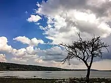
Uchhali Lake is a picturesque salt water lake in the southern Salt Range overlooked by mount Sakaser, the highest mountain in the Salt Range. Its brackish water means that its waters are lifeless.Uchhali Lake is one of the few lakes where every year birds from Siberia, Mongolia and Central Asian countries reach the water of Uchhali Lake through snowy valleys and difficult areas and breed here.[8] Khabikki Lake is also a salt water lake in the southern Salt Range. It is one kilometer wide and two kilometres long. Khabikki is also the name of a neighbouring village. These lakes attract thousands of migratory birds each year including rare white-headed ducks (Oxyura leucocephala) from Central Asia. Jahlar Lake is another serene lake in the valley, it is accessible from Nowshehra as well as from Sargodha.[9]
Historical places
- Akrand Fort of Janjua's (Road way & Tracking Way from Kanhati Garden).
- Lakes: Uchhali Lake, Khabikki Lake and Jahlar Lake.
- Waterfalls at Kufri.
- Amb Sharif is a historical place in Hinduism.
- Kanahti Garden, Sodhi Garden, Khabakki Jheel, Ugalisharif & Uchali Jheel, Sakesar and Daip Shareef and the hiking experiences of hills
- Angah, an important village.
- Sodhi village has waterfalls, a Rest House, and wild animals like Cheetah, Rabbit, Deer, Teetar (Urdu name of a bird).
- Koradhi is famous for its Historical Madrissa, where Qari Qamar Din used to teach
Amb Shareef Hindu temple
The ancient pre-Islamic ancient Hindu temple, is near the Amb Shareef village, on the Sakesar mountain in the Soon Valley. The temple complex, built in brick and mortar, is complex of two temples facing each other. The main temple is several story high, roughly 15 to 20 meter tall. To the west about 75 meters lies another smaller temple, which is 2 story or 7 to 8 meters high. It is located on the Sakesar mountain, near Amb Shareef village.[10]
See also
- Amb Temples
- Hinduism in Pakistan
- Rohtas Fort
- Rawat Fort
- Pharwala
- Sar Jalal
- Mankiala stupa
- Hinglaj Mata
- Kalat Kali Temple
- Malot
- Multan Sun Temple
- Prahladpuri Temple
- Nandana
- Sakesar
- Sadh Belo
- Shivaharkaray
- Shiv Mandir, Umerkot
- Shri Varun Dev Mandir
- Tilla Jogian
- Khabikki Lake
- Namal Lake
- Swaik Lake
- Uchhali Lake
References
- "Soon Valley – Basic Information". visitsoonvalley.com. Retrieved 17 September 2019.
- SIR LEPEL H. GRIFFIN writes in his book 'The Panjab Chiefs' (1865 Edition) p.570-571., that "All branches of the tribe (Awan) are unanimous in stating that they originally came from neighbourhood of Ghazni to India, and all trace their genealogy to Hasrat Ali the son-in-law of the Prophet. Kutab Shah, who came from Ghazni with Sultan Mahmud, was the common ancestor of the Awans……. It was only in the Rawalpindi, Jehlum and Shahpur districts that they became of any political importance……..In Shahpur District the Awans held the hilly country to the north west, Jalar, Naushera and Sukesar, where the head of the tribe still resides." H.A. Rose writes,"But in the best available account of the tribe, the Awans are indeed said to be of Arabian origin and descendants of Qutb Shah" 'A Glossary of the Tribes and Castes of the Punjab and North-West Frontier Province'A glossary of the tribes and castes of the Punjab and North-West ..., Volume 1 By H.A. Rose
- The Soon Valley. http://visitorsheaven.com/Soon%20Sakesar.php Archived 2018-09-27 at the Wayback Machine
- Complete information for tourists visiting Soon Valley http://visitsoonvalley.com/
- "Distance between Karachi and Soon Valley Sakesar".
- Lord Roberts who served as Commander-in-Chief of the British Indian army from 1885 to 1893 enunciated the theory of martial races. During this period the British were suspicious of the Russian advance towards India and Roberts wanted to create an efficient army to face the Russians in case of an invasion by the latter. According to him the most suitable persons for army were available in the north-west part of India, and he wanted that recruitment should be confined to that area only. He justified his theory on the ground that people in some region had become unfit to bear arms because of the softening and deteriorating effects of long years of peace and sense of security in those regions. Lord Roberts, Forty-one years in India (London: 1897), p. 383.
- British Indian Army
- Explore, Soon Valley (2023-02-22). "Uchhali Lake Soon Valley". Explore Soon Valley. Retrieved 2023-08-31.
- "Lakes in Soon Valley". tdcp.gop.pk. Retrieved 17 September 2019.
- Sakesar temple
