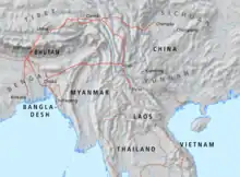
Tea Horse Road
The Tea Horse Road or Chamadao (simplified Chinese: 茶马道; traditional Chinese: 茶馬道), now generally referred to as the Ancient Tea Horse Road or Chamagudao (simplified Chinese: 茶马古道; traditional Chinese: 茶馬古道) was a network of caravan paths winding through the mountains of Sichuan, Yunnan and Tibet in Southwest China.[1] This was also a tea trade route. It is also sometimes referred to as the Southern Silk Road or Southwest Silk Road.
There are numerous surviving archaeological and monumental elements, including trails, bridges, way stations, market towns, palaces, staging posts, shrines and temples along the route.[2]
"Ancient Tea Horse Road" is a historical concept with a specific meaning. It refers to a major traffic road formed by the exchange of tea and horses between Han and Tibet from the Tang and Song Dynasties to the Republic of China.
Road classification
Shaanxi-Gansu Tea Horse Road (陕甘茶马古道)
Shaanxi-Gansu Tea Horse Road is the main road for tea in mainland China to travel west and exchange for horses. It is one of the main routes of the ancient Silk Road.[3]
Tanggu Road (蹚古道)
Beginning in the Han dynasty, it was formed by Shaanxi merchants and the ancient tea-horse market in the southwest frontier. Since the government of the Ming and Qing dynasties imposed government control on tea sales, tea sales were divided into regions, and the most prosperous tea and horse trading market was in Kangding.[3]
Yunnan-Tibet Tea Horse Road (滇藏茶马古道)
It was formed in the late sixth century AD. It started from Yiwu and Pu'er in Xishuangbanna, the main tea producing area of Yunnan, and entered Tibet through today's Dali Bai Autonomous Prefecture, Lijiang City and Shangri-La, and went directly to Lhasa. Some were also re-exported from Tibet to India and Nepal, which was an important trade route between ancient China and South Asia.[3]
Sichuan-Tibet Tea Horse Road (川藏茶马古道)
The Ancient Sichuan-Tibet Tea-Horse Road is a part of the Shaanxi-Kangding-Tibet Tea-Horse Road. It starts from Ya'an, the tea producing area of Yazhou in the east, passes through Dajian Furnace (now Kangding), reaches Lhasa, Tibet in the west, and finally leads to Bhutan, Nepal and India. More than a thousand kilometres, it is an indispensable bridge and link between ancient Tibet and the mainland.[3]
History
Sichuan and Yunnan are believed to be the first tea-producing regions in the world. The first records of tea cultivation suggest that tea was cultivated on Sichuan's Mount Mengding (蒙顶山) between Chengdu and Ya'an earlier than 65 BC. Ya'an has been an important hub of tea trading till the 20th century.
From around a thousand years ago, the Tea Horse Road become a trade link from Yunnan to Tibet; and to Central China via Sichuan Province.[3][4][5][6][7] It is believed that it was through this trading network that tea (typically tea bricks) first spread across China and Asia from its origins in Pu'er county in Yunnan.[8][9] The route earned the name because of the common trade of Tibetan ponies for Chinese tea, a practice dating back at least to the Song dynasty, when the sturdy horses were important for China to fight warring nomads in the north.[10]
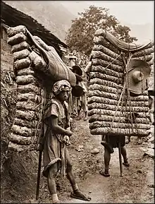
Both people and horses carried heavy loads. Tea porters sometimes carried over 60–90 kg (132-198 lb.), which was often more than their own body weight in tea.[11][12][13] Porters were equipped with metal-tipped staffs, both for balance while walking and to help support the load while they rested, so they didn't need to lay the bales down (as illustrated in the photo).
In addition to tea, the mule caravans carried salt and silk products from Chengdu, notably Shujin (蜀锦)..
Historic Site
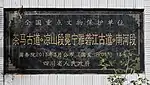
The Ancient Tea Horse Road is a complex network of roads, of which some of the ancient tea horse roads and related historical sites in Sichuan, Yunnan and Guizhou provinces were listed as the seventh batch of China National Key Cultural Relics Protection Units[14] on 5 March 2013. There are numerous cultural heritage sites listed as National Key Cultural Heritage Protection Units, including ancient road sites, post stations, shops, pagodas, bridges and piers, as well as related guild buildings, religious buildings, mining and metallurgical sites and kiln sites, cliff carvings and inscriptions in the ancient tea horse road network.
In Sichuan
The Ancient Tea Horse Road in Sichuan.[15]
| Name | Location | positioning | Description | Picture | Signpost |
|---|---|---|---|---|---|
| In Chengdu | |||||
| Pingle Longshan ancient road | Pingle Town, Qionglai City | 30°20′12″N 103°20′10″E | Located on the south side of Pingle Ancient Town, within the South Silk Road Ruins Scenic Area |  |  |
| Shuanmaling Ancient Road, Linje | Linji Town, Qionglai City | ||||
| Tiantai Mountain eart stream, Zijing Village ancient road | Tiantaishan Town, Qionglai City | 30°13′24″N 103°9′1″E | 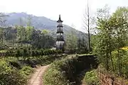 | 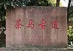 | |
| Jiaguan Gongdian Ancient Road | Jiaguan Town, Qionglai City | 30°15′19″N 103°13′34″E | 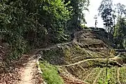 | 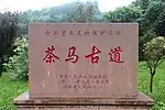 | |
| Site of ancient fire (salt) well of oil press | Huojing Town, Qionglai City | 30°22′54″N 103°13′28″E |  | ||
| Lining waist rock tea horse ancient road | Chaoyanghu Town, Pujiang County | 30°9′17.9″N 103°24′14.4″E | The old stone pathway from the old pine tree on the top of the lined waist rock to the ancient pathway on the shore of Changtan Lake is 470 metres long. |  |  |
| Songmau Ancient Road (Lung Chi Section) | Longchi Town, Dujiangyan City | 31°3′46″N 103°32′4″E |  | 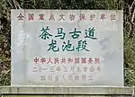 | |
| In Zigong | |||||
| Lok Shan Square | Ziliujing District | ||||
| Huicaikou ancient salt Road | Ziliujing District | 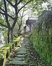 | 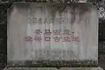 | ||
| Mugye Beach Pier | Gongjin district | 29°21′17″N 104°40′53″E | It consists of two piers, the upper and the lower, and the boat trough was dug in the 35th year of the Kangxi era (1696) and the Pingkang Weir Gate was built in the 30th year of the Guangxu era (1904). |  | 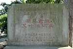 |
| Gong Jing Old Street salt Road | Gongjin district | ||||
| Salt Wharf in Xian Town | Yantan district | ||||
| In Luzhou | |||||
| Guangming Ancient Road | Fuji Town, Lu county | 29°07′23″N 105°24′29″E | Located in Guangming Village, Fuzi Town, Lu County, it runs southeast–northwest, with an existing length of 1091m and a width of 1.7m~2.9m.[16] | 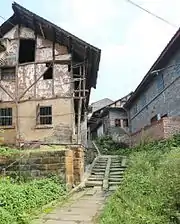 | 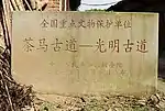 |
| Pauline Street Post Road | Longmatan district | It is 810 meters in length. | 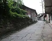 | ||
| Shawan Post Road | Jiangyang district | ||||
| Fengming Post Road | Hejiang County | 28°42′48″N 105°52′50″E | 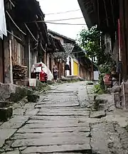 | 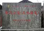 | |
| Bailu Post Road | Hejiang County | ||||
| Xiantan ancient post Road | Hejiang County | ||||
| Dashichuanqian post road | Xuyong county | ||||
| Monkey Ridge Chuanqian post road | Xuyong county | ||||
| Guandou Village Chuanqian post road | Xuyong county | ||||
| Chishui River tea horse post Road | Xuyong county | ||||
| Erlang Post Road | Gulin county | ||||
| In Ya'an | |||||
| Guanyin Tower | Yucheng district | 29°59′26.4″N 102°59′25.5″E | 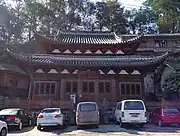 | 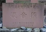 | |
| Jingju nunnery stone archway | Mingshan district | 30°4′33.5″N 103°3′13.9″E | 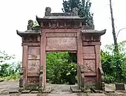 | 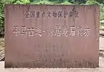 | |
| Yu Palace | Mingshan district | 30°4′40.6″N 103°2′52.7″E |  | 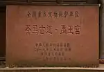 | |
| Ganlu Ling Quan courtyard stone archway | Mingshan district | 30°4′55.7″N 103°2′46.5″E | 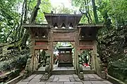 | 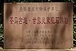 | |
| Imperial Tea Garden | Mingshan district | 30°4′59.8″N 103°2′45.8″E | 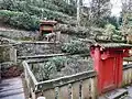 | 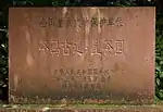 | |
| Tianti ancient path | Mingshan district | 30°4′43.3″N 103°2′51.7″E | 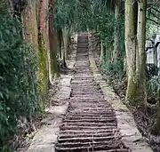 | 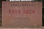 | |
| Ganxipo Tea horse ancient Road post site | Tianquan county | 30°05′25.6″N 102°41′44.3″E | 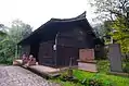 |  | |
| Bian tea official warehouse | Tianquan county | 30°01′14.8″N 102°49′47.9″E | 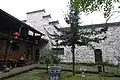 | 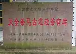 | |
| Feixian Pass and South Boundary Archway | Lushan county | 30°01′35.4″N 102°53′46.1″E | 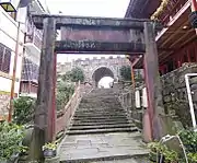 | 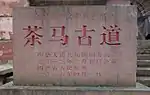 | |
| Saddle waist cliff inscription | Lushan county | ||||
| Rebuild the road monument of Daxiangling Bridge | Xingjing County | ||||
| The site of Gongxing Tea from the Qing dynasty | Xingjing County | 29°47′39.4″N 102°50′28.8″E | Also known as the ginger family compound |  | |
| Qingxi Pass Site of Tang dynasty | Hanyuan county | ||||
| Ruins of Qingxi ancient city in the Qing dynasty | Qingxi town, Hanyuan County |  | |||
| Ruins of the 24 Daoguai Ancient Road | Hanyuan county | ||||
| Yangquanmen Ancient Road site | Qingxi town, Hanyuan County | 29°36′5″N 102°37′48″E | 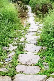 | ||
| In Aba | |||||
| Baizhangfang ancient plank road | Ganbao Township, Li County | It is found on the north bank of the Zaguzhi River near the Baodian Temple in Zaguzhi Township, Gambao Township, Li County |  | ||
| Stone carvings of Sui and Tang Dynasties in Putou Mountain | Putou Township, Li County | ||||
| Kegu Plank Road | Kegu Township, Wenchuan County | 31°30′9.1″N 103°34′17.1″E | Located on the north bank of the Miscellaneous Valley Brain River in Keku Township, Wenchuan County, the surviving site is 158 metres long and 0.4–2 metres wide, including two Qing dynasty inscriptions. | 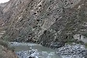 | 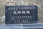 |
| Poyong ancient Road | Maerkang City | ||||
| In Ganzi | |||||
| Hualinping Tea Horse Ancient Road | Xinglong Town, Luding County | 29°42′55.9″N 102°18′14.6″E | 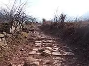 | 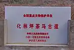 | |
| Fo'er Cliff tea Horse ancient Road | Lengqian Town,Luding county | 29°46′28.2″N 102°13′40.1″E | 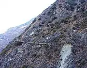 | 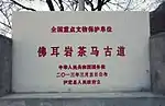 | |
| Yingge Mouth Tea Horse Ancient Road | Batang County | 29°59′11″N 99°7′30″E |  | ||
| In Liangshan | |||||
| Ganluo Qingxi Gorge ancient road | Pingba Township, Ganluo County | 29°08′07.0″N 102°34′37.5″E | 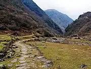 | 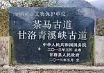 | |
| Dingshan Bridge and Lingguan Inscriptions in Yuexi | Dingshan Township, Yuexi County | 28°35′49.0″N 102°29′48.8″E | 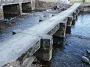 | 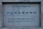 | |
| Dengxiangying Ancient Post | Xide County | 28°27′59.0″N 102°20′38.1″E | 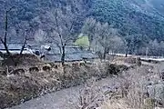 | 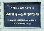 | |
| Xide Mianshan Camp site | Xiande County Mianshan Town | 28°22′31.8″N 102°19′40.5″E | 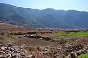 | 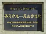 | |
| Yalong River in Mianning, including | Mianning County |
|
| ||
| Songpingguan | Huili County | ||||
In Yunnan
There are 86 cultural heritage sites on the ancient tea horse route in Yunnan province, located in 21 counties and cities[17]。
| Name | Location | Positioning | Description | Picture |
|---|---|---|---|---|
| In Xiangyun County | ||||
| Yunnanyi Ancient Road | Yunnanyi Town, Xiangyun County | 25°25′29″N 100°41′26″E | 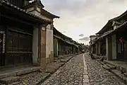 | |
| Xiaoshao to Huangcaoshao Ancient Road | Midian Town, Xiangyun County | |||
| Baisha Slope to Yongan Bridge ancient road | Midian Town, Xiangyun County | |||
| Tiger Pass to Puchang River section of the ancient post road | Midian Town, Xiangyun County | |||
| Xincun to Binchuan south boundary monument section of ancient post road | Xiangyun Town, Xiangyun County | |||
| Zhenyang Gate | Gulou East Street, Xiangcheng Town, Xiangyun County | 25°28′45″N 100°33′34″E | 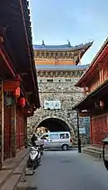 | |
| Yangbi section[18] | ||||
| Dahe River street section | Dahejiang Village, Pingpo Village Committee, Pingpo town, Yangbi | Total length 240 meters | ||
| Liziyuan to the dam field section | Liziyuan Village, Pingpo Village Committee, Pingpo town, Yangbi | The total length is about 550 meters, including the original site of Voucher Bridge | ||
| Jinniu Village mud pass section | Jiexin Village of Jinniu Village Committee, Cangshan West Town, Yangbi | Total length 100 meters | ||
| County Bonan section | Jie Village in Cangshan Xicheng town, Yangbi County | Total length 900 meters | ||
| Shuangmo Lane, Xiajie Village | Xiajie Village, Cangshan West Town, Yangbi County | Total length 400 meters | ||
| Yongpin section | ||||
| Jiaogou Mount section | Yongpin County | |||
| Wanma Guichao Section | Bonan Town, Yongping County | Total length 140 meters | ||
| Iron Works to Little Flower Bridge | Yongpin County | Total length 1600 meters | ||
| Dahuajiao Section | Yongpin County | |||
| Bonan Mount Section | Yongpin County | |||
| Shanyang Old Street Section | Yongpin County | |||
| Midu Section | Yonghe Village, Mizhi Town, Midu County | 25°10′03″N 100°31′21″E | 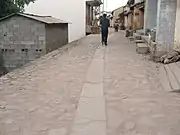 | |
| Heqing Xiangmian Mountain section | Heqing County Songgui town, Jindun Township | |||
| Jianchuan section | Shaxi Town, Jianchuan County | 26°19′12″N 99°51′03″E | .jpg.webp) | |
| Simao Section | ||||
| Site of Caiyang River section | Yutang Village Committee, Yixiang Town, Simao District, Pu 'er City (Caiyang River Nature Reserve)[19] | |||
| Site of Jiejipo section | Simao District, Pu 'er City |  | ||
| 宁洱段[20] | ||||
| Site of Cha 'an Tang Cha Ma Ancient Road | In Ninger County, it starts at Minzhu Village, Ninger Town and ends at Old Fat Tian Group, Xingguang Village, Mohei Town | 23°09′37″N 101°08′11″E | 27 kilometres in length, 7 kilometres better preserved | |
| The ancient site of the Korie Tea Horse Road | Ninger County, starts from Nakoli Village, Tongxin Township, and ends at the foot of Sanjia village, Nanping Town, Simao District | 22°54′48″N 101°02′18″E | 4.38 km in length | |
| Site of Peacock Screen Tea Horse Ancient Road | Ninger County, starting from the Peacock Screen group in Starlight Village, Mohei Town, and ending in Bian village, Mohei Town | 23°12′21.4″N 101°09′55.6″E | Approximately 27 km in length, 12 km better preserved | |
| Yulong County | ||||
| Seventy-two lines | Yulong County Taian Township, Longpan Township | |||
| Shangri-la City[21] | ||||
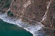
| Twenty-four turn sections | Tiger Leaping Gorge, Shangri-La, starts at Yunuo Village of Yongsheng Village Committee and ends at Yongkuk Village of Sanba Village of Jiangbian Village Committee | 38 km in length | ||
| Twelve rail section | Tiger Leaping Gorge Township, Shangri-La City, starting at Huajiao Slope, Hongqi Village Committee and ending at a village, Hongqi Village Committee | 8 km in length | ||
| Twelve rail section | Jinma Village, Yanhe Village, Guji Village, Rhinoceros Village, Lushi Town, Fengqing County | |||
| Gongshan Wengli section[22] | East bank of Nujiang River, Wuli Village, Zhongluo Town, Gongshan County | 1182m in length | ||
| Lamping Section | Lamping County | Also known as "old me well section"[23] | ||
| Longyang District, Baoshan City[24] | ||||
| Shui Shi Kan Terraced Cloud Road | Shuizhai Village, Pingpo Village, Shuizhai Township, Longyang District, Baoshan City | |||
| Shuizhaipu ancient street and horse shop | Laojie, Shuizhai Village, Shuizhai Township, Longyang District, Baoshan City | |||
| Guanpo ancient Road flagstone road | Beiniujiao Pass, Guanpo Village, Guanpo Village Committee, Banqiao Town, Longyang District, Baoshan City | |||
| Shek Ma Shan to Wu Tau Tong Ancient Road | 3 km west of Qinggangba Village, Hanzhuang Town, Longyang District, Baoshan City | |||
| The Old Stone Path of the Seventy-Six Roads in Lingshui Turnip | Shuijing Pass, Shuijing Village Committee, Pupiao Town, Longyang District, Baoshan City | |||
| The stone path of the ancient road in the Pan Serpent Valley | Pansnake Valley, 1 km west of Dapangqing Village, Ma Street Village Committee, Puxiang Town, Longyang District, Baoshan City | |||
| Huiren Bridge Site | 2 km west of Daojie Village, Daojie Village Committee, Luyang District, Baoshan City, on the Nujiang River | |||
| Gaoligong Mountain Beizhai public house Dongpo ancient road | East slope of Gaoligongshan Beizai Gongfang, Mangkuan Township, Longyang District, Baoshan City | |||
| Gaoligong Mountain Nanzhai public house Dongpo ancient road | Gao Li Gong Shan Nan Zhai Public House, Bai Hua Lin Village, Mang Kuan Township, Longyang District, Baoshan City | |||
| Ancient Eastern Slope Trail at Dafengkou, Gaoligong Mountain | Gaoligong Mountain Fengkou Pass, 25 kilometers west of Xiangshu Village, Hemu Village Committee, Lujiang Town, Longyang District, Baoshan City | |||
| Gaoligong Mountain Chengmendong Dongpo ancient road | Longyang District, Baoshan City Lujiang Town Ba Wan Village Committee Pumanshao Village 4 km west of the high east side of the Li Gong Mountain watershed highland | |||
| A bowl of water on the old stone path on the Western slope | Longyang District Banqiao Town, Baoshan City | |||
| Mang-wide double rainbow cable bridge | 2 km east of Scalding Xi Village, Mangkuan Township, Longyang District, Baoshan City on the Nu River | |||
| Tengchong section[25] | ||||
| Beizhai public House west slope ancient road flagstone road | Jietou town,Tengchong City | 25°32′39.1″N 98°45′33.4″E | ||
| Chengmen Cave west slope ancient stone road | Mangba Town, Tengchong City | 24°56′00.8″N 98°44′41.5″E | ||
| Terracotta paved ancient flagstone road | Mangba Town, Tengchong City | 24°59′36.1″N 98°36′40.3″E | ||
| Fengfengkou west slope ancient road SLATE road | Mangba Town, Tengchong City | 24°58′07.9″N 98°45′13.7″E | ||
| Big break field slope ancient trough valley road | Zhonghe Town, Tengchong City | 25°01′24.1″N 98°14′10.9″E | ||
| Olive Slope ancient road flagstone road | Mangba Town, Tengchong City | 24°58′35.3″N 98°39′38.5″E | ||
| Nanzhai public House west slope ancient road flagstone road | Qushi Town, Tengchong City | 25°17′26.7″N 98°44′00.2″E | ||
| Huangzhuyuan paved ancient road flagstone road | Mangba Town, Tengchong City | 24°58′07.8″N 98°45′13.7″E | ||
| Yubi Slope ancient stone Road | Tengchong Street,Tengchong City | 25°00′30.5″N 98°33′28.5″E | ||
| Victory blockhouse | Houqiao Town, Tengchong City | 25°20′31.4″N 98°11′12.0″E | ||
| Longchuan County[26] | ||||
| Shanmu Longshan north slope ancient road | Longchuan County Huiguo Township Shanmulong Village | 24°32′15″N 98°05′41″E | 5 km in length, 3.2 km extant | |
| Fir cage Shanxi slope ancient road | Longchuan County Huiguo Township Shanmulong Village | |||
| Lianghe County | ||||
| Maofu Ancient Road flagstone Road | Maofu Ha Zhai, Maofu Village, Jiubao Township, Lianghe County | 24°47′43″N 98°11′56″E | ||
| Deqin County | ||||
| A Dunzi section | Deqin County | |||
| Meili section | Deqin County | |||
| Lijiang Ancient City District | ||||
| Qiu Tang Guan Tea horse ancient road section | Gucheng District, Lijiang City | |||
| Shuhe Tea horse ancient road section | Gucheng District, Lijiang City | |||
| Horseshoe print stone path | Gucheng District, Lijiang City | |||
| Yuan County, Puer Town | ||||
| The Ruins of Guang'en Bridge | Minjiang Village, Enle Town, Zhenyuan County | |||
| Stone carving of the Passing Gate at Xiaoshuijing Liangzi | Yuan County | |||
| The ancient tea and horse route in the Wailing Mountains | Yuan County | |||
In Guizhou
| Name | Location | location | Description | picture |
|---|---|---|---|---|
| Guiyang Section[27] | ||||
| Changpolin Old Road | Baiyun district | Located in the Changpo Ling Forest Park, the masonry is about 3 km long and was built in the Ming dynasty. | ||
| Centipede Slope ancient Road, including Centipede Bridge | Saparing town, Xiuwen County | The post road is now about 5 km long; the Centipede Bridge is a three-hole arch bridge, 41m long and 5m wide, spanning the Cat Cave River. | ||
| Old Black Mud Post Road | Qingzhen City black mud sentinel village | Built during the Hongwu period of the Ming dynasty, it is now 5 km long and built of green stone. | ||
| Black Mud Wharf | Qingzhen City black mud sentinel village | Built in the 16th year of the Daoguang era of the Qing dynasty (1836). | ||
| Qing Yan Ancient Road | Huaxi District Qingyan Town | Built during the Wanli period of the Ming dynasty, it is now 8 km long. | ||
| Bijie Section[28] | ||||
| Qixingguan Ancient Post Road | Yangjiawan Township, Qixingguan District | The surviving ancient post road is 2 km long and 1-2m wide. | ||
| Seven Star Pass Cliffs | Yangjiawan Township, Qixingguan District | |||
| Bijie Shaanxi Association House | Chengguan Town, Qixingguan District | Also known as the "Spring and Autumn Ancestral Hall", it is located at No. 41, South China Road, Chengguan Town. It was first built during the Qianlong period, sitting west to east, and consists of a street shop, a theatre building, a large hall, a bell tower, a drum tower and a north and south wing. | ||
| Sibao Old Road | Weining County[29] Yan chang town | Located in the southern part of the village of Sibao in the town of Yancang, it was built in the Ming dynasty during the Hongwu period and survives for about 10 km. | ||
| Ying Hong Ancient Road | Jinduo Township, Weining County | Located in Ying Hong Village, Jindou Township, the masonry is about 3 km long, with the existing section from Guanyin Yan to the old town street along the Kedu River. | ||
| Six Hole Bridge Long Beach | Caohai Town, Weining County | It was built in the Qing dynasty during the Xianfeng period and repaired during the Tongzhi period. North-west-south-east, 345m long, of which 328m is the length of the embankment and 3m wide. The dike and the bridge are united, the bridge spans the Dazhong River and is a three-hole stone arch bridge, 17m long and 4.5m wide, with a net span of 3.6m and a height of 2.2m; the dike and the bridge are built of material stone, and willows are planted all over the dike. | ||
| Kedu Bridge | Jinduo Township, Weining County | |||
| Kam Tong Ancient Road | Huangniatang Township, Dafang County | The existing 2 km long, built in the Ming dynasty, is paved with stone. | ||
| Goya Old Road | Shuangshan Township and Zhuyuan Township, Dafang County | Built in the 17th year of the reign of Hongwu (1384), it is now about 5 km long. | ||
| Guli Old Road | Guli Township, Qianxi County | Built in the 17th year of the reign of Hongwu (1384), it is now about 2 km long. | ||
| Parrot's Beak Old Road | Shuitang Township, Hezhang County | Located in the village of Shuitang in the township of Shuitang, it was built in the Ming dynasty during the Hongwu period and is about 3–4 km long. | ||
| Yishenglong Trading Company | Drumfield Street, Jinsha County | Also known as "Rome Street Salt House", it is located at 133 Rome Road, Chengguan Town, and was built in the Qing dynasty. The building is laid out in the "Dragon Gate" style, consisting of a stable, a main room, a north and south wing, a salt storehouse, and a fire-fighting wall. | ||
| Ancient Road of the Yutang River | Jinsha County | |||
| Yidu Rock Carving | Qingchi Township, Jinsha County | |||
| Qing Chi Jiangxi Association House | Qingchi Township, Jinsha County | |||
| Luo Qi's Mei's Festival of Filial Piety | Jinsha County | Built in the fifth year of the Daoguang era (1825), it is approximately 9 metres high. | ||
| Anshun section | ||||
| Jigongbei Old Post Station | Guanglin County | |||
| Guangsoling Ancient Post Road, including the ruins of the Ba Ling Bridge | Guanglin County | |||
| Goshulou Sekidai | Guanglin County | |||
| Beikou Ancient Post Road | Guanglin County | |||
| Anlong Ancient Post Road | Guanglin County | |||
| Panjiang Bridge Stone Carving Group | Guanling County, Anshun City and Qinglong County, Qianxinan Prefecture | |||
| Liupanshui Section | ||||
| The ancient road from Daitieguan to Canziyao (Liuzhi section) | Liuzhi District | |||
| Old Soft Bridge Post Road with Welcome Bridge | Panzhou City | |||
| Xiaojiezi Ancient Road | Panzhou City | |||
| Huopu Ancient Road | Panzhou City | |||
| Chating Ancient Road | Panzhou City | |||
| Mothballed Old Road | Panzhou City | Also known as the Golden Land Ancient Road. | ||
| Plumtree Old Road | Panzhou City | Also known as the Great Water Well Ancient Road. | ||
| Pingguan to Shengjingguan Ancient Road | Panzhou City | |||
| Shaoshang Ancient Road | Panzhou City | Also known as the Two Rivers Water Gully Ancient Road. | ||
| Shiguan Old Road | Panzhou City | |||
| Qianxinan section | ||||
| Panjiang Bridge Stone Carving Group | Qinglong County, Qianxinan Prefecture, Guanling County, Anshun City | |||
| Pan River Bridge Old Road | Qinglong County | |||
| The Ancient Road of Halfpond | Qinglong County | |||
| Angul Pahang | Angu Township, Qinglong County | Built in 1826, it is a brick and porcelain structure with four columns and three single doors.[30] | ||
| Pinehill Temple | Pu'an County[31] | |||
| Daitieguan to Canziyao Ancient Road (Pu'an section) | Pu'an County | |||
| Ma Ling Old Road (with wooden bridge) | Yilong New District | |||
Historical value
The ruins of Guangen Bridge
The site of Guangen Bridge is located in Minjiang Village, Zhen Yuan County and Enle Old Street river bank, built in the early Qing dynasty, the bridge is 188 meters long, with stone piers and wooden frames, and more than 50 tiled houses on both sides. Qing Yongzheng five years (1727) flooding washed away, the Qing dynasty Yongzheng eight years (1730) and the Qing dynasty Daoguang three years (1823), the county Tan on the restoration of the wide grace bridge.
Qing dynasty Daoguang six years (1826), the county Zhang Zhao additional repaired the Guangen Bridge. Qing dynasty Tongzhi's first year (1862), this bridge was burned again.
In the middle of the Republic of China, repaired into a stone pier wooden surface bridge. Early liberation of China, the bridge was washed away by the river, now only four stone piers, the rest were covered by the river bank sediment, stone pier part in 1973 to build the Enable Bridge with stone was demolished. Now the west bank pier is 4.2 meters high, 12.6 meters wide, and 9.7 meters long, complete preservation.[14]
Bunakuo
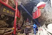
"Bunakuo" is the translation of the Naxi language, Chinese means "artemisia plain", because of the wild artemisia growing everywhere and the name, as known as "Guangle village". The administrative area belongs to Jinan Town of Gucheng District, which was the largest market town on the eastern route of the ancient tea horse road in ancient times, and is rich in cultural relics, natural landscapes, ethnic culture and other tourism resources. The natural scenery of Leidashan Mountain, the culture of Guzong created by the Tibetan descendants of the Guzong people who migrated from Yanjing in Tibet, and the local Naxi Dongba culture are intertwined here.[32]
Safeguard procedures
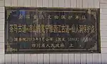
On March 5, 2013, the Tea Horse Ancient Road was announced by The State Council of the People's Republic of China as the seventh batch of national key cultural relic protection units.[14]
Future
In the 21st century, the legacy of the Tea-Horse Road has been used to promote a railway that will connect Chengdu to Lhasa. This planned railroad, part of the PRC's 13th 5-Year Plan, is called the Sichuan-Tibet railway (川藏铁路); it will connect cities across the route including Kangding. Authorities claim it will bring great benefit to the people's welfare.[33]
Gallery
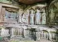 Feixiange Grottoes (689 AD), Buddhist art on the route from Chengdu to Ya'an.
- The Royal Tea Garden, named by Emperor Xiaozong of Song (1186 AD) on Mount Mengding. Mount Mengding is the place where tea was first cultivated with written records (65 BC).
- The surviving ancient route in Pujiang between Chengdu and Ya'an.
- The historical site of Ganxipo Posthouse on the route in Tianquan, Sichuan.
- The official tea warehouse of Tea Horse Bureau (Qing dynasty) on the route in Tianquan, Sichuan.
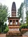 The stone pagoda of Shita Temple (1169 AD) on the route from Chengdu to Ya'an.
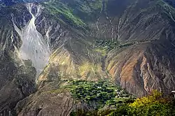 Markham County in the very east of Tibet. In this region, near upper Mekong, there was the junction of the Sichuan and Yunnan branches of the route.
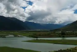
See also
- Tea
- Pu'er tea
- Mengding Ganlu tea
- Shaxi, Yunnan, a well-preserved historical trading town in Jianchuan County on the ancient tea route
- Siberian Route
- Silk Road
- Jeff Fuchs, the first westerner to walk the entire road
References
- Forbes, Andrew; Henley, David (2011). Traders of the Golden Triangle (A study of the traditional Yunnanese mule caravan trade). Chiang Mai. Cognoscenti Books. ISBN 978-1300701460.
- Williams, Tim, Lin, Roland Chih-Hung and Gai, Jorayev. Final Technical Report on the results of the UNESCO/Korean Funds-in-Trust Project: Support for the Preparation for the World Heritage Serial Nomination of the Silk Roads in South Asia, 2013–2016.
- "Horse Corridor in Heaven". Shambhalatimes.org. 2010-01-18. Retrieved 2011-11-18.
- "Tea-Horse Route". Chinatrekking.com. Retrieved 2011-11-18.
- "The road line of the ancient tea-and-horse trade road". Yellowsheepriver.com. Retrieved 2011-11-18.
- "Richness, Diversity and Natural Beauty on the Tea Horse Road". English.cri.cn. Archived from the original on July 10, 2012. Retrieved 2011-11-18.
- "Strange Brew:The Story of Puer Tea 普洱茶". Retrieved 2011-11-28.
- Jeff Fuchs. The Ancient Tea Horse Road: Travels with the Last of the Himalayan Muleteers, Viking Canada, 2008. ISBN 978-0-670-06611-7
- Forbes, Andrew, and Henley, David, 'Pu'er Tea Traditions' in: China's Ancient Tea Horse Road. Chiang Mai, Cognoscenti Books, 2011.
- Jenkins, Mark (May 2010). "The Tea Horse Road". National Geographic.
- "Between Winds and Clouds: Chapter 2". Gutenberg-e.org. 2007-12-04. Retrieved 2014-08-22.
- "Holiday". Weeklyholiday.net. Archived from the original on 15 June 2013.
- "History and Legend of Sino-Bangla Contacts". Bd.china-embassy.org. Archived from the original on 2016-03-04. Retrieved 2015-05-19.
- "国务院核定公布第七批全国重点文物保护单位". www.gov.cn. Retrieved 9 December 2022.
- "四川省人民政府关于公布四川省全国重点文物保护单位和省级文物保护单位保护范围的通知". 四川省人民政府. 2014-11-05. Retrieved 2017-10-02.
- "泸州茶马古道上的"国宝"". 泸州新闻网. 2013-11-22. Archived from the original on 2014-07-08. Retrieved 2017-10-02.
- 《国立西南联合大学旧址等298处文物保护单位保护范围和建设控制地带划定方案》(云南省文物局)
- "漾濞彝族自治县文化和旅游局关于漾濞县各级文物保护单位文物安全直接责任单位和直接责任人的公告". 大理漾濞宣传网. 2020-03-16. Retrieved 2022-07-14.
- "思茅区不可移动文物名录". 普洱市人民政府. 2020-11-19. Retrieved 2022-10-18.
- "宁洱茶马古道". 普洱日报. 2022-07-22. Retrieved 2022-10-18.
- 杨秀芸 (2020). "浅谈迪庆茶马古道及其相关的地名文化遗存". 文物鉴定与鉴赏 (24): 53–55. doi:WWJS202024018.
- "关于茶马古道翁里段封闭施工的通告". 贡山县人民政府. 2021-12-20. Retrieved 2022-10-18.
- "兰坪县人民政府关于公布国家级文物保护单位玉水坪遗址、茶马古道(老姆井段)保护范围的通知" (PDF). 兰坪县人民政府. 2014-10-21. Retrieved 2022-10-18.
- 隆阳区文化和旅游局 (2022-06-28). "隆阳区不可移动文物汇总表(188项)". 隆阳区人民政府. Retrieved 2022-10-18.
- "国家级文保单位:茶马古道腾冲段". 腾冲市文化和旅游局. 2021-06-04. Retrieved 2022-07-23.
- "德宏民族团结月40年丨德宏文保丨 陇川杉木笼茶马古道". 德宏州人民政府. 2022-10-11. Retrieved 2022-10-18.
- "我市五处文物纳入"茶马古道"全国重点文物保护单位". 贵阳日报. 2013-06-09. Archived from the original on 2016-03-04. Retrieved 2017-10-02.
- "悠悠历史苍茫古道 "茶马古道"毕节段". 云贵旅游地理网. 2013-05-12. Archived from the original on 2017-10-03. Retrieved 2017-10-02.
- "威宁报社:第七批全国重点文物保护单位名单出炉". 新华网. 2013-05-16. Archived from the original on 2016-03-04. Retrieved 2017-10-02.
- "优势:晴隆县文化旅游资源". Archived from the original on 2020-06-04. Retrieved 2015-12-20.
- "普安县情简介". 多彩贵州网. 2015-08-09. Archived from the original on 2017-10-02. Retrieved 2017-10-02.
- "Lijiang Daily News - Bunakou". Lijiang Daily News. 2022-08-07. Retrieved 2022-12-05.
- "Reviving the ancient tea-horse route". CCTV News. 2015-08-13. Retrieved 2022-12-09.
Further reading
- Forbes, Andrew ; Henley, David (2011). China's Ancient Tea Horse Road. Chiang Mai: Cognoscenti Books. ASIN B005DQV7Q2
- Forbes, Andrew ; Henley, David (2011). Traders of the Golden Triangle. Chiang Mai: Cognoscenti Books. ASIN B006GMID5
- Freeman, Michael; Ahmed, Selena (2011). Tea Horse Road: China's Ancient Trade Road to Tibet. Bangkok: River Books Co, Ltd. ISBN 978-974-9863-93-0.
External links
- Documentary: Insight on Asia - Asian Corridor in Heaven - Made by KBS. TV Program.
- Tea Horse Road - National Geographic Magazine
- "The Tea Horse Road", Jeff Fuchs, The Silk Road, Vol.6, No.1 (Winter 2008).
- Interview: Jeff Fuchs, Gokunming, August 11, 2010.
- Bob Rogers and Claire Rogers, "Traveling Today's Tea Horse Road", Desert Leaf magazine, February 2011.