Shire of Strathbogie
The Shire of Strathbogie is a local government area in the Hume region of Victoria, Australia, located in the north-east part of the state. It covers an area of 3,303 square kilometres (1,275 sq mi) and in June 2018 had a population of 10,645.[1]
| Shire of Strathbogie Victoria | |||||||||||||||
|---|---|---|---|---|---|---|---|---|---|---|---|---|---|---|---|
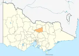 Location in Victoria | |||||||||||||||
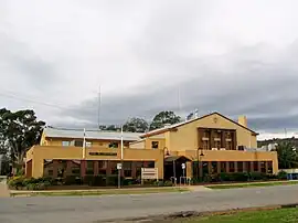 Council Offices in Euroa | |||||||||||||||
| Population | 10,645 (2018)[1] | ||||||||||||||
| • Density | 3.2228/km2 (8.3471/sq mi) | ||||||||||||||
| Established | 1994 | ||||||||||||||
| Gazetted | 18 November 1994[2] | ||||||||||||||
| Area | 3,303 km2 (1,275.3 sq mi)[1] | ||||||||||||||
| Mayor | Cr Laura Binks | ||||||||||||||
| Council seat | Euroa | ||||||||||||||
| Region | Hume | ||||||||||||||
| State electorate(s) | Euroa | ||||||||||||||
| Federal division(s) | |||||||||||||||
| Website | Shire of Strathbogie | ||||||||||||||
| |||||||||||||||
It includes the towns of Avenel, Euroa, Longwood, Nagambie, Strathbogie and Violet Town. It was formed in 1994 from the amalgamation of parts of the Shire of Euroa, Shire of Goulburn, Shire of Violet Town, Shire of McIvor and Rural City of Seymour.[2]
The Shire is governed and administered by the Strathbogie Shire Council; its seat of local government and administrative centre is located at the council headquarters in Euroa, it also has service centres located in Nagambie and Violet Town. The Shire is named after the major geographical feature in the region, the Strathbogie Ranges, which is located in the south-east of the LGA.
The Shire is about 150 kilometres (90 mi) from Melbourne and bordered to the east by the Strathbogie Ranges and to the west by the Nagambie Lakes district. It is also known for its sheep production, horse studs (earning the title "The Horse Capital of Victoria"), wineries (Mitchelton, Tahbilk, Fowles Wines), olives and alpacas. Tourism is a growing industry in the area, with many B&Bs, hotels and restaurants.
Council
Current composition
The council is composed of five wards and seven councillors, with two councillors per ward elected to represent each of the Seven Creeks and Lake Nagambie wards, and one councillor per remaining ward elected to represent each of the other wards.[3]
| Ward | Councillor | Notes[4] | |
|---|---|---|---|
| Honeysuckle Creek | Chris Raeburn | ||
| Hughes Creek | Paul Murray | Deputy Mayor | |
| Lake Nagambie | Robin Weatherald | ||
| Reg Dickinson | |||
| Mount Wombat | Laura Binks | Mayor | |
| Seven Creeks | Sally Hayes-Burke | ||
| Kristy Hourigan | |||
Administration and governance
The council meets in the council chambers at the council headquarters in the Euroa Municipal Offices, which is also the location of the council's administrative activities. It also provides customer services at both its administrative centre in Euroa, and its service centres in Nagambie and Violet Town.
Townships and localities
The 2021 census, the shire had a population of 11,455 up from 10,274 in the 2016 census[5]
| Population | ||
|---|---|---|
| Locality | 2016 | 2021 |
| Arcadia South | 75 | 95 |
| Avenel^ | 1,048 | 1,112 |
| Baddaginnie^ | 338 | 347 |
| Bailieston | 109 | 120 |
| Balmattum | 110 | 135 |
| Boho | 68 | 88 |
| Boho South^ | 77 | 93 |
| Creek Junction^ | 16 | 34 |
| Creightons Creek | 138 | 162 |
| Earlston | 79 | 82 |
| Euroa | 3,275 | 3,508 |
| Gooram^ | 148 | 141 |
| Population | ||
|---|---|---|
| Locality | 2016 | 2021 |
| Goulburn Weir^ | 82 | 90 |
| Graytown | 58 | 60 |
| Kelvin View | 64 | 76 |
| Kirwans Bridge | 136 | 134 |
| Kithbrook | 47 | 67 |
| Koonda | 15 | 26 |
| Locksley | 110 | 131 |
| Longwood | 240 | 263 |
| Longwood East | 95 | 131 |
| Mangalore^ | 182 | 183 |
| Marraweeney | 52 | 77 |
| Population | ||
|---|---|---|
| Locality | 2016 | 2021 |
| Miepoll | 211 | 223 |
| Mitchellstown | 57 | 71 |
| Moglonemby | 27 | 28 |
| Molka | 38 | 34 |
| Moorilim^ | 25 | 25 |
| Moormbool West | 32 | 43 |
| Nagambie | 1,886 | 2,254 |
| Nalinga^ | 25 | 22 |
| Pranjip | 18 | 28 |
| Riggs Creek | 30 | 31 |
| Ruffy^ | 112 | 164 |
| Population | ||
|---|---|---|
| Locality | 2016 | 2021 |
| Sheans Creek | 33 | 38 |
| Strathbogie | 304 | 351 |
| Tabilk | 131 | 160 |
| Tamleugh | 51 | 54 |
| Tarcombe^ | 42 | 32 |
| Upotipotpon | 57 | 56 |
| Upton Hill | 23 | 29 |
| Violet Town^ | 874 | 936 |
| Wahring | 85 | 88 |
| Whroo^ | 42 | 45 |
| Wirrate | 3 | 3 |
^ - Territory divided with another LGA
See also
References
- "3218.0 – Regional Population Growth, Australia, 2017-18: Population Estimates by Local Government Area (ASGS 2018), 2017 to 2018". Australian Bureau of Statistics. Australian Bureau of Statistics. 27 March 2019. Retrieved 25 October 2019. Estimated resident population, 30 June 2018.
- Victoria Government Gazette – Online Archive (1837–1997). "S87 of 1994: Order estg (Part 8) the Shire of Strathbogie". State Library of Victoria. State Government of Victoria (published 18 November 1994). p. 4. Retrieved 10 January 2014.
- Local Government in Victoria. "Strathbogie Shire Council". Department of Transport, Planning and Local Infrastructure. State Government of Victoria. Retrieved 10 January 2014.
- "Councillors - Strathbogie Shire Council". 30 June 2022.
- "Census | Australian Bureau of Statistics". www.abs.gov.au. 11 January 2023.
External links
- Strathbogie Shire Council official website
- Metlink local public transport map
- Link to Land Victoria interactive maps
- Strathbogie Ranges Tourism
- The Euroa Gazette
Localities in the Shire of Strathbogie | ||
|---|---|---|
| Town | 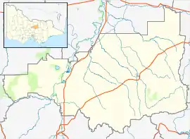 | |
| Locality |
| |
^ - Territory divided with another LGA | ||