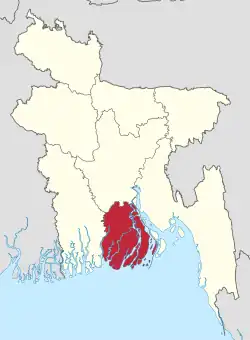
Taltali Upazila
Taltali (Bengali: তালতলী) is an upazila of Barguna District in the division of Barisal, Bangladesh.
Taltali
তালতলী | |
|---|---|
.svg.png.webp) | |
| Coordinates: 21.985°N 90.085°E | |
| Country | |
| Division | Barisal Division |
| District | Barguna District |
| Area | |
| • Total | 333.83 km2 (128.89 sq mi) |
| Population (2011) | |
| • Total | 88,004 |
| • Density | 260/km2 (680/sq mi) |
| Time zone | UTC+6 (BST) |
| Website | [taltali |
History
Taltali Upazila was established on 25 April 2012.[1] It was previously part of Amtali Upazila.
Geography
Taltali is at 22.0876°N 90.1770°E. It covers an area of 258.94 km2 with the population of 88,004 people. It's literacy rate is 89%. It is by the Bay of Bengal. The Burishwar river and Barguna Sadar Upazila are on the west of it. Andharmanik river and Kalapara Upazila of Patuakhali are in the east.[2]
Demographics
As of the 2011 Bangladesh census, Taltali has a population of 88,004 living in 21,011 households. Taltali has an average literacy rate of 54.99% (7+ years) and a sex ratio of 1013 females per 1000 males. The population is entirely rural.[3]
Muslims are 81,375 (92.47%), Hindus 5,611 (6.38%) and Buddhists 974 (1.11%).[3] Most of The area is Rural Based. Farmer's and Fishermen are the Leading profession. She has a Natural Forest Reserve Named TengraGiri Eco Park and a Clean and Calm Beach Named Shuvo-Shondha, Many Tourists come here to Enjoy the Natural Beauty of Paira-Bishkhali-Bay of Bengal Mohona. Some 998 Rakhaine people are still living here.
Administration
Taltali Upazila is divided into seven union parishads: Barabagi, Chhotabagi, Kariibaria, Nishanbaria, Panchakoralia, Sarikkhali, and Sonakata.[4]
References
- "Taltali Upazila at a glance". National Information Web. Retrieved 18 September 2015.
- Shorowarthy, Shahab Uddin (2022-10-29). "Taltali Upazila: 5 Interesting Places To Visit in This Area". nehrin.com. Retrieved 2023-01-16.
- "Population Census 2011 Community Tables: Barguna" (PDF). Bangladesh Bureau of Statistics.
- "List of Unions". Taltali Upazila.
