Te Kowhai
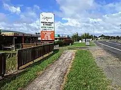
Te Kowhai is a small rural town situated 15 km north west of Hamilton City in New Zealand. It consists of mainly dairy and cattle farms and also includes a small dairy/takeaway, fresh vegetable and fruit store, cafe, bakery, a large park with a playground and skate park, and mechanics shop. Te Kowhai Aerodrome is situated near the township. The town is popular for new subdivisions.
Te Kowhai
Te Kōwhai | |
|---|---|
 | |
| Coordinates: 37°44′18.1″S 175°9′15.25″E | |
| Country | New Zealand |
| Region | Waikato |
| District | Waikato District |
| Ward | Newcastle Ward |
| Electorates | |
| Government | |
| • Territorial Authority | Waikato District Council |
| • Regional council | Waikato Regional Council |
| Area | |
| • Total | 0.75 km2 (0.29 sq mi) |
| Population (June 2023)[2] | |
| • Total | 660 |
| • Density | 880/km2 (2,300/sq mi) |
The New Zealand Ministry for Culture and Heritage gives a translation of "the kōwhai tree" for Te Kōwhai.[3]
Demographics
Statistics New Zealand describes Te Kowhai as a rural settlement, which covers 0.75 km2 (0.29 sq mi)[1] and had an estimated population of 660 as of June 2023,[2] with a population density of 880 people per km2. Te Kowhai settlement is part of the larger Te Kowhai statistical area.
| Year | Pop. | ±% p.a. |
|---|---|---|
| 2006 | 390 | — |
| 2013 | 432 | +1.47% |
| 2018 | 492 | +2.64% |
| Source: [4] | ||
Te Kowhai settlement had a population of 492 at the 2018 New Zealand census, an increase of 60 people (13.9%) since the 2013 census, and an increase of 102 people (26.2%) since the 2006 census. There were 189 households, comprising 222 males and 270 females, giving a sex ratio of 0.82 males per female, with 111 people (22.6%) aged under 15 years, 60 (12.2%) aged 15 to 29, 213 (43.3%) aged 30 to 64, and 114 (23.2%) aged 65 or older.
Ethnicities were 90.9% European/Pākehā, 15.2% Māori, 1.2% Pacific peoples, 1.8% Asian, and 3.7% other ethnicities. People may identify with more than one ethnicity.
Although some people chose not to answer the census's question about religious affiliation, 50.6% had no religion, 39.6% were Christian and 1.8% had other religions.
Of those at least 15 years old, 75 (19.7%) people had a bachelor's or higher degree, and 90 (23.6%) people had no formal qualifications. 87 people (22.8%) earned over $70,000 compared to 17.2% nationally. The employment status of those at least 15 was that 168 (44.1%) people were employed full-time, 63 (16.5%) were part-time, and 6 (1.6%) were unemployed.[4]
Te Kowhai statistical area
Te Kowhai statistical area covers 44.95 km2 (17.36 sq mi)[1] and had an estimated population of 2,320 as of June 2022,[5] with a population density of 52 people per km2.
| Year | Pop. | ±% p.a. |
|---|---|---|
| 2006 | 1,509 | — |
| 2013 | 1,746 | +2.11% |
| 2018 | 2,061 | +3.37% |
| Source: [6] | ||
Te Kowhai statistical area had a population of 2,061 at the 2018 New Zealand census, an increase of 315 people (18.0%) since the 2013 census, and an increase of 552 people (36.6%) since the 2006 census. There were 711 households, comprising 1,008 males and 1,053 females, giving a sex ratio of 0.96 males per female. The median age was 41.2 years (compared with 37.4 years nationally), with 489 people (23.7%) aged under 15 years, 300 (14.6%) aged 15 to 29, 957 (46.4%) aged 30 to 64, and 315 (15.3%) aged 65 or older.
Ethnicities were 91.3% European/Pākehā, 12.7% Māori, 0.7% Pacific peoples, 2.3% Asian, and 1.9% other ethnicities. People may identify with more than one ethnicity.
The percentage of people born overseas was 10.8, compared with 27.1% nationally.
Although some people chose not to answer the census's question about religious affiliation, 56.5% had no religion, 35.4% were Christian, 0.3% had Māori religious beliefs, 0.1% were Muslim, 0.1% were Buddhist and 1.7% had other religions.
Of those at least 15 years old, 303 (19.3%) people had a bachelor's or higher degree, and 309 (19.7%) people had no formal qualifications. The median income was $39,500, compared with $31,800 nationally. 414 people (26.3%) earned over $70,000 compared to 17.2% nationally. The employment status of those at least 15 was that 867 (55.2%) people were employed full-time, 261 (16.6%) were part-time, and 36 (2.3%) were unemployed.[6]
Education
Te Kowhai School is a coeducational full primary (years 1-8) school with a roll of 325 students as of April 2023.[7][8] The school opened in 1890, and moved to its present site in 1900.[9]
See also
- Micro Aviation NZ, manufacturer based in the town
References
- "ArcGIS Web Application". statsnz.maps.arcgis.com. Retrieved 24 September 2022.
- "Subnational population estimates (RC, SA2), by age and sex, at 30 June 1996-2023 (2023 boundaries)". Statistics New Zealand. Retrieved 25 October 2023. (regional councils); "Subnational population estimates (TA, SA2), by age and sex, at 30 June 1996-2023 (2023 boundaries)". Statistics New Zealand. Retrieved 25 October 2023. (territorial authorities); "Subnational population estimates (urban rural), by age and sex, at 30 June 1996-2023 (2023 boundaries)". Statistics New Zealand. Retrieved 25 October 2023. (urban areas)
- "1000 Māori place names". New Zealand Ministry for Culture and Heritage. 6 August 2019.
- "Statistical area 1 dataset for 2018 Census". Statistics New Zealand. March 2020. 7011273–7011275.
- "Population estimate tables - NZ.Stat". Statistics New Zealand. Retrieved 25 October 2022.
- "Statistical area 1 dataset for 2018 Census". Statistics New Zealand. March 2020. Te Kowhai (172400). 2018 Census place summary: Te Kowhai
- "New Zealand Schools Directory". New Zealand Ministry of Education. Retrieved 12 December 2022.
- Education Counts: Te Kowhai School
- Wilson, Libby (5 November 2014). "Teacher's Te Kowhai links span generations". Waikato Times.