Teroele
Teroele is a village in De Fryske Marren in the province of Friesland, the Netherlands. It had a population of around 20 in 2017.[3]
Teroele | |
|---|---|
Village | |
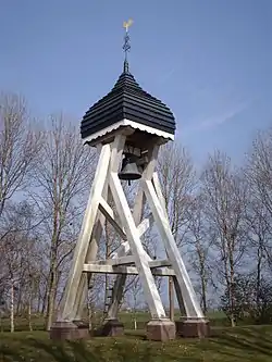 Teroele wooden bell tower | |
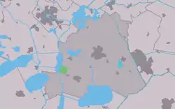 Location in the former Skarsterlân municipality | |
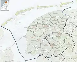 Teroele Location in the Netherlands  Teroele Teroele (Netherlands) | |
| Coordinates: 52°56′09″N 5°41′39″E | |
| Country | |
| Province | |
| Municipality | |
| Area | |
| • Total | 2.91 km2 (1.12 sq mi) |
| Elevation | 0.0 m (0.0 ft) |
| Population (2021)[1] | |
| • Total | 25 |
| • Density | 8.6/km2 (22/sq mi) |
| Postal code | 8524[1] |
| Dialing code | 0513 |
History
The village was first mentioned in 1482 as Olis, and means land on water.[4] The bell tower dates from 1723. The church was demolished in the 17th church. In 1840, it was home to 72 people.[5]
Before 2014, Teroele was part of the Skarsterlân municipality and before 1984 it was part of Doniawerstal.[5]
References
- "Kerncijfers wijken en buurten 2021". Central Bureau of Statistics. Retrieved 30 March 2022.
- "Postcodetool for 8524DK". Actueel Hoogtebestand Nederland (in Dutch). Het Waterschapshuis. Retrieved 29 March 2022.
- Kerncijfers wijken en buurten 2017 - CBS
- "Teroele - (geografische naam)". Etymologiebank (in Dutch). Retrieved 30 March 2022.
- "Teroele". Plaatsengids (in Dutch). Retrieved 30 March 2022.
External links
![]() Media related to Teroele at Wikimedia Commons
Media related to Teroele at Wikimedia Commons
This article is issued from Wikipedia. The text is licensed under Creative Commons - Attribution - Sharealike. Additional terms may apply for the media files.