Tinpatan Rural Municipality
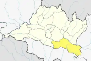
Tinpatan is a Rural municipality located within the Sindhuli District of the Bagmati Province of Nepal. The municipality spans 280.26 square kilometres (108.21 sq mi) of area, with a total population of 38,395 according to a 2011 Nepal census.[1][2]
Tinpatan (RM)
तीनपाटन गाउँपालिका | |
|---|---|
 Tinpatan (RM) Location 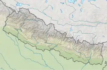 Tinpatan (RM) Tinpatan (RM) (Nepal) | |
| Coordinates: 27°06′31″N 86°09′39″E | |
| Country | |
| Province | Bagmati |
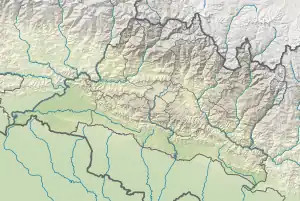
| District | Sindhuli District |
| Wards | 11 |
| Established | 10 March 2017 |
| Government | |
| • Type | Rural Council |
| • Chairperson | Mr. Karna B. Magar |
| • Vice-chairperson | Mrs. Padmaya Tamang |
| • Term of office | (2017 - 2022) |
| Area | |
| • Total | 280.26 km2 (108.21 sq mi) |
| Population (2011) | |
| • Total | 38,395 |
| • Density | 140/km2 (350/sq mi) |
| Time zone | UTC+5:45 (Nepal Standard Time) |
| Headquarter | Lampantar |
| Website | tinpatanmun |
On March 10, 2017, the Government of Nepal restructured the local level bodies into 753 new local level structures.[3][4] The previous Balajor, Jarayotar, Lampantar, Tribhuvan Ambote, Tosramkhola, Bahuntilpung, Bhimsthan and Belghari VDCs were merged to form Tinpatan Rural Municipality. Tinpatan is divided into 11 wards, with Lampantar declared the administrative center of the rural municipality.
Demographics
At the time of the 2011 Nepal census, Tinpatan Rural Municipality had a population of 36,420. Of these, 45.4% spoke Nepali, 32.6% Magar, 14.3% Tamang, 5.7% Newar, 0.8% Majhi, 0.5% Sunwar, 0.3% Maithili, 0.1% Bhojpuri, 0.1% Rai and 0.1% other languages as their first language.[5]
In terms of ethnicity/caste, 34.2% were Magar, 14.9% Tamang, 10.6% Chhetri, 10.1% Hill Brahmin, 9.3% Newar, 5.7% Sarki, 5.0% Kami, 4.4% Damai/Dholi, 1.5% Gharti/Bhujel, 1.1% Majhi, 0.8% Terai Brahmin, 0.7% Sunuwar, 0.7% Thakuri, 0.4% Sanyasi/Dasnami, 0.1% Hayu, 0.1% Rai, 0.1% Sonar and 0.2% others.[6]
In terms of religion, 73.4% were Hindu, 25.9% Buddhist, 0.4% Christian, 0.1% Kirati and 0.1% others.[7]
In terms of literacy, 65.0% could read and write, 2.8% could only read and 32.1% could neither read nor write.[8]
References
- "District Corrected Last for RAJAPATRA" (PDF). www.mofald.gov.np. Retrieved 17 July 2018.
- "स्थानीय तहहरुको विवरण" [Details of the local level bodies]. www.mofald.gov.np/en (in Nepali). Ministry of Federal Affairs and Local Development. Retrieved 17 July 2018.
- "New local level structure comes into effect from today". www.thehimalayantimes.com. The Himalayan Times. 10 March 2017. Retrieved 17 July 2018.
- "New local level units come into existence". www.kathmandupost.ekantipur.com. 11 March 2017. Retrieved 18 July 2018.
- NepalMap Language
- NepalMap Caste
- NepalMap Religion
- NepalMap Literacy
External links