West Karbi Anglong district
The West Karbi Anglong district is a district formed out of the existing Donka circle of Karbi Anglong district of Assam in 2016.[5] Hamren is the headquarter of the newly formed district.[5] The district is part of Karbi Anglong Autonomous Council and administered according to the provisions of Sixth Scheduled of the Indian Constitution.[5]
West Karbi Anglong district | |
|---|---|
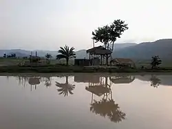 Hills in Baithalangso | |
.svg.png.webp) Location in Assam | |
| Coordinates (Hamren): 17.35°N 75.16°E - 18.32°N 76.15°E | |
| Country | |
| State | Assam |
| Division | Central Assam |
| Established | 15 August 2016 |
| Headquarters | Hamren |
| Government | |
| • Lok Sabha constituencies | Autonomous District (shared with Dima Hasao & Karbi Anglong district) |
| • Vidhan Sabha constituencies | Baithalangso |
| Area | |
| • Total | 3,035 km2 (1,172 sq mi) |
| Population (2011)[2] | |
| • Total | 295,358 |
| • Density | 97/km2 (250/sq mi) |
| Languages | |
| • Official | Assamese, Bodo, Bengali[3] English and Hindi[4] |
| • Regional | Karbi |
| Time zone | UTC+05:30 (IST) |
History
Early 1800s
Karbi Anglong was one of the site of Burmese invasion of Assam and was the part of the Konbaung dynasty of Burma from 1817 to 1826.[6]
Pre-independence
The hill tribes of Northeast India were independent of the settled kingdoms around them prior to the British colonisation of the region.[7] After the recommendation of Simon Commission, the hills area (Now present district, Karbi Anglong district, Dima Hasao district) was given a different status under Section 92 of the Government of India Act 1935: Mikir Hills was placed under the "Partially Excluded Areas". The Govt. of Assam, which means had no jurisdiction over the excluded areas which were administered directly under the special power of the Governor.[7]
During mid-1930s, political leaders such as Semsonsing Ingti, Seng Bey, Khorsing Terang, etc. emerged from this particular area. In 1937, these leaders, in a memorandum to Assam Governor, Sir Robert Neil Reid, at Mohungodijua, demanded a separate hill district for Mikirs. A regional political forum, called Karbi-A-Durbar, was formed to intensify the movement.
After Independence of India, the hill district was formed by the name of United Mikir & NC Hills on 17 November 1951 under Sixth Schedule of the Indian Constitution. Since then, the district has been constant part of Autonomous State demand movement.[8][9] The District was later divided into Karbi Anglong and North Cachar Hills district on 2 February 1970.[10]
In 2016, Karbi Anglong district was further divided into two, of which the west part (comprising Donka revenue circle), including Hamren, Baithalangso (Vothatlangso) and Dongkamukam and other adjoining areas formed the new district of West Karbi Anglong to develop the mass rural area. Hamren is the headquarters of the newly created district.[11][12]
Geography
Karbi Anglong plateau is an extension of the Indian Plate (The Peninsular Block) in the Assam of India. This area receives maximum rainfall from the Southwest summer Monsoon from June through September.[13] It is bounded by Golaghat in east, Meghalaya and Morigaon on west, Nagaon on North NC hills and Nagaland in the south. The district covers an area of 3035 km2.[14]
The eastern part of this region is plain and the western part is mostly covered with hills. The important rivers of this district are: The Myntriang River, Karbi Langpi River, Kopili river and Amreng river. Among these rivers, Hydro Electric Project have been set up on the Myntriang and Karbi Langpi rivers.[15][16]
Administration
The district is administrated under Karbi Anglong Autonomous Council. CEM is the Chief executive of the district, supported by 14 Executive Member of the Council.[17] The Principal Secretary (generally an officer selected from IAS/ACS cadre) of Karbi Anglong Autonomous Council is the administrative head of the district.[18] The Deputy Commissioner is responsible for the maintenance of law & order, and administration of justice.
Hamren is the district headquarter. The district has one sub-division, namely Hamren sub-division, and one Revenue circle, Dongkamukam.[19]
Police station
West Karbi Anglong district have three police station namely Hamren PS, Baithalangso PS, Kheroni PS and Zerikingding PS.
Demographics
According to the 2011 census, West Karbi Anglong district, then comprising the Donka revenue circle of the Karbi Anglong district, had a population of 295,358, of which 17,863 (6.05%) live in urban areas. Karbi Anglong has a sex ratio of 954 females per 1000 males. Indigenous communities such as Hills Tiwa, Karbis, Garos, Bodos form majority of the population, comprising 193,518 (65.52%) of the population. Scheduled Castes are 11,438 (3.87%) of the population.[2] Other communities that migrated to West Karbi Anglong district include Bengalis, Biharis and Nepalis during the British rule.
Religion
Hinduism is the largest community making up 2,34,833 (79.51%) of the population, while Christians are 56,538 (19.14%). Much of the population practices traditional tribal religion but records their religion as Hindu on the census.[20]
Transport
The district headquarter Hamren is well connected by road. Karbi Anglong Autonomous Council Transport buses ply at regular intervals from the district headquarters to important places like Guwahati, Nagaon, Diphu, Lanka, Hojai and Jowai.
Notable town and place of interest
Notable people
See also
Notes
- "West Karbi Anglong District | Hill Areas | Government Of Assam, India". had.assam.gov.in. Retrieved 15 September 2019.
- "District Census Handbook: West Karbi Anglong" (PDF). censusindia.gov.in. Registrar General and Census Commissioner of India. 2011.
- "52nd Report of the Commissioner for Linguistic Minorities in India" (PDF). nclm.nic.in. Ministry of Minority Affairs. Archived from the original (PDF) on 25 May 2017. Retrieved 27 August 2019.
- http://www.neportal.org/northeastfiles/Assam/ActsOrdinances/Assam_Official_Language_Act_1968.asp
- "District Profile of West Karbi Anglong - West Karbi Anglong District - Government Of Assam, India". westkarbianglong.assam.gov.in. Retrieved 19 March 2022.
- (Nag 2018:13–14)
- Hussain, Monirul (1987). "Tribal Movement for Autonomous State in Assam". Economic and Political Weekly. 22 (32): 1329–1332. ISSN 0012-9976. JSTOR 4377333.
- Menon (15 September 1987). "Karbi tribals demand autonomous state within Assam". India Today. Retrieved 15 September 2019.
- Madhukalya, Amrita (29 July 2018). "Karbi Anglong- Dima Hasao bodies want autonomous state in Assam". DNA India. Retrieved 15 September 2019.
- Law, Gwillim (25 September 2011). "Districts of India". Statoids. Retrieved 11 October 2011.
- "Assam get new districts". Retrieved 27 December 2019.
- "West Karbi Anglong district inaugurated" Archived 3 April 2016 at the Wayback Machine, The Assam Tribune, 11 February 2016
- Vasudevan, Hari; et al. (2006). "Structure and Physiography". India:Physical Environment. New Delhi: NCERT. p. 17. ISBN 81-7450-538-5.
- Bordoloi, Kongkon (2020). "A Review on Drinking Water Quality of West Karbi Anglong District of Assam, India" (PDF). International Journal of Advances in Engineering and Management (IJAEM). 2 (5): 81–82.
- "Running Projects of APGCL | Power | Government Of Assam, India". power.assam.gov.in. Retrieved 15 September 2019.
- "Karbi Langpi Hydroelectric Power Project India - GEO". globalenergyobservatory.org. Retrieved 15 September 2019.
- "KAAC | Legislative & Executive Structure". www.karbianglong.co.in. Retrieved 15 September 2019.
- "KAAC | Administrative Structure". www.karbianglong.co.in. Retrieved 15 September 2019.
- Hasnu, Sunil Kumar. "Official Website of Karbi Anglong Autonomous Council". karbianglong.co.in. Retrieved 15 September 2019.
- "Table C-01 Population By Religion: Assam". census.gov.in. Registrar General and Census Commissioner of India. 2011.
- "Table C-16 Population By Mother Tongue: Assam". censusindia.gov.in. Registrar General and Census Commissioner of India. 2011.
References
- Nag, Sajal (2018). "Devour thy Neighbour: Foreign Invasions and the Decline of States in Eighteenth Century North East India".
{{cite journal}}: Cite journal requires|journal=(help)
External links
Places adjacent to West Karbi Anglong district | ||||||||||||||||
|---|---|---|---|---|---|---|---|---|---|---|---|---|---|---|---|---|
| ||||||||||||||||
| Proposed states |
|  |
|---|---|---|
| Proposed union territories |
| |