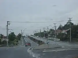
West Tamar Highway
The West Tamar Highway is a highway in Tasmania, Australia. It covers the western edge of the Tamar River, from Launceston to the beach town of Greens Beach.
West Tamar Highway | |
|---|---|
 | |
| General information | |
| Type | Highway |
| Length | 65.2 km (41 mi) |
| Route number(s) | Launceston — Greens Beach |
| Former route number | |
| Major junctions | |
| South end | Launceston, Tasmania |
| |
| North end | Greens Beach Road Gardners Road Greens Beach, Tasmania |
| Location(s) | |
| Major settlements | Riverside, Legana, Exeter, Beaconsfield, Kelso |
| Highway system | |
It is labelled as state route A7.
Major intersections
Four shielded routes terminate at the intersections of streets in the Launceston CBD. Because all the involved streets are one-way each route has separate inbound and outbound termini.[2] One of these routes is the West Tamar Highway. Distances from each terminus to a point on the route may not be identical. Those shown below are from the outbound terminus.
| LGA | Location | km[3] | mi | Destinations | Notes |
|---|---|---|---|---|---|
| Launceston | Launceston | 0 | 0.0 | Southern end of West Tamar Highway. Road proceeds south-west as York Street. | |
| South Esk River | 0.7– 0.8 | 0.43– 0.50 | The Paterson Bridge[4] | ||
| West Tamar | Riverside | 5.6 | 3.5 | Windsor Drive - north-east - Windsor Park Sports Complex | |
| Legana | 11.3 | 7.0 | |||
| 12.0– 12.1 | 7.5– 7.5 | Freshwater Point Road - north-east - Legana | |||
| 13.5 | 8.4 | ||||
| Lanena | 21.7 | 13.5 | |||
| Lanena, Blackwall, Exeter tripoint | 22.5 | 14.0 | |||
| Exeter | 23.8 | 14.8 | |||
| 23.9 | 14.9 | ||||
| Loira | 29.9 | 18.6 | |||
| Sidmouth | 33.1 | 20.6 | |||
| 34.8 | 21.6 | ||||
| Beaconsfield Flowery Gully midpoint | 38.5 | 23.9 | |||
| Beaconsfield | 41.4 | 25.7 | |||
| 42.0 | 26.1 | ||||
| 52.1 | 32.4 | West Tamar Highway turns from south-west (out of Beauty Point) to north-west (towards Greens Beach) | |||
| York Town | 54.4 | 33.8 | |||
| Badger Head, Clarence Point midpoint | 55.3 | 34.4 | |||
| 55.4 | 34.4 | ||||
| Greens Beach | 65.1 | 40.5 | End of highway - road continues as Greens Beach Road | Northern end of West Tamar Highway | |
| 1.000 mi = 1.609 km; 1.000 km = 0.621 mi | |||||
See also
References
- Former State Route Numbering System in Tasmania, Ozroads: the Australian Roads Website.
- Google (30 October 2018). "Launceston CBD" (Map). Google Maps. Google. Retrieved 30 October 2018.
- Google (1 November 2018). "West Tamar Highway" (Map). Google Maps. Google. Retrieved 1 November 2018.
- "The Paterson Bridge". Stable Tasmanian Online Repository System (STORS). Libraries Tasmania. 2 November 1973. Retrieved 1 November 2018.
This article is issued from Wikipedia. The text is licensed under Creative Commons - Attribution - Sharealike. Additional terms may apply for the media files.