Xammes
Xammes is a commune in the Meurthe-et-Moselle department in north-eastern France.
Xammes | |
|---|---|
 The Saint-Clément church in Xammes | |
.svg.png.webp) Coat of arms | |
Location of Xammes | |
 Xammes 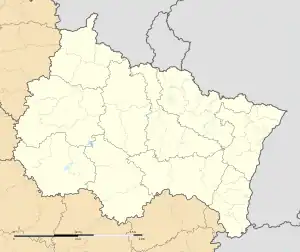 Xammes | |
| Coordinates: 48°58′32″N 5°51′19″E | |
| Country | France |
| Region | Grand Est |
| Department | Meurthe-et-Moselle |
| Arrondissement | Toul |
| Canton | Le Nord-Toulois |
| Intercommunality | Mad et Moselle |
| Government | |
| • Mayor (2020–2026) | Dominique Leroy[1] |
| Area 1 | 8.16 km2 (3.15 sq mi) |
| Population | 166 |
| • Density | 20/km2 (53/sq mi) |
| Time zone | UTC+01:00 (CET) |
| • Summer (DST) | UTC+02:00 (CEST) |
| INSEE/Postal code | 54594 /54470 |
| Elevation | 208–280 m (682–919 ft) (avg. 250 m or 820 ft) |
| 1 French Land Register data, which excludes lakes, ponds, glaciers > 1 km2 (0.386 sq mi or 247 acres) and river estuaries. | |
History
It may have been the village Scannis mentioned in charters since 776. The church of Saint-Clément dates back to the 12th century.[3]
Population
| Year | Pop. | ±% p.a. |
|---|---|---|
| 1968 | 131 | — |
| 1975 | 102 | −3.51% |
| 1982 | 105 | +0.41% |
| 1990 | 122 | +1.89% |
| 1999 | 121 | −0.09% |
| 2007 | 125 | +0.41% |
| 2012 | 129 | +0.63% |
| 2017 | 153 | +3.47% |
| Source: INSEE[4] | ||
References
- "Répertoire national des élus: les maires". data.gouv.fr, Plateforme ouverte des données publiques françaises (in French). 2 December 2020.
- "Populations légales 2020". The National Institute of Statistics and Economic Studies. 29 December 2022.
- Mémoires de la Société d'archéologie lorraine (in French). 1871. p. 360.
- Population en historique depuis 1968, INSEE
Wikimedia Commons has media related to Xammes.
This article is issued from Wikipedia. The text is licensed under Creative Commons - Attribution - Sharealike. Additional terms may apply for the media files.