Yaak, Montana
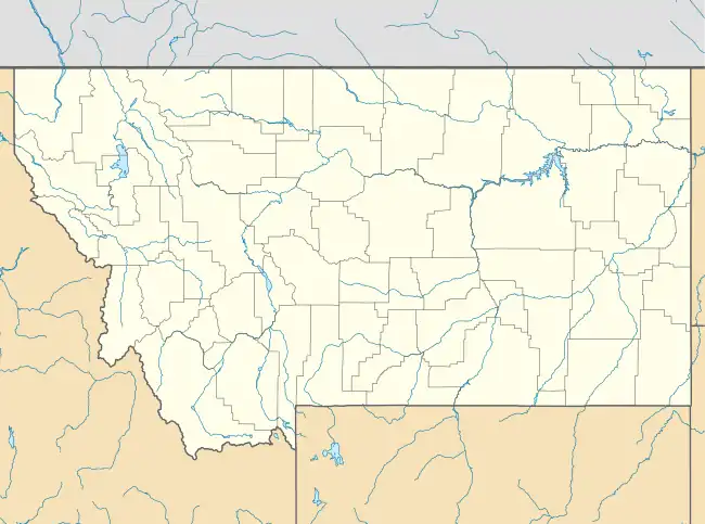
Yaak is an unincorporated community and census-designated place in Lincoln County, Montana,[2] United States. It is located along the Yaak River, within the Kootenai National Forest. As of the 2020 census, its population was 338.
Yaak, Montana | |
|---|---|
 Yaak  Yaak | |
| Coordinates: 48°49′59″N 115°42′32″W | |
| Country | United States |
| State | Montana |
| County | Lincoln |
| Area | |
| • Total | 28.12 sq mi (72.83 km2) |
| • Land | 27.85 sq mi (72.12 km2) |
| • Water | 0.28 sq mi (0.71 km2) |
| Elevation | 2,986 ft (910 m) |
| Population (2020) | |
| • Total | 338 |
| • Density | 12.14/sq mi (4.69/km2) |
| Time zone | UTC-7 (Mountain (MST)) |
| • Summer (DST) | UTC-6 (MDT) |
| Area code | 406 |
| GNIS feature ID | 778715[2] |
| FIPS code | 30-82130 |
Yaak has frequently been noted on lists of unusual place names.[3]
Yaak derives its name from the Yaak River.[4] According to local lore, A’ak is a Kootenai name meaning “Arrow.” The Kootenai River forms the shape of a drawn bow; its tributary the Yaak River is its arrow. Homesteaders arrived shortly after the passage of the Forest Homestead Act of 1906.
Climate
This climatic region is typified by large seasonal temperature differences, with warm to hot (and often humid) summers and cold (sometimes severely cold) winters. According to the Köppen Climate Classification system, Yaak has a humid continental climate, abbreviated "Dfb" on climate maps.[6]
| Climate data for Yaak, Montana, 1991–2020 normals: 3085ft (940m) | |||||||||||||
|---|---|---|---|---|---|---|---|---|---|---|---|---|---|
| Month | Jan | Feb | Mar | Apr | May | Jun | Jul | Aug | Sep | Oct | Nov | Dec | Year |
| Average high °F (°C) | 29.3 (−1.5) |
35.8 (2.1) |
44.4 (6.9) |
54.4 (12.4) |
64.9 (18.3) |
71.1 (21.7) |
80.9 (27.2) |
81.1 (27.3) |
69.8 (21.0) |
52.6 (11.4) |
35.7 (2.1) |
26.5 (−3.1) |
53.9 (12.2) |
| Daily mean °F (°C) | 21.7 (−5.7) |
25.0 (−3.9) |
33.2 (0.7) |
40.7 (4.8) |
50.0 (10.0) |
56.0 (13.3) |
62.1 (16.7) |
61.6 (16.4) |
52.6 (11.4) |
40.2 (4.6) |
28.6 (−1.9) |
20.7 (−6.3) |
41.0 (5.0) |
| Average low °F (°C) | 14.0 (−10.0) |
14.1 (−9.9) |
21.9 (−5.6) |
27.0 (−2.8) |
35.0 (1.7) |
40.9 (4.9) |
43.4 (6.3) |
42.0 (5.6) |
35.4 (1.9) |
27.8 (−2.3) |
21.5 (−5.8) |
14.8 (−9.6) |
28.2 (−2.1) |
| Average precipitation inches (mm) | 2.27 (58) |
1.73 (44) |
2.27 (58) |
1.23 (31) |
2.18 (55) |
2.54 (65) |
1.17 (30) |
0.93 (24) |
1.31 (33) |
1.70 (43) |
2.75 (70) |
2.69 (68) |
22.77 (579) |
| Source: NOAA[7] | |||||||||||||
References
- "ArcGIS REST Services Directory". United States Census Bureau. Retrieved September 5, 2022.
- U.S. Geological Survey Geographic Names Information System: Yaak
- Parker, Quentin (2010). Welcome to Horneytown, North Carolina, Population: 15: An insider's guide to 201 of the world's weirdest and wildest places. Adams Media. pp. xii. ISBN 9781440507397.
- "Yaak". Montana Place Names Companion. Montana Historical Society. Retrieved April 11, 2021.
- "Census of Population and Housing". Census.gov. Retrieved June 4, 2016.
- Climate Summary for Yaak, Montana
- "Yaak 9NME, Montana 1991-2020 Monthly Normals". Retrieved August 14, 2023.
External links
Municipalities and communities of Lincoln County, Montana, United States | ||
|---|---|---|
| Cities | 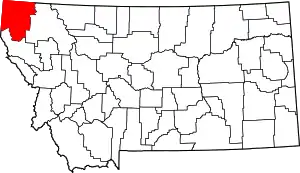 Lincoln County map | |
| Towns | ||
| CDPs | ||
| Other communities | ||