Canal Intracostero del Atlántico
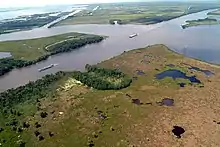
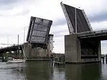
El Canal Intracostero del Atlántico (en inglés: Intracoastal Waterway) es una ruta de navegación de los EE. UU., de más de 4.800 km, que va desde el océano Atlántico hasta el golfo de México.


Su construcción fue autorizada por el Congreso de los Estados Unidos en el año 1919, para facilitar una ruta resguardada a las embarcaciones comerciales y los botes de recreo, siendo construido por el Cuerpo de Ingenieros del Ejército. Fue planeado originalmente para formar un canal ininterrumpido desde Nueva York hasta Brownsville, en Texas.
Nunca fue terminado a causa del entronque que se encuentra en la península de Florida, quedando separado en dos secciones. El tramo del Atlántico consiste de ríos, bahías y acueductos que van desde la península de Cabo Cod hasta la bahía de Florida, incluyendo el canal de Cabo Cod y el canal C&D.
Cuerpos de agua naturales
El Canal Intracostero del Atlántico atraviesa los siguientes cuerpos naturales de agua:
- bahía Apalachicola
- bahía de Barnegat
- Charleston Harbor
- Charlotte Harbor
- bahía de Corpus Christi
- bahía de Galveston
- Laguna Madre
- río Misisipí
- Mississippi Sound
- bahía Mobile
- Mosquito Lagoon
- bahía de Pensacola
- bahía de Perdido
- Indian River Lagoon
- Pine Island Sound
- Port Royal Sound
- Santa Rosa Sound
- bahía Sarasota
- Saint Helena Sound
- bahía de Tampa
| Golfo de Maine | |
| Bahía de Casco | |
| Bahía de Penobscot | |
| Río Piscataqua (Su desembocadura forma el puerto de Portsmouth.) | |
| Río Annisquam | |
| Bahía de Massachusetts | |
| Bahía de Cabo Cod | |
| Canal de Cape Cod | |
| bahía de Buzzards | |
| Rhode Island Sound | |
| Block Island Sound | |
| Long Island Sound | |
| Long Island Sound | |
| Río East | |
| El Sistema de Canales de Nueva York forma parte del Canal Intracostero del Atlántico[1] | |
| Río Manasquan | |
| Point Pleasant Canal | |
| Barnegat Bay | |
| Manahawkin Bay | |
| Little Egg Harbor | |
| Great Bay | |
| Little Bay | |
| Reed's Bay | |
| Clam Thorofare | |
| Inside Thorofare | |
| West Canal | |
| Lake's Bay | |
| Risley Channel | |
| Great Egg Harbor | |
| Ludlam Bay | |
| Ludlam Thoroughfare | |
| Townsend Channel | |
| Ingrams Thorofare | |
| Great Sound | |
| Great Channel | |
| Grassy Sound | |
| Jarvis Sound | |
| Cape May Canal | |
| bahía de Delaware | |
| Chesapeake and Delaware Canal | |
| Chesapeake and Delaware Canal | |
| Bahía de Chesapeake | |
| Río James | |
| Hampton Roads | |
| Río Elizabeth | |
| South Branch Elizabeth River | |
| Canal artificial | |
| Río North Landing | |
| Río North Landing | |
| Currituck Sound | |
| Canal artificial | |
| Great Swamp | |
| Río North | |
| Albemarle Sound | |
| Río Alligator | |
| Canal artificial | |
| Río Pungo | |
| Río Pamlico | |
| Arroyo Goose | |
| Canal artificial | |
| Pamlico Sound | |
| Río Neuse | |
| Arroyo Adams | |
| Canal artificial | |
| Río Newport | |
| Bogue Sound | |
| Río White Oak | |
| Río New | |
| Stump Sound | |
| Topsail Sound | |
| Middle Sound | |
| Masonboro Sound | |
| Canal artificial | |
| Río Cape Fear | |
| Canal artificial | |
| Río Lockwoods Folly | |
| Canal artificial | |
| Río Shallotte | |
| Canal artificial | |
| Little River | |
| Pine Island Cut (canal artificial de aproximadamente 38,6 kilómetros de longitud).[5] El Pine Island Cut es la sección artificial más larga de todo el canal. Fue la última sección del canal en terminarse y se abrió al uso el 11 de abril de 1936.[6] | |
| Arroyo Socastee | |
| Río Waccamaw | |
| Bahía de Winyah | |
| Estherville Minim Creek Canal | |
| North Santee River | |
| Fourmile Creek Canal (cruza el Río Santee) | |
| Arroyo Casino | |
| Mathews Cut | |
| Río Harbor | |
| Arroyo Awendaw | |
| Arroyo Graham | |
| Canal artificial | |
| Seewee Bay | |
| Arroyo Price | |
| Arroyo Capers | |
| Copahee Sound | |
| Seven Reaches | |
| Meeting Reach | |
| Sullivans Narrows | |
| Arroyo Jeanette | |
| Charleston Harbor | |
| Arroyo Wappoo | |
| Elliott Cut | |
| Río Stono | |
| Church Flats | |
| Río Wadmalaw | |
| Río Dawhoo | |
| Arroyo North | |
| Watts Cut | |
| Río Edisto Sur | |
| Fenwick Cut | |
| Río Ashepoo | |
| Ashepoo Coosaw Cutoff | |
| Arroyo Rock | |
| Ashepoo Coosaw Cutoff | |
| Río Coosaw | |
| Arroyo Brickyard | |
| Río Beaufort | |
| Port Royal Sound | |
| Arroyo Skull | |
| Calibogue Sound | |
| Río Cooper (Condado de Beaufort) | |
| Arroyo Ramshorn | |
| Río New | |
| Watts Cut | |
| Río Wright | |
| Fields Cut | |
| Río Savannah | |
| Río Savannah | |
| South Channel Río Savannah - USGS Feature Detail Report | |
| Elba Island Cut - USGS Feature Detail Report | |
| Arroyo Saint Augustine - USGS Feature Detail Report | |
| Río Wilmington - USGS Feature Detail Report | |
| Río Skidaway - USGS Feature Detail Report | |
| Skidaway Narrows - USGS Feature Detail Report | |
| Río Moon | |
| Río Vernon - USGS Feature Detail Report | |
| Green Island Sound - USGS Feature Detail Report | |
| Ossabaw Sound - USGS Feature Detail Report | |
| Hell Gate - USGS Feature Detail Report | |
| Río Ogeechee | |
| Florida Passage - USGS Feature Detail Report | |
| Río Bear | |
| Saint Catherines Sound - USGS Feature Detail Report | |
| Río North Newport - USGS Feature Detail Report | |
| Arroyo Johnson | |
| Río South Newport - USGS Feature Detail Report | |
| Sapelo Sound - USGS Feature Detail Report | |
| Río Sapelo - USGS Feature Detail Report | |
| Río Front - USGS Feature Detail Report | |
| Creighton Narrows - USGS Feature Detail Report | |
| Río Crescent - USGS Feature Detail Report | |
| Arroyo Old Teakettle - USGS Feature Detail Report | |
| Doboy Sound - USGS Feature Detail Report | |
| Río North - USGS Feature Detail Report | |
| Río Back - USGS Feature Detail Report | |
| Río Little Mud - USGS Feature Detail Report | |
| Altamaha Sound - USGS Feature Detail Report | |
| Buttermilk Sound - USGS Feature Detail Report | |
| Río Mackay - USGS Feature Detail Report | |
| Manhead Sound - USGS Feature Detail Report | |
| Saint Simons Sound - USGS Feature Detail Report | |
| Río Brunswick- USGS Feature Detail Report | |
| Arroyo Jekyll (Jekyll River) - USGS Feature Detail Report | |
| Jekyll Sound - USGS Feature Detail Report | |
| St. Andrews Sound - USGS Feature Detail Report | |
| Río Cumberland - USGS Feature Detail Report | |
| Cumberland Dividings - USGS Feature Detail Report | |
| Cumberland Sound - USGS Feature Detail Report | |
| Cumberland Sound (frontera estatal entre Florida y Georgia) | |
| Río Amelia | |
| Arroyo Kingsley | |
| Canal artificial | |
| Río South Amelia | |
| Canal artificial | |
| Arroyo Sawpit | |
| Gunnison Cut (artificial) | |
| Arroyo Sisters | |
| Arroyo Pablo | |
| Canal artificial | |
| Río Tolomato | |
| Canal artificial | |
| Río Tolomato | |
| Río Matanzas | |
| Canal artificial | |
| Fox Cut (artificial) | |
| Canal artificial | |
| Arroyo Smith | |
| Arroyo Halifax | |
| Río Halifax | |
| Ponce de Leon Cut (artificial) | |
| Mosquito Lagoon | |
| Río Indian | |
| Haulover Canal (artificial) | |
| Río Indian | |
| Great Pocket | |
| Canal artificial | |
| Peck Lake | |
| Jupiter Narrows | |
| Hobe Sound | |
| Jupiter Sound | |
| Río Loxahatchee | |
| Arroyo Lake Worth | |
| Lago Worth | |
| Canal artificial | |
| Lake Rogers | |
| Lake Wyman | |
| Canal artificial? | |
| Lake Boca Raton | |
| Canal artificial (Hillsboro Canal parte del Río Hillsboro) | |
| Río Hillsboro | |
| Canal artificial | |
| Río Middle | |
| New River Sound | |
| Río New | |
| Río Stranahan | |
| Canal artificial | |
| Dumfoundling Bay | |
| Arroyo Biscayne | |
| Biscayne Bay | |
| Card Sound | |
| Little Card Sound | |
| Barnes Sound | |
| Arroyo Jewfish | |
| Blackwater Sound | |
| Arroyo Dusenberg | |
| Tarpon Basin | |
| Arroyo Grouper | |
| Buttonwood Sound | |
| Baker Cut (artificial) | |
| Bahía de Florida |
Canales
Principales canales de transporte
- canal Chesapeake y Delaware
Otros canales
- canal Chesapeake and Albemarle
- canal Dismal Swamp
- canal Cape May
- canal Delaware and Raritan (Ya no está operativo ni forma parte del Canal Intracostero del Atlántico.)
- Okeechobee Waterway
- canal Point Pleasant
- canal Lewes and Rehoboth
Véase también
- Canal Intracostero del Golfo
Notas
- https://web.archive.org/web/20071025040538/http://www.nyscanals.gov/exvac/landwater/index.html, cuarto párrafo. Consultado el 8 de noviembre de 2007.
- En Carolina del Sur, el canal está formado por numerosos canales naturales y artificiales que pasan entre las islas marinas.National Oceanic and Atmospheric Administration, Office of Coast Survey. Intracoastal Waterway: Beaufort River to St. Simons Sound [mapa], 1 : 40.000, Nautical Charts. (2009) 11507. Consultado el 8 de febrero de 2009.
- National Oceanic and Atmospheric Administration, Office of Coast Survey. Intracoastal Waterway: Casino Creek to Beaufort River [mapa], 1:40.000, Nautical Charts. (2009) 11518. Consultado el 8 de febrero de 2009.
- National Oceanic and Atmospheric Administration, Office of Coast Survey. Intracoastal Waterway: Myrtle Grove Sound and Cape Fear River to Casino Creek [mapa], 1:40.000, Nautical Charts. (2009) 11534. Consultado el 8 de febrero de 2009.
- Intracoastal Waterway on HorryCounty.org
- Lewis, Catherine Heniford (1998). Horry County, South Carolina, 1730-1993 (Google books). Columbia, South Carolina: University of South Carolina Press. pp. xxiii, 192. ISBN 9781570032073. Consultado el 8 de febrero de 2009.
Enlaces externos
 Wikimedia Commons alberga una categoría multimedia sobre Canal Intracostero del Atlántico.
- US Army Corps of Engineers – Atlantic Intracoastal Waterway information site
- History of the Gulf Intracoastal Waterway
- Atlantic Intracoastal Waterway Association
- Gulf Intracoastal Canal Association
- Elizabeth City Area Convention & Visitors Bureau
- Gulf Intracoastal Waterway at Handbook of Texas
- US Army Corps of Engineers – History of the Waterways of the Atlantic Coast of the United States
- TV.com listing for Modern Marvels episode Archivado el 4 de febrero de 2010 en Wayback Machine.
- Intracoastal Waterway, Encyclopædia Britannica
- Esta obra contiene una traducción derivada de «[[:en:|]]» de Wikipedia en inglés, publicada por sus editores bajo la Licencia de documentación libre de GNU y la Licencia Creative Commons Atribución-CompartirIgual 4.0 Internacional.