wikiHow is a “wiki,” similar to Wikipedia, which means that many of our articles are co-written by multiple authors. To create this article, volunteer authors worked to edit and improve it over time.
There are 22 references cited in this article, which can be found at the bottom of the page.
This article has been viewed 6,642 times.
Learn more...
With more than 1,908 miles of driveable distance, I-95 is a popular highway that many motorists travel on.[1] . Whether you are traveling a short distance only a few exits away or going on a long-distance trip, I-95 will be your friend. If you want to experience more of what it has to offer, this article can give you a taste of what you can expect to experience on a journey on this interstate.
Steps
Preparing to Travel
-
1Learn the general path of Interstate 95. Interstate 95 is the longest north-south interstate traveling through the largest number of states. It travels between Houlton, Maine (at it's Border Control Plant) and Miami, Florida (just north of Key Largo).[2] It travels over several tolled and untolled bridges and changes names many times.
-
2Learn the oddball travel routes around and through major cities. I-95 doesn't take you through Boston, and Washington, DC (as you'll see soon in this article). It also travels just east of Philadelphia's Historic District.Advertisement
-
3Look at the rash of cities that I-95 will completely avoid. These examples include Cape Cod, Virginia Beach-Williamsburg, Myrtle Beach, Hilton Head, Charleston (SC), Orlando, Tampa. If you also don't factor in its extender route US-1, it also doesn't pass through Key Largo and Key West.


Traveling the Northeast
-
1Travel along with the seaside towns of Maine. I-95's closest city to the starting point (where it attaches to New Brunswick, Canada) is Houlton, ME, and you can begin there at exit 63. Houlton is a small town but has its own exit about a mile in from the border because of its border patrol station just inside the United States. As you work your way down I-95 in Maine, I-95 is a toll route called the Maine Turnpike. You'll pass the bigger coastline cities of Bangor, Augusta (Maine's capital), and Portland. These are all great fishing cities containing several famous lighthouses near the Atlantic Ocean. On your route down, you'll pass over the Penobscot River (near Medway), Piscataqua River (near Howland), Kennebec River (near Benton Station), Androscoggin River (near Auburn), Saco River (near Biddeford), York River (near York) and many small lakes and streams.
-
2Come across the Piscataqua River Bridge. This bridge bridges yourself from Maine to New Hampshire, and is the first major bridge on I-95 from the north.
-
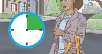
3Climb and descend the mountains in New Hampshire. As you make your way into New Hampshire on the tolled Blue Star Turnpike, you'll quickly pass several exits for Portsmouth - including its seaport. However, your trip through won't take all that long - and you should be able to time it at just about a half-hour of travel time - based on traffic.
-
4Travel into Massachusetts. As you come in, you'll travel across the toll-free John Greenleaf Whittier Bridge over the Merrimack River on I-95[3] , then wrap into Boston's outer boroughs, where it comes into Boston's northwestern end, and start running on a southwest curve. I-95 will bring you close to Peabody-Danvers, then begin to curve southeast, curve a second time and reroute back southwest again - becoming the Yankee Division Highway - passing Hanscom Air Force Base, Waltham, Newton, and Dedham. By the time you get to the edge of the Blue Hills Reservation, you'll have to follow signage as it curves into an exit and splits, forming a confusing interchange wrapping I-93 and US-1 into the interchange heading in the former direction. It loses the highway name and brings you south - passing around Foxborough and Attleboro.
- The Merrimack River is the only river you'll cross in this state that is of any value to anyone. Many smaller streams exist in this state, but nothing worthy to mention in this article.
-
5Enter into Rhode Island. Exits come quickly, as they pass around the coastal cities of Pawtucket, Providence (Rhode Island's capital), and Warwick - over such rivers as the Seekonk, Woonasquatucket Pawtuxet Rivers over non-tolled bridges.
- On a good day, you could expect about a twenty to thirty-minute ride to go from the northeast side of the state to the southwest side at its exit point.
-
6Travel through Connecticut's oceanside towns. Expect to pass the Mystic Seaport and Mystic Aquarium, then onto New London, Westbrook, Old Lyme, and New Haven. Then into Connecticut's drooping panhandle across the Quinnipiac River and through several big fishing and seaside industrial coastal cities, including Milford, Stratford, Bridgeport, Fairfield, Norwalk, Stamford, and Greenwich. As soon as you cross into Connecticut, your highway will begin as the Jewish War Veterans Memorial Highway until you reach Lyme. I-395 intersects back up with I-95 and then becomes the Governor John Davis Lodge/Connecticut Turnpike.
- On your way through Connecticut, you'll pass over the Mystic River (near Mystic, CT), Groton Reservoir and Thames River (near Groton, CT), Connecticut River (near Lyme, CT), Indian Lake, East River, Lake Saltonstall, Quinnipiac River, West River, Housatonic River (over the untolled Moses-Wheeler Bridge), and two connection points to Long Island Sound, over the Southport River (and Harbor), Saugatuck River, Norwalk River, Cos Cob Harbor and River, Indian Harbor and Byram River all in an attempt to get into New York State!
- Travels in this state could vary wildly in timing due to traffic.


Traveling the Mid-Atlantic
-
1Drive in New York. Although there is a culture shift from the more "quick paced" exits of Westchester County's towns, it'll bring you south into the Bronx and into Manhattan. I-95 in New York is mostly untolled, though there is a spot where there is a toll area heading north.
- Pass through exits devoted to Port Chester, Rye, Harrison and New Rochelle - all in Westchester County, as you make your way down the New England Thruway (owned by the New York State Thruway Authority').
- Be very careful of exits 6A and 6B - as it's a confusing interchange. It'll intersect both I-278 and I-678 then appears to head on a more northwest run after heading due south with a new name as the Cross Bronx Expressway For those traveling northbound between exits 9 and 10[4] , it has one cashless toll in New Rochelle that costs $1.75.[5] But as it crosses over Westchester Creek, it'll pass into the Bronx where it will become the Cross Bronx and Bruckner Expressways.[6]
- Follow the Cross Bronx and Bruckner Expressways past where they encounter the toll-free Alexander Hamilton Bridge over the Harlem River.
- I-95 will become the Trans-Manhattan Expressway as it wanders around Manhattan - dodging in and out of tunnels in two levels - starting just after the Hamilton Bridge, which according to Google Maps, begins near the Hamilton Bridge Skate Park.[7]
- US-9 joins at two spots within the route (including at exit 1A) and leads you to the George Washington Bridge into New Jersey.
- Pass through exits devoted to Port Chester, Rye, Harrison and New Rochelle - all in Westchester County, as you make your way down the New England Thruway (owned by the New York State Thruway Authority').
-
2Travel across the George Washington Bridge. This bridge connects the Washington Heights section of Manhattan Island(NY) to Fort Lee, NJ. There are no tolls heading southbound, but going north is not toll-less and is quite a sticker-shocker to most who aren't expecting it. Its toll begins at about $16 (for 2-axle cars and minivans) and increases for add-ons from there.[8] It carries seven lanes of traffic going each direction, as well as a lower level carrying seven more express lanes of traffic between New York and New Jersey. Major tie-ups are possible here. [9]
- The George Washington Bridge is also the world's busiest automobile bridge.[10]
- If you have an E-ZPass box registered to a New York-given address, you'll see some discounts applied on your ride.[11] If you don't, you'll be paying for the full cost.
- Other bridges can lead you across the Hudson River, but they aren't associated with I-95 and are located at different access points.
-
3Ride the New Jersey Turnpike from Exit 18W to Exit 6. The tolled New Jersey Turnpike is mapped as I-95 at first. As you cross into New Jersey and you'll immediately see the skyscraper towns of Fort Lee, Newark, Teaneck (the beginning of I-80), and Hoboken, then pass through more skyscraper towns and travel through Edison, Harrison, and a few others, as it makes its way down to Exit 6 where it's essentially the heart of Central New Jersey.
- Take exit 6 towards the Pennsylvania Turnpike, as exit 6 is the only official turn-off that continues your path on I-95, passing through the city of Trenton (New Jersey's capital).
- Exit 6 is about halfway through the state and spurs I-95 off from NJT about mid-way north through the state - towards and through Trenton - if people read maps.
-
4Cross the Delaware River-Turnpike Toll Bridge. Although it's got cashless tolling on the Pennsylvania side[12] , the toll is rather cheap in Pennsylvania for an adequately-maintained bridge. Just don't confuse it for the Delaware Memorial Bridge to its south, leading you across this same river, but it will still add as an alternative route to I-95.
-
5Watch for the split just to the north of I-95, and the Pennsylvania Turnpike split. While I-76 combines with I-95 at the border with I-76, you quickly get split and get sent south back onto I-95 south. Watch for and follow signs "towards Philadelphia" following the I-95 designator on the same sign. (One mess-up, and you'll be on the tolled Pennsylvania Turnpike heading west with the next exit a bit far away.) Follow past the first exit, then turn onto I-95 at the following exit where the highways split.
-
6Ride through the southeastern edge of Pennsylvania. During your drive in Pennsylvania - on the Delaware Expressway (I-95's name in Pennsylvania), you'll pass by several interesting intersections and pass several landmarks. Big landmarks include the Chris Columbus Blvd exit (passing to the south of the Historic District), then the sports stadiums (Citizen's Bank Park, Lincoln Financial Field, and Wachovia Arena), then past Philadelphia International Airport (off in the distance). You'll spot the Benjamin Franklin Bridge (I-676) and Commodore Barry Bridge (US-332/PA-291) on your route.
- Depending on traffic, this may take about 45-60 minutes to complete end-to-end.
-
7Travel through New Castle County in Delaware. Right away, you'll reach your first exit at milepost 23.43 (with the next at 23.10mi).[13] , but it isn't until after I-95 splits with a belt around Wilmington to it's east that I-95 gains the name Wilmington Expressway, and doesn't stop until I-95 and I-495 meet up with I-295 later when it becomes the Delaware Turnpike. You pay a toll for the entire route, passing by the Christina River and Christiana city in the process.
- Travel time on I-95 in Delaware depends on traffic, and although seasonal variations exist, this route could be done in about 30-45 minutes.
-
8Travel through Maryland on I-95 - called the JFK Memorial Highway and is tolled. Your main objective here is to get through this state up to the Capital Beltway around Washington.
- Get down and across the Susquehanna River via the tolled Millard E Tydings Memorial Bridge - bridging the gap between Aiken-Arrowhead Acres and (the French) Havre De Grace, Maryland. However, it's toll is collected if you are traveling north on this bridge - via E-ZPass or other cashless tolling forms at the cost of about $8.[14]
- Learn the bridge and tunnel crossings' makeup of Baltimore, Maryland. You'll have to get across the Patapsco River in Baltimore, and I-95 is no exception. I-95 crosses you through the Fort McHenry Tunnel, but this tunnel can see very long lines because of it's well-traveled nature. Tolls are collected going in both directions, and you can expect to pay $4 for a cash (pay-by-mail) toll. E-ZPass rates differ, depending on the state you started your account in (E-ZPass discount for Maryland-started accounts is $3, depending on vehicle type used). [15]
- There are other auxiliary interstate beltways in Baltimore - but you still have to cross other bridges or tunnels, including the Baltimore Harbor Tunnel (I-895) or the tolled Baltimore Beltway to the Francis Scott Key Bridge (I-695). Tolls are set up at the same amounts, regardless of the crossing location, and these connections meet back up with I-95 south of Baltimore.[16] [17] [18] [19]
- Exit out of Baltimore and head towards Washington (DC), and it's component "Capital Beltway."
-
9Take the Capital Beltway "Inner Loop" southbound towards Richmond. I-95 will join with I-495 to become a belt around Washington at several entry points. It'll cross the Potomac River in the southeast corner as the Woodrow Wilson Memorial Bridge and lead you into DC and Virginia, then head towards an exit point where I-95, I-495 initially turns south and becomes I-95 and I-395 for one exit, then head you going further into Virginia from there.
- For those continuing on I-495, continue to reach back up to and across the Potomac River there, too, as the American Legion Memorial Bridge in the Beltway's northwest corner.
- When traveling clockwise, legislators call the route traveling clockwise as the "Inner Loop" and those traveling counterclockwise the "Outer Loop." [20]
- The Woodrow Wilson Bridge is the only bridge to span over three state lines - Maryland, District of Columbia (for .11 miles), and Virginia. No direct exit comes into contact with the District of Columbia from I-95 and isn't mentioned on signage.[21]
- There are ETA times on a digital board before the split.
- Two interstate spurs off of the Beltway head to downtown Washington including I-395 (more commonly used) and I-295.


Traveling the South
-
1Travel through Virginia.
- Follow signs "towards Richmond" (Virginia's capital). You will hit a common trouble spot in Woodbridge, as every day this stretch across he Occoquan may be backed up. Richmond was the Confederate capital and the munitions' place for its military, which burned some of the towns during the US Civil War.[22] You'll spot the Virginia state Capitol building in the distance (as you approach the city limits) as well as their Amtrak train station (on the northbound side of I-95). But when you reach the intersection of I-95 and I-295's northern starting point, I-95 receives the name "Richmond-Petersburg Turnpike" - until I-95 and I-85 meet in the heart of Petersburg.
- I-295 springs outward from I-95 but doesn't continue to bring you back onto I-95 the easy way - taking the long route around it and onto the I-95 just south of Petersburg.
- In your travels, you'll pass over the Occoquan, South Anna, and James Rivers.
-
2Travel the highway in North Carolina. North Carolina is large in the distance you travel at 181 miles of travel distance (contrasted to 198 miles in South Carolina).[23] You could easily spend hours driving on I-95 in North Carolina. When seen from exit after exit and no more than trees blocking most of the route, it may make traveling this section seem bland and tough to sit through but push through because it gets better.
- Head through Rocky Mount. North Carolina makes it a big deal that the first city you'll have to pass through is Rocky Mount as you head south. You'll pass through exits dealing with smaller cities, then all of a sudden be told you'll be heading for Rocky Mount on I-95.
- Continue taking I-95 as it heads south towards Fayetteville. I-95 will head southeast (crossing over US-301 in Kenly), then heads southwest again.
- I-95's route through Fayetteville is short and quick, lying to the east of the city's center, and besides the auxiliary route (I-295) that gets you to Fort Bragg. Don't worry about city traffic in Fayetteville. I-295 does not curve back around and end back at I-95!
-
3Ride through South Carolina.
- Stop by "South of the Border" - an attraction all of its own in Hamer, SC. Displaying humungous signs seen from both sides of the Carolina border miles away, this place has become a popular stop for many. Its 200-foot high Sombrero Tower (sign)[24]
and Mexican-styled mascot Pedro sign looking into the horizon from miles around, attracts many curious eyes to see what's in store for them - including many places to take pictures.
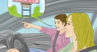
- South of the Border is a great rest stop for southern flare. It includes the convention center, a popular restaurant, a Sunoco gas station, a truck stop with adequate restrooms, and even a motel.[25] , [26] [27]
- For $2 US per ride, you can take a ride up in a glass elevator to the observation deck of the Sombrero Tower to the nearby area to see for miles around. [28]
- Exits towards Florence - a southern belle city with ties to the Civil War - come up quickly.
- Take I-95 across the untolled Francis Marion Bridge - bridging across Lake Marion between Santee and Addams Landing.
- Don't worry too much about the name change between Ridgeland and Hardeeville exits - as I-95 renames itself as the Jasper Highway.
- Continue the path towards the state line. It's almost a straight shot heading southwest.
- Stop by "South of the Border" - an attraction all of its own in Hamer, SC. Displaying humungous signs seen from both sides of the Carolina border miles away, this place has become a popular stop for many. Its 200-foot high Sombrero Tower (sign)[24]
and Mexican-styled mascot Pedro sign looking into the horizon from miles around, attracts many curious eyes to see what's in store for them - including many places to take pictures.
-
4Travel through Georgia.
- As you enter, expect immediate exits for Savannah. However, when you come in, you'll find yourself just to Savannah's west. After Savannah, I-95 will turn southeast and begin a southeast route. You'll pass by many Georgian shoreline islands and towns, including Osssabow, St Catherine's, Sapelo, Little St Simons, Sea, Jekyll, Cumberland, and St Mary's Islands - all with a southern flair.
- If you pull off your route, you may hear people talking about the Okefenokee National Wildlife Refuge. However, although it doesn't pass directly on your route through this state, you'll be dodging a bullet with what people talk about.
-
5Arrive in Florida - and the end state for this route. With more than 382 miles to this interstate in this state end-to-end[29] (about 15% of the route), this state's information needs to be digested in three easy to read substeps below.
- Pass through North Florida. Just after coming into the state, you'll pass small exits, then all of a sudden pass into the eastern side of Jacksonville - passing the Jacksonville Zoo, then heading right for downtown as it makes a turn and heads a little to the west of Jacksonville. You'll pass over the St John's River on the Fuller Warren Bridge, but continue on I-95 past Nocatee and begin making the straight run down the coast of Florida. You'll pass St. Augustine a few exits later and notice its aquarium nearby.
- Ponce De Leon's Fountain of Youth Archaeological Park, Ripley's Believe It or Not, and the Marcos National Monument are all a little bit further than the eye can see from I-95 directly, but not impossible if you exit out into the St Augustine streets.
- Head down towards Palm Coast and the many towns of Central Florida, as you prepare for I-95 and I-4 to weave and intersect as it gets closer to Daytona Beach's Speedway and International Airport - keeping you far away from the Atlantic Ocean. Then this highway intersects I-4. You'll pass New Smyrna Beach and Titusville. Then as you come into Manatee at the FL-528 exit, speed will slow to a buffer zone, as you'll notice Cape Canaveral and Kennedy Space Center in the distance, then continue and pass exits for Melbourne and Palm Bay.
- Have some fun traveling along with the oceanside cities of South Florida. Starting at Vero Beach, take I-95 south towards Miami. You'll come upon such cities as Port St. Lucie and Jupiter (spring training homes of the Mets and Cardinals), Palm Beach Gardens and West Palm Beach, Lake Worth and Boynton Beach, Delray Beach, and Boca Raton, Pompano Beach, then onto Fort Lauderdale (spring training home of the Orioles), Hollywood (Florida) then onto Hialeah and Miami (with Miami Beach coming to its east on its own island).
- Pass through North Florida. Just after coming into the state, you'll pass small exits, then all of a sudden pass into the eastern side of Jacksonville - passing the Jacksonville Zoo, then heading right for downtown as it makes a turn and heads a little to the west of Jacksonville. You'll pass over the St John's River on the Fuller Warren Bridge, but continue on I-95 past Nocatee and begin making the straight run down the coast of Florida. You'll pass St. Augustine a few exits later and notice its aquarium nearby.
-
6Look towards where the southern terminus of this interstate is. I-95 officially terminates at exit 1A at the southern tip of Florida near the corner of SW 1st Ave (going southbound although no connector until SW 3rd Ave comes up) and near the corner of SW 32nd St going north. At this point, I-95 turns into US-1 and continues further south as a higher-speed highway.
-
7Have an understanding of where the extender road (US-1) essentially travels in, towards, and through - just south of the endpoint of I-95. It then heads further south through Coconut Grove, past the University of Miami, down past Pinecrest and all the other Miami-based seaside towns all the way down past Homestead and through the eastern end of the Everglades National Park heading out towards Key Largo, then turns and heads on a causeway out past Stock Island all the way out to Key West - and the southern-most island in the Florida keys turns around and heads back in the opposite direction.
- Continue further into Key West's southwestern-most corner, and you'll reach the border marker marking the southernmost point in the continental United States - where it's only 90 miles to Cuba.


Warnings
- Be careful. Several paid bridges - including the expensive George Washington Bridge- cross from New York into New Jersey. Keep this in mind if you have to cross. It's toll is taken one-way (northbound into New York City), so expect the increased toll! There are others in and around Maryland.⧼thumbs_response⧽
- Pay attention to speed limits. Navigation apps - such as Waze and Google Maps - can be a savior for showing speed signs.⧼thumbs_response⧽
- Through the use of various side routes, there are very few connections to the Outer Banks of North Carolina.[30]⧼thumbs_response⧽


References
- ↑ https://en.wikipedia.org/wiki/Interstate_95
- ↑ https://en.wikipedia.org/wiki/Interstate_95
- ↑ https://www.google.com/maps/place/John+Greenleaf+Whittier+Bridge/@43.0886699,-71.0492408,10z/data=!4m5!3m4!1s0x89e2e3def7cc68df:0x56e3d9845136d736!8m2!3d42.8346764!4d-70.9116284
- ↑ https://en.wikipedia.org/wiki/Interstate_95_in_New_York
- ↑ https://en.wikipedia.org/wiki/New_York_State_Thruway
- ↑ https://en.wikipedia.org/wiki/Interstate_95_in_New_York
- ↑ https://www.google.com/maps/place/Hamilton+Bridge+Skate+Park/@40.8463271,-73.9315376,18z/data=!4m5!3m4!1s0x89c2f418aace9a41:0x7aa8faffbe113e42!8m2!3d40.8464306!4d-73.9300731
- ↑ https://www.panynj.gov/bridges-tunnels/en/tolls.html
- ↑ https://en.wikipedia.org/wiki/George_Washington_Bridge
- ↑ https://en.wikipedia.org/wiki/George_Washington_Bridge
- ↑ https://www.panynj.gov/bridges-tunnels/en/tolls.html
- ↑ https://en.wikipedia.org/wiki/Delaware_River%E2%80%93Turnpike_Toll_Bridge
- ↑ https://en.wikipedia.org/wiki/Interstate_95_in_Delaware#Exit_list
- ↑ https://en.wikipedia.org/wiki/Millard_E._Tydings_Memorial_Bridge
- ↑ https://mdta.maryland.gov/Toll_Rates/harbor_crossings_rates.html
- ↑ https://en.wikipedia.org/wiki/Francis_Scott_Key_Bridge_(Baltimore)
- ↑ https://en.wikipedia.org/wiki/Baltimore_Harbor_Tunnel
- ↑ https://mdta.maryland.gov/key-bridge-rates-i-695
- ↑ https://mdta.maryland.gov/Toll_Rates/harbor_crossings_rates.html
- ↑ https://en.wikipedia.org/wiki/Capital_Beltway#History
- ↑ https://en.wikipedia.org/wiki/Woodrow_Wilson_Bridge
- ↑ https://en.wikipedia.org/wiki/Richmond_in_the_American_Civil_War
- ↑ https://en.wikipedia.org/wiki/Interstate_95#Route_description
- ↑ https://www.sobpedro.com/attractions/sombrero-tower
- ↑ https://www.sobpedro.com/facilities/south-of-the-border-i95-gas-station-dillon-sc
- ↑ https://www.sobpedro.com/facilities/pedros-truck-stop-pantry-west-i95-sc
- ↑ https://www.sobpedro.com/accommodations/south-of-the-border-motor-inn-motel-hotel-i95-sc
- ↑ https://www.sobpedro.com/attractions/sombrero-tower
- ↑ https://en.wikipedia.org/wiki/Interstate_95#Route_description
- ↑ https://en.wikipedia.org/wiki/Interstate_95