13th parallel north

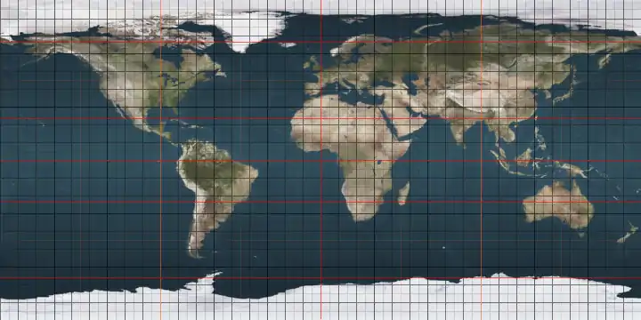
The 13th parallel north is a circle of latitude that is 13 degrees north of the Earth's equatorial plane. It crosses Africa, Asia, the Indian Ocean, the Pacific Ocean, Central America, the Caribbean and the Atlantic Ocean.

Line across the Earth
13°
13th parallel north

At this latitude the sun is visible for 12 hours, 53 minutes during the summer solstice and 11 hours, 22 minutes during the winter solstice.[1]

Around the world

Starting at the Prime Meridian and heading eastwards, the parallel 13° north passes through:

Co-ordinates Country, territory or sea Notes
13°0′N 0°0′E  Burkina Faso
13°0′N 1°7′E  Niger
13°0′N 4°6′E  Nigeria
13°0′N 6°55′E  Niger For about 14 km
13°0′N 7°3′E  Nigeria
13°0′N 8°36′E  Niger
13°0′N 9°50′E  Nigeria
13°0′N 13°48′E Lake Chad Passing through territorial waters of  Cameroon
13°0′N 15°10′E  Chad
13°0′N 21°54′E  Sudan
13°0′N 36°10′E  Ethiopia
13°0′N 41°53′E  Eritrea
13°0′N 42°44′E Red Sea
13°0′N 43°23′E  Yemen
13°0′N 45°10′E Indian Ocean Gulf of Aden (passing just north of Socotra)
Arabian Sea
Laccadive Sea
13°0′N 74°47′E  India Karnataka - passing through Bangalore
Andhra Pradesh
Tamil Nadu - passing through the southern parts of Chennai
13°0′N 80°16′E Indian Ocean Bay of Bengal - passing just north of Interview Island,  India
13°0′N 92°49′E  India Andaman and Nicobar Islands - North Andaman Island
13°0′N 92°57′E Indian Ocean Andaman Sea (passing just north of Sound Island)
13°0′N 98°17′E  Myanmar (Burma) Island of Mali Kyun
13°0′N 98°18′E Indian Ocean Andaman Sea
13°0′N 98°36′E  Myanmar (Burma)
13°0′N 99°11′E  Thailand Phetchaburi province
13°0′N 100°4′E Bay of Bangkok
13°0′N 100°56′E  Thailand Passing just north of Pattaya
13°0′N 102°32′E  Cambodia Passing through Tonlé Sap lake
13°0′N 107°30′E  Vietnam
13°0′N 109°23′E South China Sea
13°0′N 120°46′E  Philippines Island of Mindoro
13°0′N 121°29′E Tablas Strait Passing just north of Maestro de Campo Island,  Philippines
13°0′N 122°0′E Sibuyan Sea Passing just north of Banton Island,  Philippines
13°0′N 123°1′E  Philippines Island of Burias
13°0′N 123°8′E Burias Pass
13°0′N 123°28′E  Philippines Island of Luzon
13°0′N 124°9′E Pacific Ocean Passing just south of  Guam
13°0′N 87°38′W  Nicaragua Passing through the Cosigüina volcano
13°0′N 87°30′W Pacific Ocean Gulf of Fonseca
13°0′N 87°19′W  Honduras Extreme south of the country
13°0′N 87°1′W  Nicaragua
13°0′N 83°32′W Caribbean Sea
13°0′N 61°15′W  Saint Vincent and the Grenadines Island of Bequia
13°0′N 61°13′W Atlantic Ocean Passing just south of  Barbados
13°0′N 16°45′W  Senegal
13°0′N 11°25′W  Mali
13°0′N 4°16′W  Burkina Faso

See also

References

  1. "Duration of Daylight/Darkness Table for One Year". U.S. Naval Observatory. 2019-09-24. Archived from the original on 2019-10-12. Retrieved 2021-03-10.
This article is issued from Wikipedia. The text is licensed under Creative Commons - Attribution - Sharealike. Additional terms may apply for the media files.